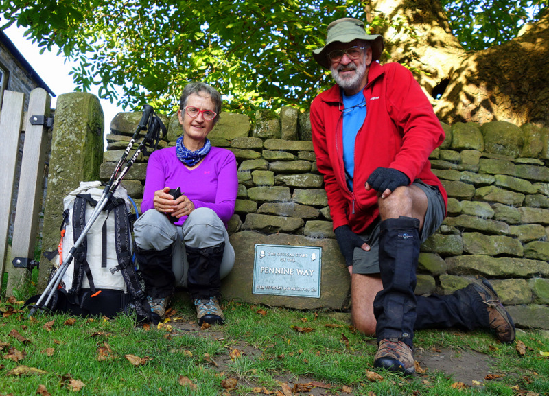
The Pennine Way is a 407 km trail in the UK running from Edale, just outside Manchester, to Kirk Yetholm just across the Scottish border. It was established as an official path in 1965, although it had been in use for several decades before then, and so is the oldest long distance walk in the UK.
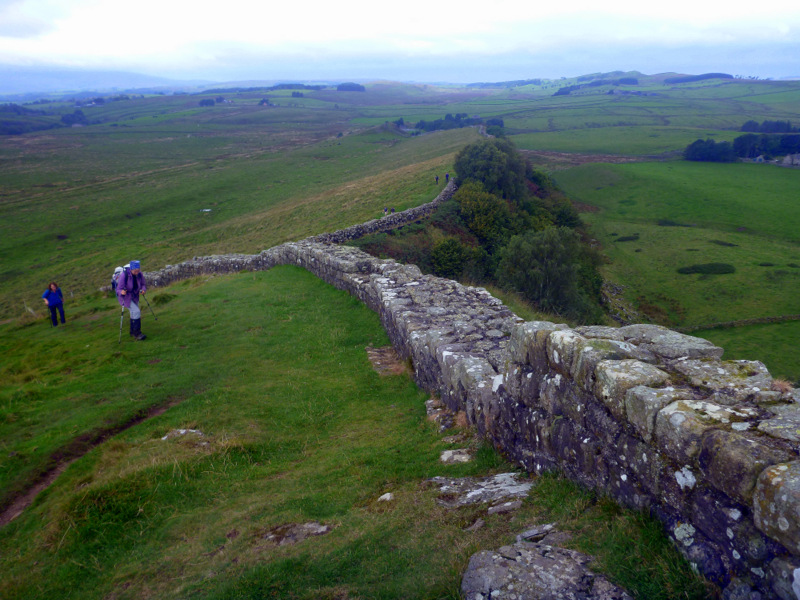
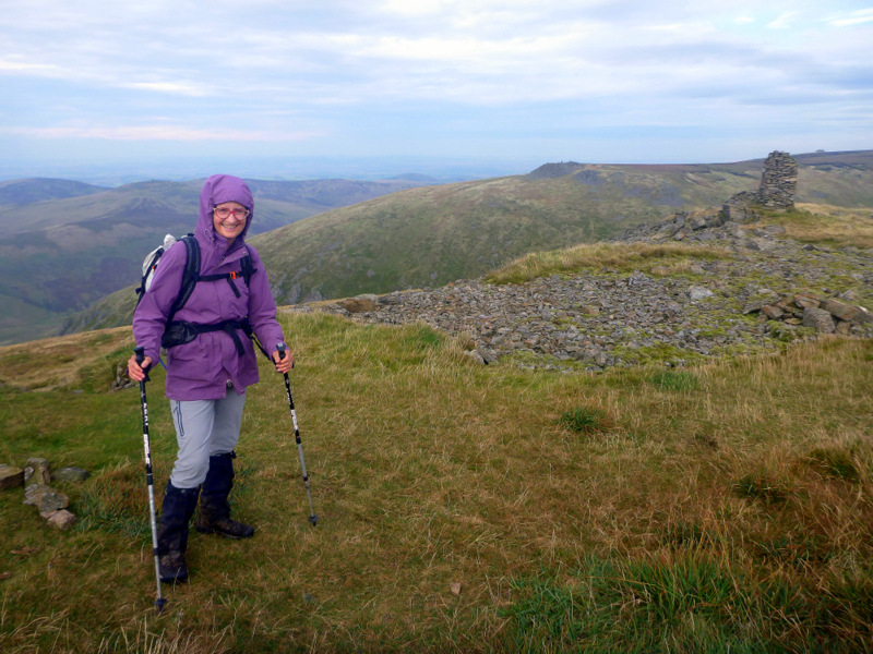
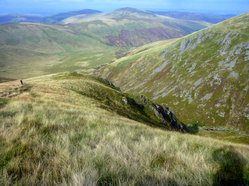
Pen Y Ghent
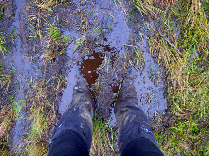
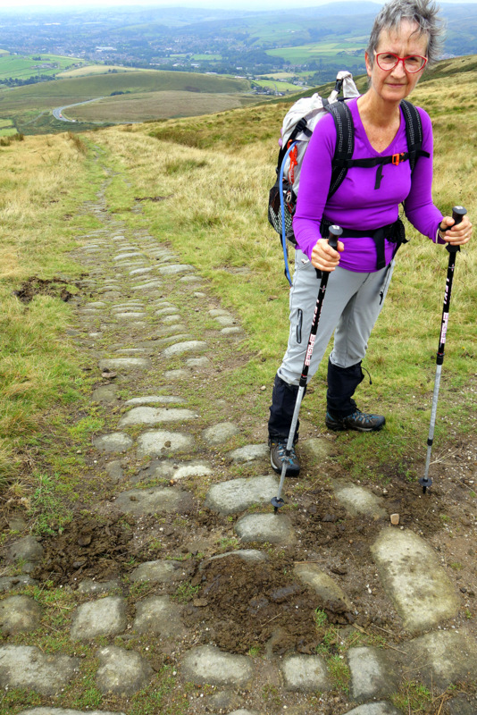
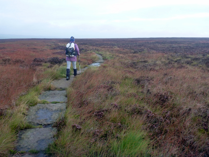
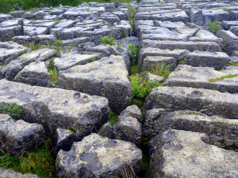
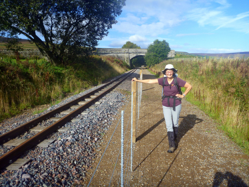
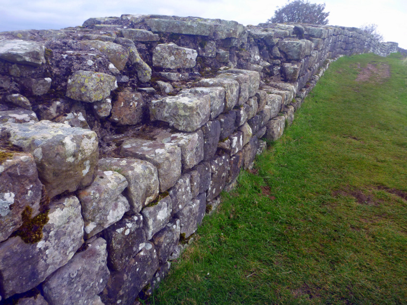
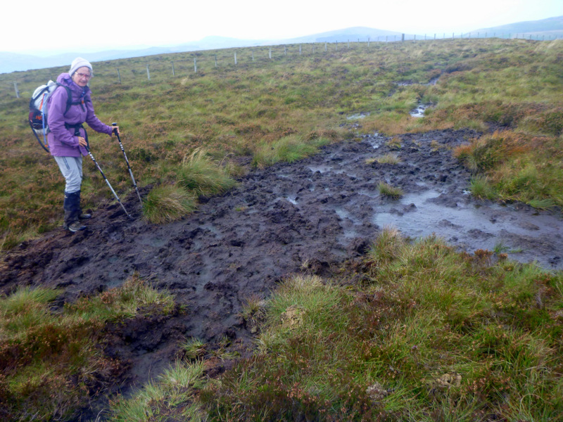
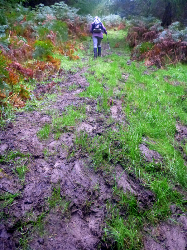
The through hike is regarded as difficult, although the walking itself is relatively easy with few steep sections and is well marked. The difficulties arise from the state of the track and the English weather. The track runs for many kilometres through wet peatbog, and has been much damaged and widened by generations of walkers and sheep, all trying to dodge the mud. Some of the worst sections have been paved with recycled stone slabs, but while these contribute to impact bruising, at least you can stay clean. I saw no evidence of attempts to divert water off the track, either with lateral or cutoff drains, instead the mud is accepted as a way of life. A walker does get very adept at picking the difference between a knee deep bog, firm dry bog and sheep shit mud slurry on a firm base that forms everywhere else. Waterproof boots and knee high gaiters are essential, but unlikely to keep your feet dry.
Typical section of “track”.
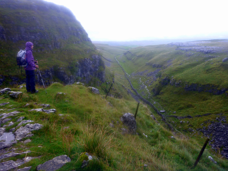
English autumn weather is the epitome of unreliable, with 4 seasons in one day the norm. We were often tempted by blue sunny skies in the morning to don shorts and t-shirts for walking, but by the time breakfast was completed, clouds had rolled in with a 30 kph wind off an ice floe somewhere. We were normally walking in long pants, merino top and a windproof parka, with overpants in reserve for the afternoon rain showers. The walking is mostly between 100-300 meters, with half a dozen climbs up onto the fells at 600-800 meters. Typically we would be in cloud for the high points, with restricted visibility leaving us reliant on occasional cairns, compass and gps.
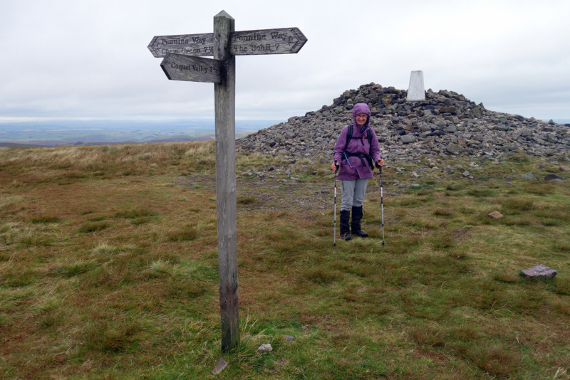
Summit plateau of Cross Fell
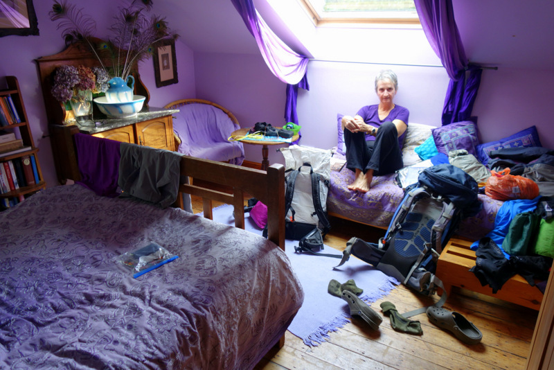
We decided early on that we would do this walk slowly and in autumn, avoiding the crowds of summer, and cope with the weather by doing it as a slack pack, staying in B&B accommodation throughout. This meant we could enjoy the trail, absorb home and village culture, and carry less than 10 kg for the duration. There are well established businesses which will move your excess gear from one BB to the next, but we are now well used to keeping gear down to manageable levels so did not use the carry service. Most fit young hikers take around 17 days for the through hike, so we planned for 23 days, with a few zero (non-walking) days and a few nero (nearly zero) days, but otherwise averaging around 20km each day.
Grange Fell B&B
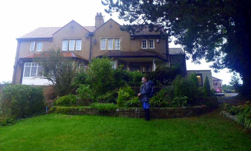
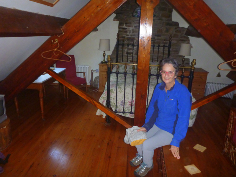
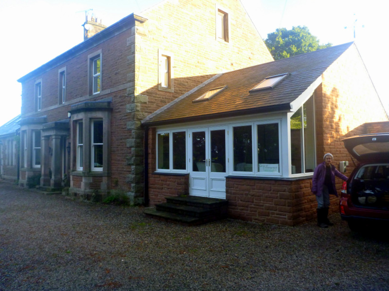
Our plan had us arriving in the early afternoon in Manchester with plenty of daylight to catch a train into town and then another out to Edale. Our accommodation was booked for two nights to allow recovery from the flights. Delayed in Abu Dhabi by an overheated plane (!), then again in Manchester by insufficient customs officers and our bags falling off the conveyor belt out of sight, we finally arrived in Edale in full darkness at 9:30pm. Ollerbrook Barn BB was situated about 1 km out of town on unlit farm tracks, so we were very grateful for our host being willing to come and collect us from the station.
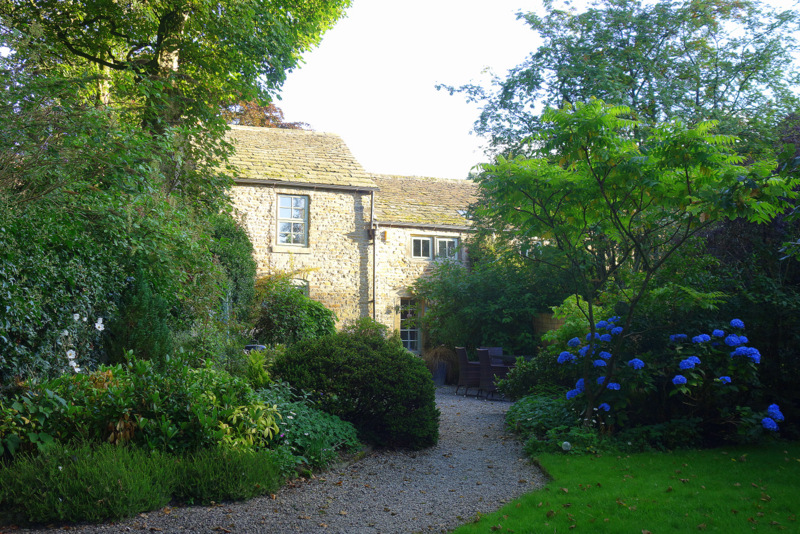
Ollerbrook Barn B&B in Edale
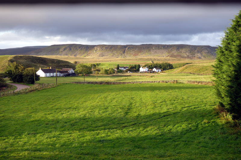
Edale was our first of many stone villages, spread out along a river valley, where the water flow was used for running mills of various types. It had been an isolated community until the 1800’s when tunnels through the blocking ranges allowed railway access. It is also therefore a hub for walking trails heading off in all directions, including the start of the Pennine Way. Appropriately one of the pubs in town is “the Rambler”, but we’re up at the other end eating at The Nag’s Head, and never make it down for a drink. Never the less, I’m singing “I’m a rambler, I’m a rambler from Manchester way….” for the first few days of walking. I wandered around the church, admiring the stonework and the gravestones, while Ali did her first sketch, huddled out of the wind, but discovering that stone walls are too cold to sit on for long. We walked up the valley side a little, trying for a village overlook, but were defeated by the trees. The steeple poking out was the only sign that a village existed.
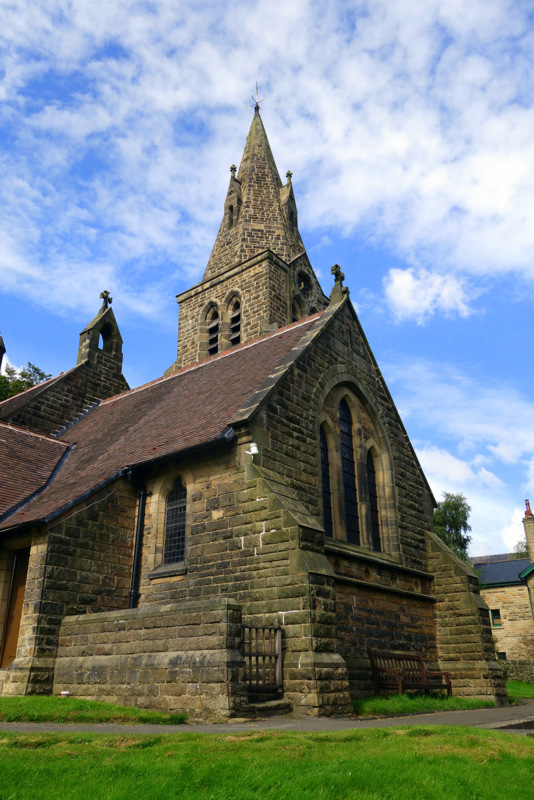
Church in Edale
After 5 months of planning and dreaming, we finally actually start walking on Saturday 2nd September, with 3 days planned to reach Hebden Bridge for our first zero. We know we will need the break as we are not trail fit and these three days are all over 20 km. There is little to no flexibility with accommodation in this area, so we know we just have to make the miles and hope for the best.
Southern end of the Pennine Way, in Edale
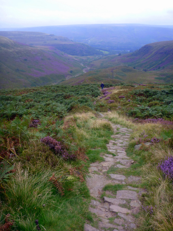
Terry gives us an early breakfast and we’re off walking up the valley by 8. An hour or so of gentle climbing has us at the foot of Jacob’s ladder, a stone stairway climbing steeply 300m up to the main ridge and the high point of Kinder Low (I have no idea why it would be called that) at 633m.
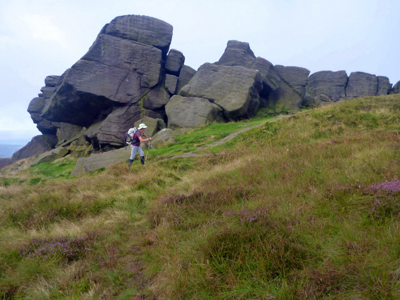
Tors on the way up Kinder Scout
Flagstones are laid for some of the boggy bits, but the dry areas are very rocky, so the walking is slow, stepping from rock to rock to the waterfall called Kinder Downfall and then Jacob’s Ladder – the Reckoning, where the track drops steeply on stairs again, then flagstones for 3 km to Snake Pass. Lunch on cheese and dry biscuits just off the main road and we’re off again to climb another summit for the afternoon. Much of the track here had been eroded 2 meters down through the bog to the hard clay beneath, following a stream and crossing it many times, but we pop up out of the cut often enough to get an idea of the country around us. As we come down off Bleaklow Head, the trail is again rocky and difficult and Ali is now tiring, so takes several falls but without damage. Our free GPS app on the phone saved us as we headed off 50m down a grouse shooters track. It pointed us to our proper track which was just out of sight below an edge. This level of precision in navigation saved us from many hundreds of meters of unnecessary walking, so I’m sold on the device after a few rescues like this. We’re both exhausted but very grateful to reach the road alongside the Torside Reservoir, but now have to cope with traffic and no verge for the last km or so up to The Old House. We tottered in to be greeted by another dozen walkers and a cup of tea almost before the boots come off. A bath is welcome, fortunately, as there is insufficient headroom to stand up for a shower. The low ceiling and big beams were the norm, and even Ali’s head had damage. The BB owner ran a shuttle service to the Crowden pub 5km down the road for all their guests, probably the only time I’ll get to ride in a BMW.
Western House B&B
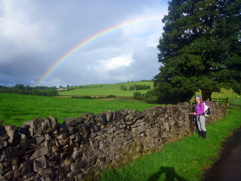
Rainbow
We’re back to almost normal by morning, after coping with leg cramps overnight, and Ali just feeling sore all over at least until she warms up for the day. Breakfast is early and efficient, so we’re off and walking back to the trail by 8. Our hosts pointed out an alternative route, so we didn’t have to walk back down the main road, but were able to divert through a paddock, then through a wet and spooky tunnel under an abandoned rail line, and eventually back to the dam wall, with sheep grazing on the grassy face.
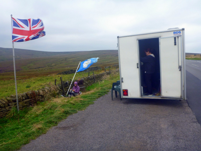
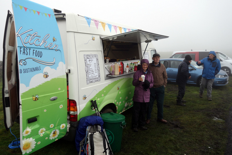
The climb for this morning is up and over Black Hill, no longer black thanks to a massive regeneration and recovery program. Tonne bags of lime fertiliser are scattered over the plateau and sheep have been fenced out. The track follows a sharp edge, and we were grateful for the wind blowing us away from it as it’s a long way down. From near the top of Black Hill, we can see our lunch target, another major road across the moor where we have been assured that as it is a Sunday, there will be a hot food van parked in a layby. As we get closer, the tension rises as although we can see the food van, there is no movement and the sidewalls are shut. We’ve resigned ourselves to biscuits and cheese when we realise that the van is operating out the backdoor because of the wind. Several cups of tea with egg and bacon butties later, while we huddle up against a stone wall out of the wind, and we are revitalised for the afternoon.
Food Van in the middle of nowhere.
The excitement for the afternoon was a pack of about 20 clean beagles, all on leads, coming past as we walk around several reservoirs and a deer park. Every other dog we have so far seen has been off lead and covered in mud. Our feet were feeling the pain as it has been gravel tracks and flagstones for the entire way to Redbank Reservoir where we could see our hotel across the moor. It was very tempting to take a short cross across around the southern edge of the dam, but we could see sedge and sphagnum, so we decided to stay on the safer track for the extra 2 km despite our blisters. We settled into the Carriage House by 4:30, and were delighted to shower standing up for a change. There were another 16 hikers for dinner as this hotel is a focal point, other options involving many extra miles or hitching. After passing or overtaking one another for a couple of days, the English reserve is melting and we are able to chat and exchange information. We’re unlikely to see these people again, as most are much fitter and faster than us, or they have been just out for the weekend. It was still great to be back in a hiking fraternity for a while.
Looking back to Edale
In the morning we found that the weather had finally shut down after the last few days of cool and dry, and we were greeted by low cloud and drizzle for the km back up the main road to the trail. This lead to misreading a fingerboard in the mist and taking the Pennine Bridleway for 500m or so until Ali got upset at appearing to go the wrong way and we consulted the non-waterproof gps despite the rain. Back on track and following Blackstone edge, a famous climbing cliff, but there was nothing to see from above except vague grey rocks and cloud.
Cobbled path
Some of the track has been cobbled with stones in Roman times, and for contrast we cross a 6 lane freeway on a bridge also made for hikers. We also went past a 600 year old property boundary marker, before following a disused aqueduct to the Whitehorse Inn and Guinness, soup and bread for lunch. It’s a hard life.
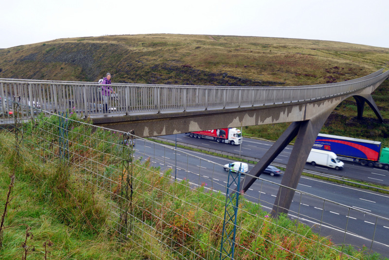
Hiker bridge over the M62
The Way was dead flat after lunch, following reservoirs and dam walls for many miles before the stone tower of Stoodley Pike came into view. After another hour or so of hilly ground we can finally appreciate the size of the thing. This 30m high column was constructed as a memorial for the victory over Napoleon, but after destruction by lightening, and cancellation of construction after his escape, the actual completion took many decades. An internal spiral staircase climbs in darkness up to the balcony level 7m above the ground, but we decline the climb. From here we descend 400m on lanes and roads more and more steeply as we approach the valley bottom and day’s end.
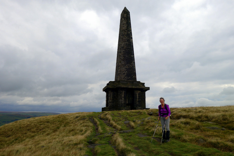
Stoodley Pike
Hebden Bridge is a town of weavers, originally with hand looms, then powered by water wheels then steam engines burning coal. Chimneys are everywhere.
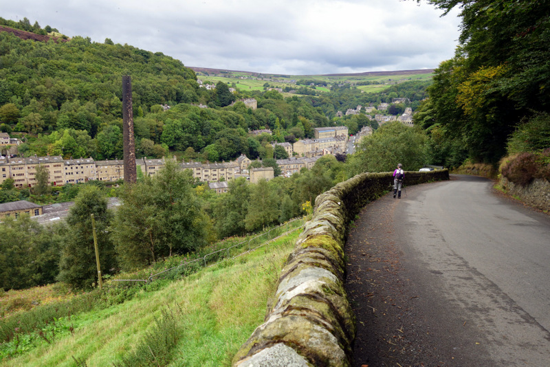
Dropping into Hebden Bridge
The black satanic mills could have been right here, and the town still looks the part. A river, a highway and a canal compete for space along the valley floor, while the houses seemed squeezed upwards. Police and ambulance sirens were continuous as they try to fight their way down the crowded single lane highway.

Hebden Bridge
We’re lucky to find our B&B as the street numbers appear to be discontinuous and the B&B sign is hidden. Our room is huge, so the bathroom in the wardrobe appears even smaller than reality. The shower is 60cm by 60cm, meaning I cannot touch the floor, while the toilet and hand-basin fit in the other 60 x 60 space. Fortunately the door opened outwards. We had just enough energy to make it the 100m down many stairs to ground level and the pub for dinner. A recovery day tomorrow was perfectly timed.
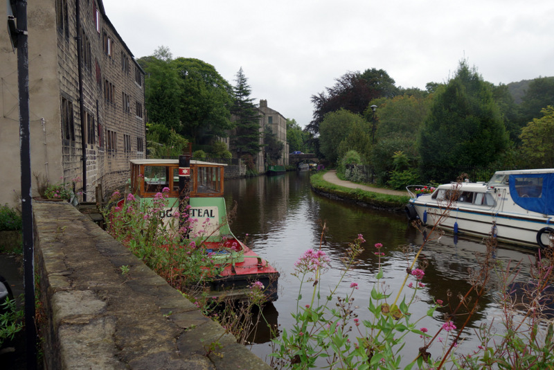
Canal boats in Hebden Bridge
We spent our day off wandering quietly, doing coffee and lunch while Ali managed a few sketches. We were hoping for an early dinner, but pub 1 wasn’t serving till 6 while pub 2 had no food, so it was back to the pub next door to our B&B for a second time.
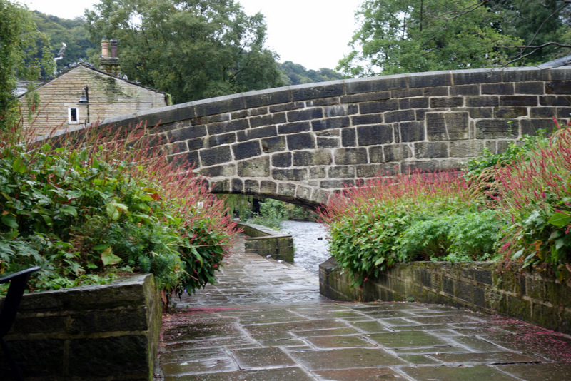
The bridge in Hebden Bridge
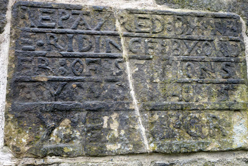
Sign in the middle of the bridge advertising the bridge repairer
With our clothes washed and dried, dry clean boots and socks, our batteries were fully charged and we’re raring to go the next morning. Especially as our host, Sharon, offered to drive us 5 km up to Colden, neatly avoiding a 200 m steep climb up out of the valley. The moorland was exposed and open to a freezing wind, gladly in our back, but it was hats and gloves with parka and long pants for the whole day, walking past another 3 reservoirs before a solid 150m climb to Top Withins and some ruins said to be the inspiration for Wuthering Heights. Whuther it was or not, it was a spectacular location on the edge of high moorland and overlooking Haworth, the home of the Bronte sisters.
Top Withins ruin
The descent for the afternoon is to Ponden reservoir, with our B&B set on a peninsula overlooking the valley and the lake. We were met by Brenda with tea and pikelets with jam and cream ready by the time our boots were off. She gave us our choice of rooms, as we were the first arrival, so we had to have the purple one! After some recovery time she drove us 2 km down to the pub for dinner, but had forgotten to mention that we had to make our own way back until we were there. As we hadn’t brought parkas or a torch we were a little miffed, but made it back ok before the rain and dark set in.
Purple room at Ponden House
Brenda was again very apologetic the next morning as she had received an sos from her daughter to help with her kids, and so had to give us an early breakfast. Fine by us as the day looked to be a hard one, with three 200 m climbs to get over. A pub after hill 2 looked promising for lunch until we arrived and discovered it to be under renovation, so we found shelter against a wall under some blackberries and settled down to our cheese and bikkies. The last hill was over before we expected and from there it is all downhill to Earby, sadly on a sealed road for 2 km, so our feet are sore and Ali is cranky as we wend our way through the town to find a store for snack-food for the next few days. Tracey at Grange Fell gives us a comfortable and casual welcome and we settled in with a cuppa and a snooze before heading across the road to the Punch Bowl pub.
Flagstones on the way to Top Withins
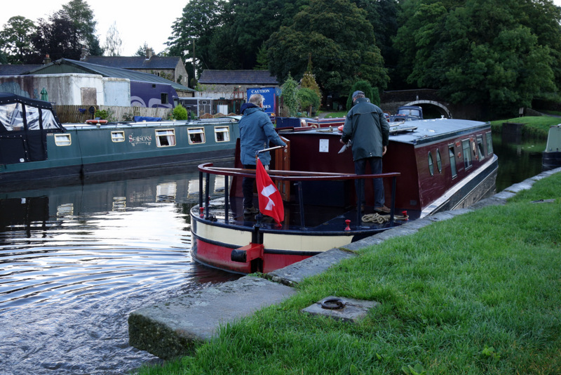
Tracey was able to show us a disused railway line which lead back to the main Way avoiding about 5 km of busy road. Then wet paddocks and following a canal crowded with boats and moorings. A couple even had “lounge rooms” built into their docks.
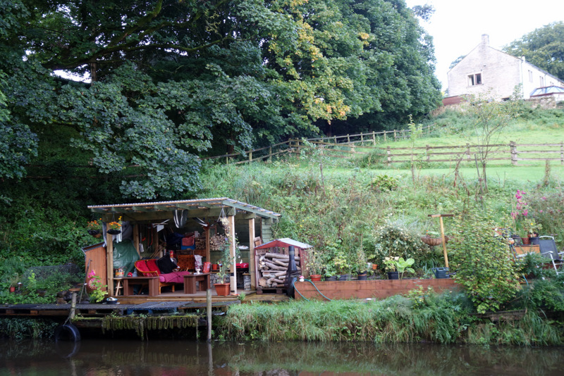
Lounge room at the mooring
Danish canal tourists
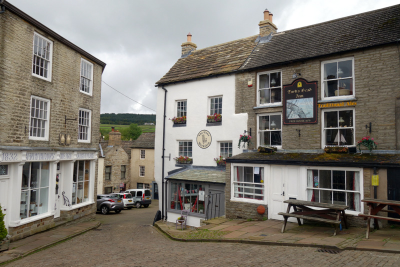
That saw us into Gargrave and “The Dalesman” a trail café famed for coffee and cake. They also stocked a huge collection of lollies, so we were able to buy lots of acid drops and jubes to help us along. Gargrave is also a favourite place to drop out as there is a railway station but after our morning tea and lollies we were content to wander on. From here the trail deteriorated to a sheep shit slurry in the lanes and wetter bog on the pastures. My boots seem to have no traction, and it’s like I’m wearing skis. We followed the Aire river for several kms, admiring the continuous grade 2 water with timber screens and barbed wire fencing making life entertaining for the intrepid kayaker. We were curious about one paddock which had a double mesh fence and what appeared to be chicken feeding stations inside. A dozen hen pheasant and one male finally gave the clue that this was a semi-wild breeding colony. Our stay for the night at the very appropriately named Miresfield Farm seemed deserted at 3 pm, so we crossed the river and found a café for soup and bread before going back and checking in. The owner lit a fire for us in the living room, so we sat and enjoyed the heat and their wifi until dinner time and the pub beckoned.
Doubled bridge on the canal
Another Saturday dawns, so we’ve been on the track a full week and seem to have arrived at a comfortable level of walking fitness. We certainly hoped so, as today is one of our hardest days on the Way. 450m of climbing to get out of the valley and up to Fountain Fell, then down 300m and back up again to get over Pen Y Ghent before the 500m drop to Horton in Ribblesdale. We need every hour we can to make it but the B&B owners want to give us a late breakfast at 8:30, we put our case and they pass the problem to their son, who seems happy enough to feed us at 7:30 even if it was just to get rid of us.
Bleak moorland on Fountain Fell
The day started with climbing 420 steps up the side of Malham Cove, a limestone amphitheatre formed by a waterfall 50,000 years ago, but now known for a breeding colony of Peregrine Falcons, but they do not show up for me.
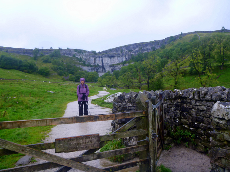
Malham Cove
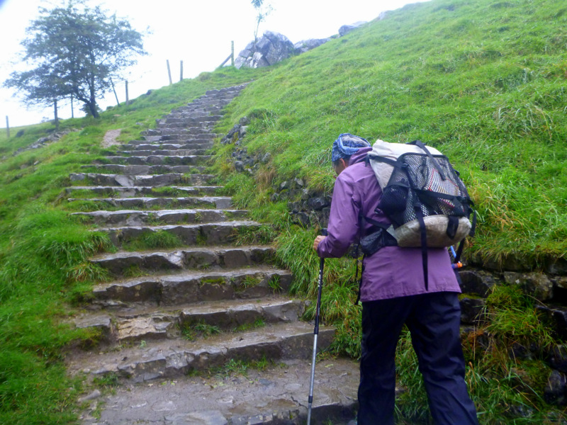
Steps up Malham Cove
The top of the cliff is a limestone pavement and we follow the course of the now dry river valley on up to Malham tarn, a lake several kms across.
Limestone pavement
Dry river valley above Malham Cove
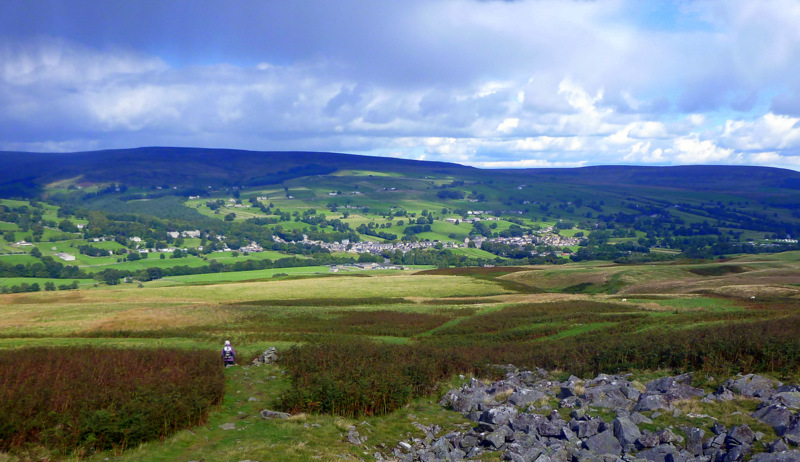
Fishermen in boats were sitting out there, huddled against the wind and drizzle, but determined to bring home their catch. We continued on past a hotel, now a recreation and field studies centre, lots of sheep on several active farms and after about 4 hours steady climbing we reached the double cairn marking the top of Fountain Fell. Mineshafts were scattered about, some with fences and some with dire warning signs. We don’t leave the path. The afternoon light makes the next range across glow as if the grass is backlit, but that’s our next target and we wonder how on earth we can get up there as it all looks impossibly steep.
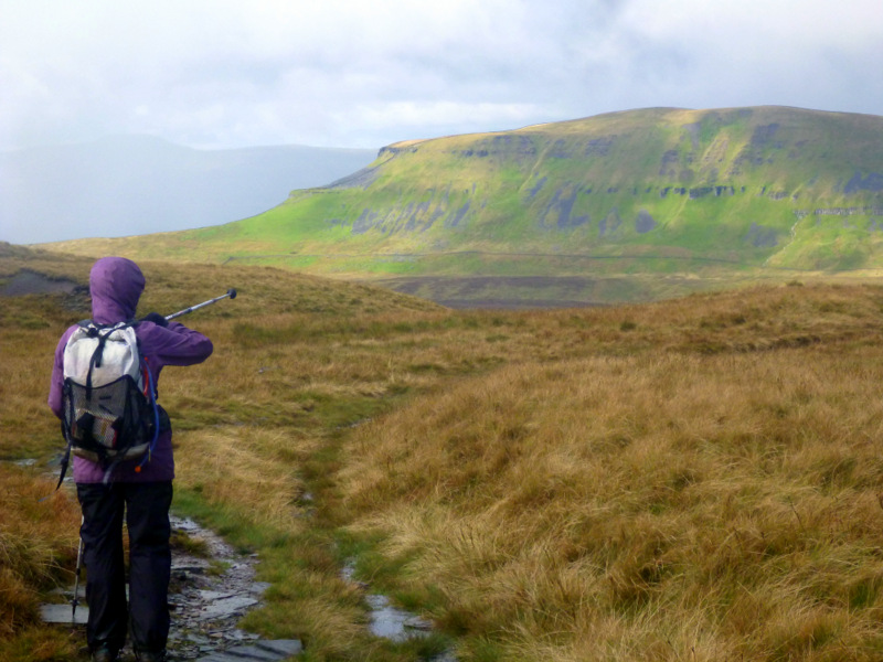
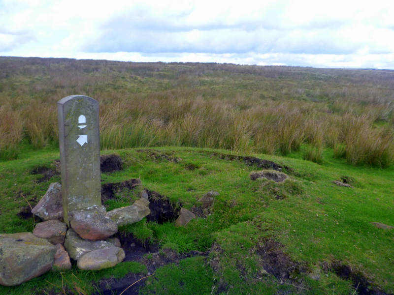
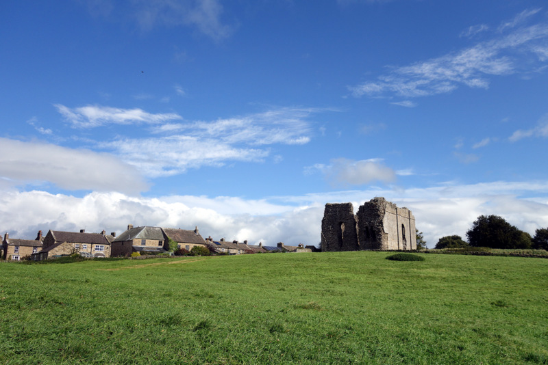
Pen Y Ghent
Straight up the nose of the ridge is the answer, and the stepped path winds through two cliffs before easing off for the gently rounded summit of Pen Y Ghent. There is shelter in the lee of a wall, but we don’t stay long as there is a queue for the sheltered spot. The trail down is hardened, with lots of steps to make it easy for trail runners, for whom this is the first of three peaks in the aptly named 3 Peak Challenge. We don’t run, so it’s about 2 hours down to the Golden Lion, packed after a local football match. They are expecting us and after a drink and a warm up we are shown our room. Dinner is a multiple meat roast carvery with hot veges, but after that we’re collapsed in bed by 8 with the bar still going strong, but unnoticed by us.
Pennine Way fingerboards.
Sunday greeted us with miserable weather, drizzling rain again with that biting wind. There was a 400m climb for the morning, but it was all on rough tracks so route finding in the cloud wasn’t a problem. As we got closer to the top, it became apparent that there was a serious mountain bike competition using our path. Bikes whizzed past in both directions, appearing out of the cloud with little to no warning, so we had to stay on full alert. We started across the summit plateau to find a motocross competition in full swing around us as well. This was at the end of a sealed road, so there were several hundred people with cars and trailers parked in all directions. We were boggling at all this activity, when two of the organisers pointed the hot food van out to us. Hamburgers and hot chocolate with marshmellow for lunch on the summit were a wonderful compensation for our invaded feeling. Motocross bikes and mountain bikes continued past us, very politely, for another kilometre until we turned off their path at Ten End and started down towards Hawes and Laburnum House.
Motocross food van with hot chocolate
The burst of foul weather was expected to continue for a few days, so with a major climb over Great Shunner Fell looming, we didn’t hesitate to book a taxi to skip 10 km and stay low down for the day. The taxi driver said he could fit us in at 7:30 if we didn’t mind having his dogs in the car with us. He was booked to help beat for grouse, and would be going straight on after dropping us. Our host was happy to feed us at 7, as she also had a group of farmers coming in for an early breakfast and it would help her to get rid of us as early as possible. So trail magic took control and had us out and on the Way early next morning, with 6 hours shaved off our timing for the day. A missed signpost had us following the wrong path out of Thwaite, but after a few hundred m, a check on the gps let us know we were several hundred m away from the true path, so back we go.
The acorn trail markers
We climb gradually up a valley, with another obvious path at the same height on the other side, and we eventually realise that we are looking at the Coast to Coast path where we walked 12 years ago. We meet this other track just out of Keld at a pretty little waterfall. A flock of pheasant got upset as we approached them, and after a lot of scolding, the males ran away uphill while the hens and young birds made a flappy take-off, then glided several hundred metres downhill before crash-landing in the heather. Archaeopteryx lives again.
Heather thatching on the roof
We climbed on, after saying hello to the C2C, through very wet and boggy moorland. I had wrapped my feet in tesco bags inside the boots, but they still got wet. The pub for the night was the Tan Hill Inn, almost on top of all this moorland, and a major search and rescue centre as well as being the highest pub in the UK at 572m. We were way too early to check in, but we were welcome to do lunch by the coal fire and they could upgrade us from the bunkroom to an ensuite B&B, so we were quite happy to sit around and booze for the afternoon with our boots opened to the fire. The clouds were scudding by just over our head, and Shunner Fell a good 300m above that, so the decision to skip was a good one.
Tan Hill Inn at 572m
The grouse shooting party turned up after dinner, with the squire and his off-siders resplendent in tweed 3 piece suit with plus fours, tie, tagged socks, leather shoulder pads etc. The fat and bald stereotype could have been photographed for Punch magazine.
The walkers accumulated at the other end of the bar, so again lots of chat about who’s done what. One had completed the Te Araroa end to end of NZ and had really enjoyed it, so it’s looking like we’ll have to put it back on our list. One had come over Shunner Fell today despite the weather and told us that it wasn’t too bad, just windy and clouded in. We didn’t feel guilty at all.
Digby inside Bowes castle
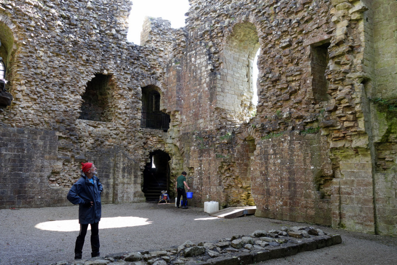
The 5 km of track north from Tan Hill Inn had the worst reputation of any bog along the Way, so we opted to follow the road around it, covering 6 km instead. This allowed us to complete the day’s walk with dry socks, the only day where that occurred. We followed farm tracks and minor roads for the morning, dropping 350m over 12 km without noticing the drop. Bowes Castle came into view from several km away and it dominated the valley. It was built in 1170, replacing a roman fort, then ruined itself by the16th century. The outer walls were still in place and some rooms and stairways within the walls were still operational, but workers were pressure cleaning the stairs so we stayed down. Alison was able to go back later for some sketches and photos from the higher levels. We lunched in the grounds, then headed over to our newly renovated stay, “The Ancient Unicorn” where we have two nights booked.
Bowes castle still dominating the valley, even as a ruin
We wanted to visit Bowes Museum which is about 6km away from Bowes, but near a market town called Barnard Castle and there was a public bus service we were able to use between the two towns. We think there is a castle in Barnard Castle, but it is surrounded by a 3m wall and cannot be seen. We were quite confused by all this, but with the help of the driver and his passengers we got it all sorted and they drop us off near the Bowes Museum with instruction to catch the bus back in 3 hours, or catch a taxi. The museum was built in 1850 by a coal mining philanthropist (Bowes) and his actress artist French wife. It is a full-on French Chateau which would be quite at home in the Loire valley, but out of place amidst all the Norman stone work. The museum has been filled with furniture, artworks, ceramics and clothing from the early 1800’s, all collected by John and Josephine Bowes, both of whom died before the house and display were finished. Good to have seen it all, but although our ticket is valid for a year, I don’t think I’ll make it back. We made it back to Bowes on the bus with the same elderly passengers who had gone to town to do their shopping.
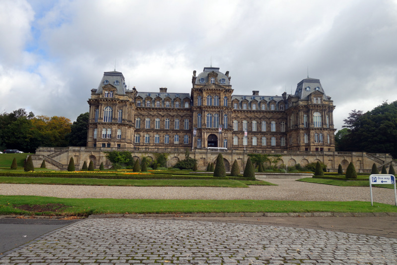
Bowes Museum
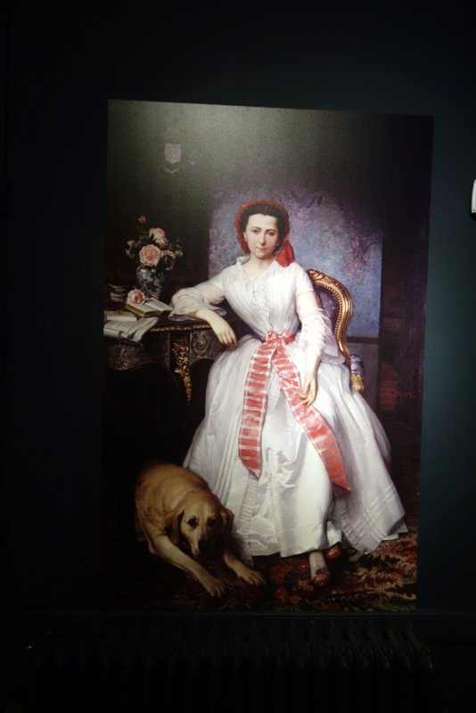
Josephine Bowes
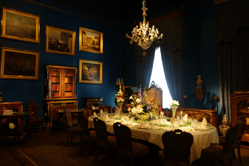
Dinner setting
We were in Horton in Ribblesdale a few day ago and next we’re on our way to Middleton In Teesdale. Even the locals use the whole name as there are several other Middletons in the area. Aussies get laughed at about the longish names we use, but I can’t see any difference. We head off, uphill of course, out of Bowes past a huge community garden full of cared for gardens and veges, but no-one at work yet.
Bowes community garden
The lane we were following had a warning sign every 50m or so gently suggesting that we stay on the road as there was unexploded ordinance in the neighbouring fields. It seemed to be ok to go in there as long as you didn’t touch or disturb anything. We’re walking on wet boggy ground for the morning, past rocky tors on the high points and reservoirs on the low areas before reaching “Hannah’s Meadow”. This is a few hectares of ground which has never known fertilizers or pesticides and so has the full diversity of grasses, herbs, flowers, insects and birds. An interpretation centre building is on one edge, but closed. That’s ok as the farm is advertised as “Traditional farming methods without power or water”, so we are rather familiar with that. Up over another 200m ridge and the valley of the Tees is on display before us, Middleton has the only bridge, and so is a major centre. Our B&B was in the middle of town with a French restaurant across the road. Dinner was a real treat, with terrine, cocquilles St Jacque, chicken provencal, and venison sausage instead of the usual pub grub. Still too much food, but not a chip in sight.
Middleton in the valley of the Tees
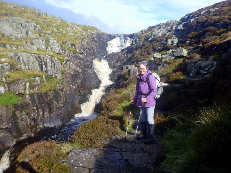
The next day the Way followed gently along the Tees river for the whole day, passing Low Force and High Force waterfalls where the river crashes over bluestone edges.
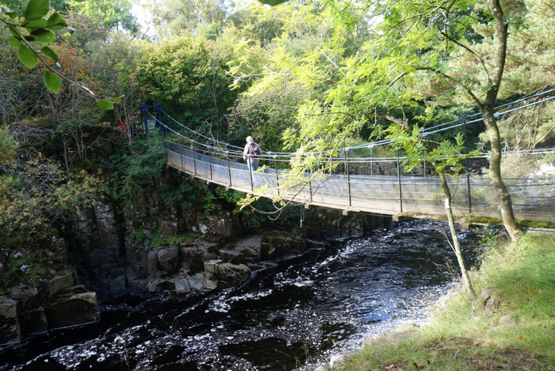
Elderly suspension bridge, only repaired twice so far.
A 150 year old suspension bridge crossed the river to some recommended tea rooms for a good coffee and poor cakes for morning tea. Lots of info and signs and a bird feeder strategically placed outside a window, with about a dozen species haggling over the food. We learned that the word force for waterfall came from the Nordic term of Foss.
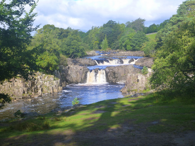
Low Force
Low Force is a series of 1-2 m drops over a kilometre or so, probably canoe-able but at about grade 4 with manoeuvring inside white water, while High Force is a near vertical drop of about 10m, crashing off rocks on its way down. The Way avoids a gorge by climbing a ridge, then drops back to a bridge where we leave it for a 2km road bash to our pub for the night, Langdon Beck. They are able to give us a late lunch of soup and bread and suggest a short cut back to the Way so we don’t have to retrace our steps tomorrow, so we’re feeling pretty chipper about the next two days, both long and difficult.
We woke to brilliant lighting on the range outside our window, with the hillsides glowing green and grey in the low sun.
Spotlighted ranges at Langdon Beck
A flock of pheasants were running around in the paddock below us, but they disappeared as the pub started to wake up. They had apparently heard about the shooting party which had started to assemble at the pub as we left. We were back on the Way after about 30 minutes, again following up the river to where it emerged from a dam. This gave us an exposed and frightening climb up wet and slippery rock alongside Cauldron Snout before reaching the dam wall and a farm track again.
That’s the track, up the right hand side
Gunfire was by then echoing around the valley, hopefully from gun butts a kilometre or so off to one side, while appropriately there are more warning signs of unexploded ordinance in the moors around us. We keep moving and appear to get out of range of threats as we approach High Cup Nick, a spectacular glacial land form with a semicircle of cliffs around a closed valley.
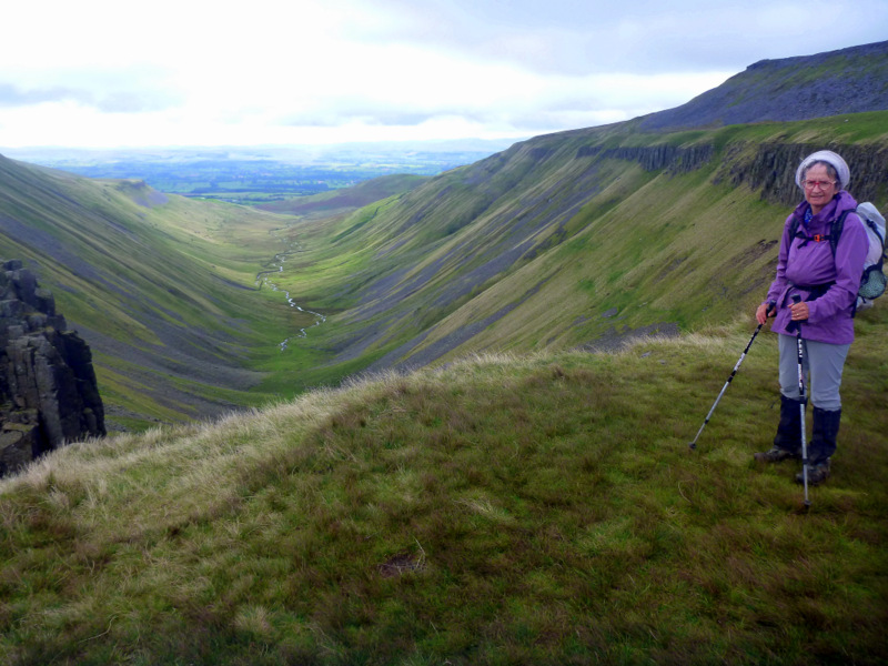
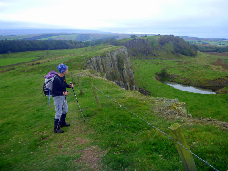
High Cup Nick
The Way edges along the top of the right hand wall and down to Dufton where we have arranged to be collected by Jan from ‘The Hollies”.
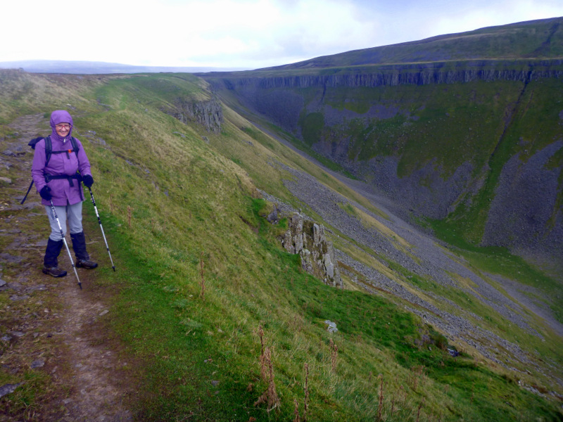
Leaving High Cup Nick
We managed an early dinner of coffee and panini at a Dufton café before she arrives, so we won’t have to go out again tonight. The Hollies is very walker friendly and comfy with plenty of power points, wifi and a hard bed. Jan is also happy to give us a 7am breakfast and drive us back to Dufton to get us back on the trail early for the 25km and 600m climb over Cross Fell and its friends.
Red stone work at the Hollies
All went to plan and we’re slipping and sliding up cow shit covered lanes out of Dufton by 8am. It was a steady uphill grind for a few kms before a small bridge and the main climb started. This was steep with steps, then a plateau before steep again for about 6 steep bits before topping out on Knock Fell at 670m. The Way then bobs along, with 200m down and 200m up to Dun Fell and it’s radar station, then repeat for Little Dun Fell before the final climb up onto Cross Fell at 900m, our highest point for the walk.
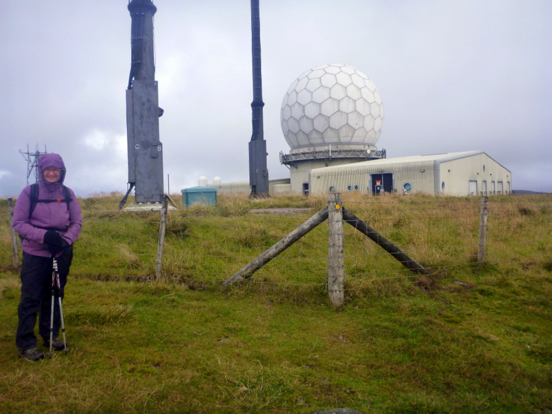
Radar station on Dunn Fell
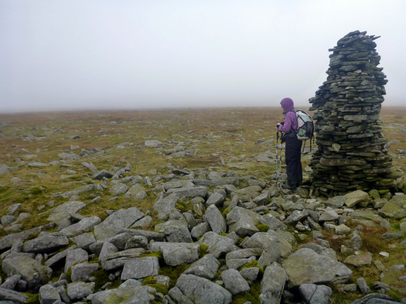
By then the cloud had rolled in, so visibility on the main plateau was down to 25m and we had to use the gps to see our way from cairn to cairn. The summit cairn is in the shape of a cross, the arms about 10m long providing some shelter regardless of the wind direction. We had a snack there but decide to press on down to Greg’s hut for lunch, the gps worth it’s weight in gold for this tricky bit of navigation. Greg’s hut dates from a lead mining era, so for several kms we’re on a rough and rocky track in a wasteland of spoil heaps.
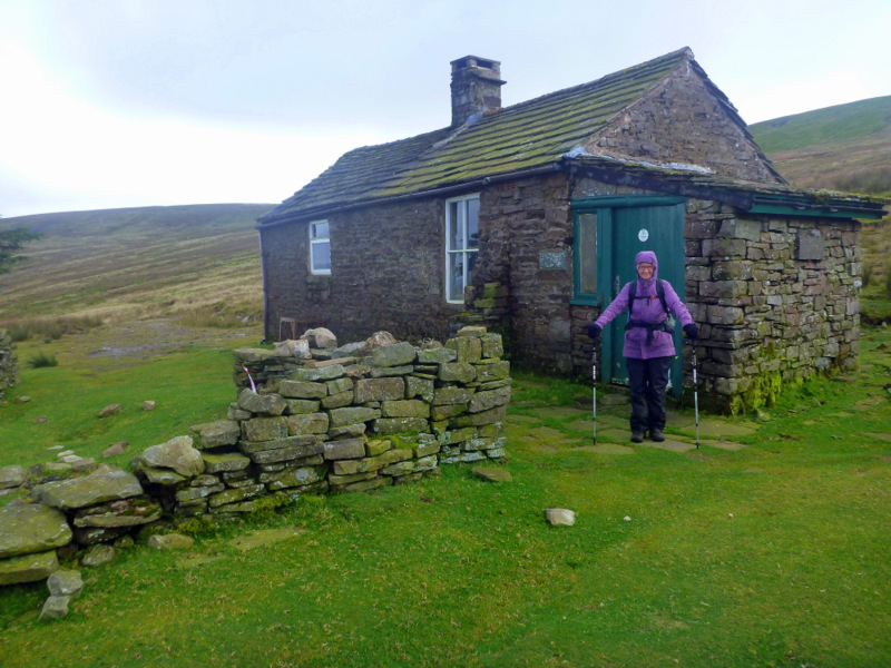
Greg’s Hut just off the side of Cross Fell
The road way improves, but it was still a long way down on a hard surface to reach Garrigal and the Post Office BB. We received a warm welcome and were happy to hear that the pub next door had just reopened and would be able to cope with feeding us, even if just a cheese toastie. That went well with Guinness and cider before going back next door and crashing. Another couple of walkers arrived at 7:30, after taking even longer than us for the crossing after being unable to start before 10am. We commiserated but pat ourselves on the back for coping well with the hardest day of the walk. This B&B was also memorable for all the signs and instructions posted on every available surface. I counted 10 in the shared bathroom, and several more in the bedrooms. She has obviously had problems with some people, but I boggled at the one which said “please take off your cycling shoes before entering the shower”.
Alston streetscape
Out of Garrigal for a nero of 8 km following the Tyne river down to Alston. We mooched around town and had coffee and lunch before crossing back over the river to Greycroft B&B. Pat was a little peeved as she had been expecting us for morning tea, I had forgotten that I had arranged an early check in and she had hung around waiting for us. Back down to town for dinner at the Cumberland Hotel in company of other walkers. They were using a pack carrying service, Brigantes, so seriously slackpacking it.
South Tyne railway
Our first frost was making the grass glow white in the early morning as we breakfasted before heading out. The Way out of Alston goes up and down through many farms and bogs, but there was an easier option for about 6km following the South Tyne railway to where it crosses the Pennine Way. The rail trail is flat and dry so we don’t hesitate to take it. The line is being rebuilt by volunteers, and is only functional for about 4 km. A work crew is laying ballast as we reach the railhead and sleepers are roughly laid in position for the next leg of steel.
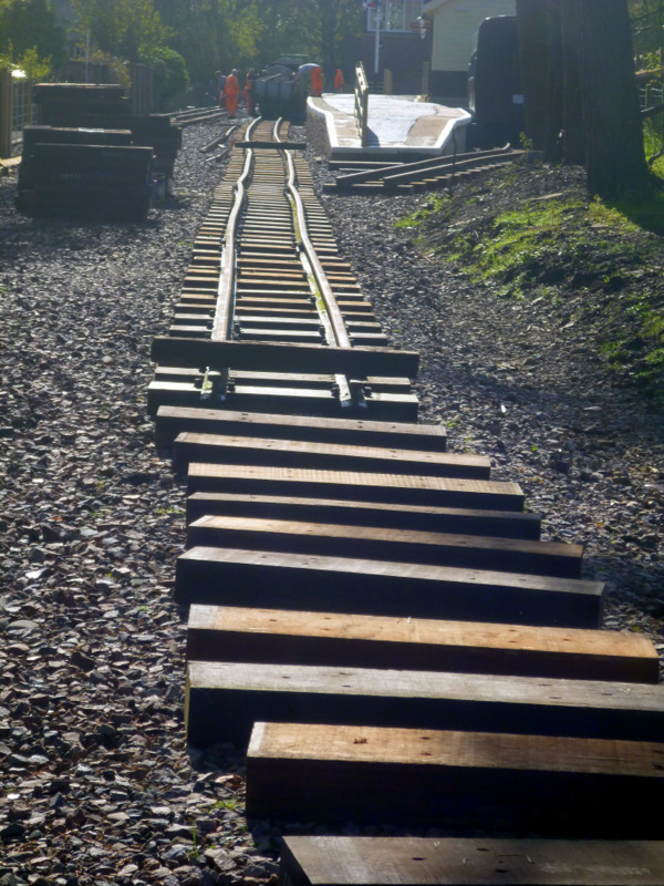
Volunteer work crew laying ballast for new track
We were making 3 miles an hour along the rail-trail, so it was a bit sad to head back into the boggy ground and a climb over another Black Hill. Bog over the boot tops this time, so we were very grateful for some more hard track for the last few kms to Greenhead pub. After the frost, the day was clear, so we’re walking in shirtsleeves for the first time since day 1.
The natural part of Hadrians Wall
Greenhead has an active railway, and we were able to follow it back to the Way, without backtracking to where we left it the day before.
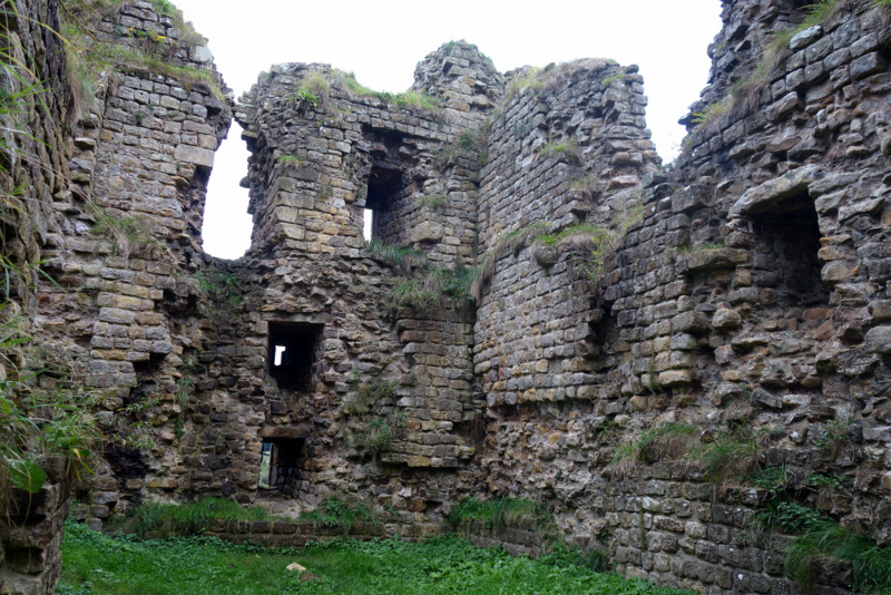
Thirlwall Castle
Thirlwall castle was our first stop, built from Roman stone taken from Hadrians Wall, then a ruin itself by 1700. There was nothing to see of Hadrians Wall, so we were feeling a bit let down, but as we gained some height it was possible to look down on Greenhead and see the double ditch where the wall had been, and where we were actually walking.
Hadrian’s Wall remnant
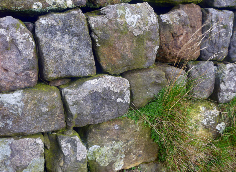
As we walked on, it became more obvious that much of the Wall is a natural landform, with west facing cliffs, that the Romans were able to develop and extend. After we passed Walltown quarry, sections of wall and remains of watchtowers became evident, with what’s left of the wall being about 1.5m thick and 2m high in places, some mortared and some not with an infill of rubble and soil.
Hadrian’s Wall undulations
The wall follows the top edge of the cliffline, so it was constantly undulating, and we were on the lookout for sidling sections where we could skip the climbs. Today was another nero of 12 km to give us time to explore the possibilities of Hadrian’s Wall, so after arriving early at Twice Brewed, we were able to take a bus to Vindelandia, 3 km away, to spend the afternoon.
Stonework on Hadrian’s Wall
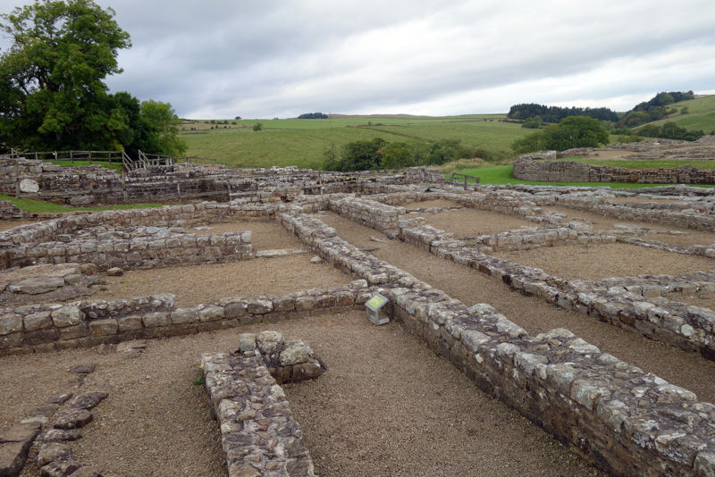
Uncovered footings of Vindelandia fort
Vindelandia is a Roman Fort and an ongoing excavation that has been in progress for over 100 years, with 400 years of work left. The original fort, built of timber around 100AD is about 5m below current ground level, but the fort is known to have been rebuilt at least 9 times on top of that. As well as a town of exposed building structures and foundations, there is a museum collection of items recovered from the outside ditch and preserved by the anaerobic conditions in peat.
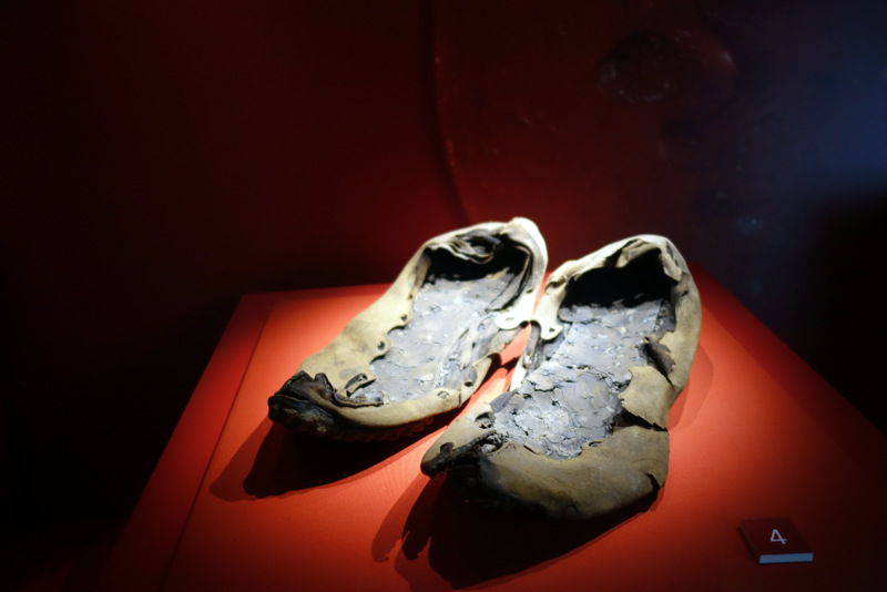
Pair of shoes from a collection of 72 individual shoes
The outstanding items are the shoe collection as well as a collection of timber fragments with inked personal notes to and from all members of the community. Pleas for more beer, wedding invitations, pleas for pardon and so on. We were just amazed that these could have survived because a bonfire had been extinguished by rain as the people left. Then it was back to the pub on the bus after a most satisfying and interesting day.
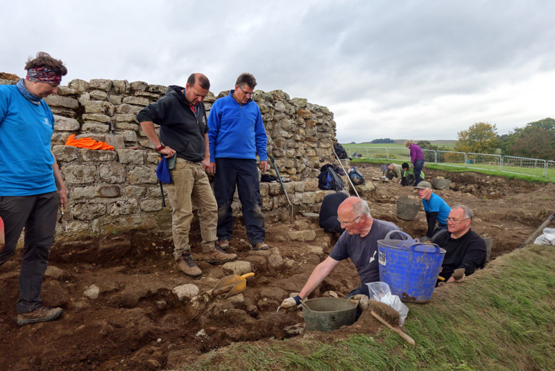
Volunteer time team at work
The next day it was back up to the Wall and its undulations for another hour before reaching Rapishaw Gap and heading off north again away from the Wall. The Way was composed of boggy pastures and hard roads through pine plantations. At one stage we were confronted joyfully by a sheep, coming to within 2 m and following while we walked on. We reached a closed gate with another, larger sheep, upset and baaing on the other side. It ran away as we approached and opened the gate, but stayed close by. Now they were both baaing. I opened the gate a little and held it. The outside sheep instantly ran at the gap and charged through, butting its smaller mum and feeding immediately while she braced. The “lamb” had obviously been a bit too adventurous and couldn’t get back. I hope we did the right thing by the farmer, the sheep were very happy.
Typical track in moorland
More boggy farmland and a climb over Shitlington Crags, I kid you not, but I do wonder how it is pronounced as we are headed for Bellingham, pronounced Bellingen, and a very odd B&B near the centre of town. Our bathroom was so small, the builder had left the basin in the main room, while the shower and toilet were in the bathroom. I had to sit slantways on the toilet to fit my knees inside if I wanted to close the door. We were required to attend breakfast at a set time and place an order, but as each couple arrived the host had to read the entire menu aloud every time while everyone else listened. As we were first to attend, we got to hear the menu read in a Basil voice four times. Everything, including muesli, was measured out in the kitchen and brought to us. None of this helping yourselves stuff, who knows what would go missing. After breakfast, our dry and warm boots and socks were returned for a very pleasant start to the day. We survived to laugh about it, but that B&B has become notorious on the trail.
Roman cut stone recycled from the Wall nearby
Alison on Windy Gyle
Our host had also warned us about a badly bogged and broken 4 km of the trail for the day, and gave us a suggested route around the bog on a forestry road, so with some misgivings we took his advice, deciding that 5km of road had to be better than 4 km of bog. The walking was boring along the roads with little to see for the 5 km and about 300m of climbing through pine forest. Patrick from our B&B caught up to us shortly after lunch, where we regained the Way, and told us that the boggy bits were nothing worse than where we had walked already. He walked with us all the way down the next 8 km to Byrness, chatting about his job in Belgium all the way and the kms just disappeared with the company. Two large hunting type dogs ran past as we headed down, they knew where they were going and just charged past, so we hoped that they were not feral.
We had booked into Forest View BB for 2 nights with dinner, bed and breakfast as there was nothing else in the village. They also offer a pick up and return service from half way through this last section of 36 km to Kirk Yetholm and the end of the Pennine Way. It sounded like a good deal as that was far too much for us in one day, especially with all the climbing required along the Scottish Border ranges. The hostel didn’t open till 4, so we were able to shed boots and make a cuppa in their foyer while we waited. The owner arrived on cue, and immediately took away all boots, socks and gaiters for washing and drying, to be returned only when we check out. He did literally scrub every boot, apparently for disease control, so it was as if he thought foot and mouth disease was still around. There were 12 for dinner, including Patrick who is planning to go right through tomorrow and Martin who will be joining us at Windy Gyle for the pickup at 4:30 tomorrow.
Windy Gyle
The trail next day climbed out of the valley on the steepest and slipperiest path we’d yet encountered for the first couple of hundred m out of Byrness. This was really exhausting work and made us reflect on the overall lack of maintenance we had seen and the amount of repair work needed to keep it as an iconic trail, particularly after seeing all the volunteer work put into the Appalachian and Pacific Crest trails. However we made it up to the ridge crest and the Way continued climbing more gently along the border fence from there. We had started in mist and drizzle, but as we climbed the cloud lifted with us, so by the time we were at 500m, we had a clear blue sky. The wind was still very cold, so parkas remained on, with beanies most of the time protecting the ears.
Climbing out of Byrness
There were still lots of sheep everywhere on the bare moorland, but a few individual black ones caught my eye, then a flock of 20 or more. We finally passed close enough to one of these flocks, to realise that they were the famed feral mountain goats of the Border Ranges. They were apparently released in 1830 after the closure of a monastery, now feral and numbering about 400 but left to roam at will. They were 50% bigger than the ubiquitous black faced sheep, with huge curling horns adorning the head. They were not fussed by our approach to 20m with the billy watching but the others ignoring us, so not feral goats as we know them.
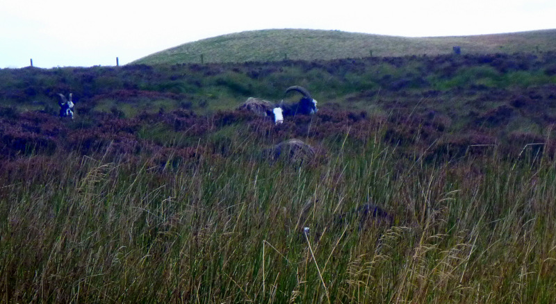
“Feral”goats in the Cheviots.
I must have been losing concentration on the path as I managed a knee deep plunge into a bog I thought was dry, then a full face plant, fortunately onto sphagnum, not mud, when both feet lost traction. We topped out on Windy Gyle after 71/2 hours, then had another ¾ hour to drop 300m over 2km to the farm where we were to be collected at 4:30. Martin was just ahead of us, but the rest of the people were well out of sight, at least 45 minutes behind us. Joyce was waiting in the bus, and decided to take the three of us immediately as she had to do two runs anyway, at 30 minutes each way. After the second run she would be back by 6 and expected to cook dinner to order for 14 people. No wonder they were planning to shut down and get out at the seasons end. Colin again confiscated all boots etc for cleaning, while we made sure that we were on the first transfer back to the farm tomorrow morning.
Looking back down to the Trows Farm drop off point
Our last day on the trail and we started walking from Trow’s Farm at 9:30 with the climb back to Windy Gyle looming over us. It only took an hour to get back to the Way, then slabs and bogs in equal measure up onto West Cheviot. A detour out to the main peak didn’t attract us, so we continued onto a bothy for lunch. Two of these have been placed in extremely exposed positions as shelter huts. I guess that makes them easy to find and they would be kept free of snow by the wind. Room inside for 6 with 3 on benches and 3 on the floor. More than that and life would get warmer inside at least. We climbed on over The Shill, then started the 8 km descent to Kirk Yetholm. As it was a Sunday, there were people everywhere, dog walkers, fell runners, day hikers and a few like us just trying to finish. There was a high path for people happy to follow the lay of the land and a low path for those like us who just wanted to get down. The low path gently descends on farm tracks, then a road until it rejoins the high path at a car park. Then there is a last ridge to cross on 2 km of sealed road. Just as we started this bit, Ali stuck out her thumb and a lovely couple picked us up and took us to the front door of our B&B. That made for a great finish after a strenuous and foot pounding day. Claire at Mill House took us in, got our washing done and booked us for dinner at the Border Hotel where we can get our free pint and certificates signed.
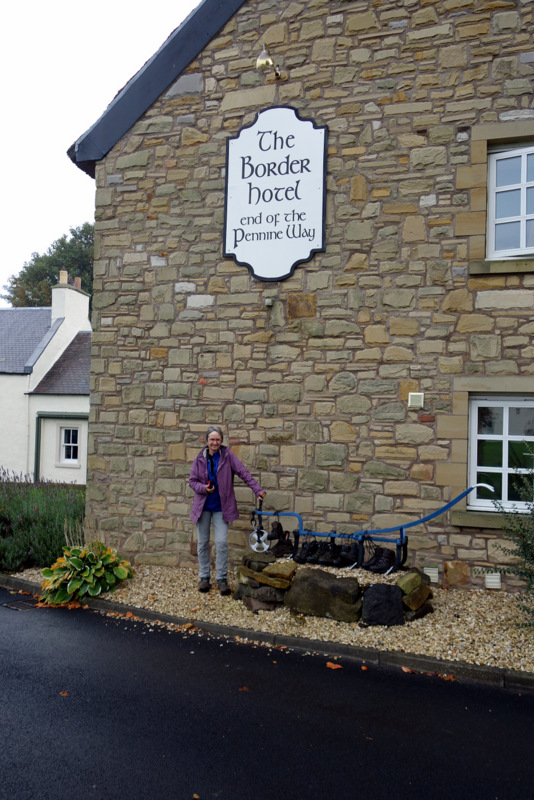
Border Hotel and northern end of the Pennine Way
We settled into the pub and wifi to discover a reminder from Facebook that today, the 24th of September, is our anniversary for completion of the Appalachian Trail in 2010. So how’s that for serendipity.
