The most dramatic and spectacular walk in Australia. Rough unmarked tracks, wild weather and isolation make this a walk for experienced and well prepared walkers not to be undertaken lightly. This 16 day trip combines the traverse of both ranges without resupply making it one of our most memorable shorter walks.

South West Tasmania Walking Map of the Arthur Ranges
Day 1, Tue March 3, Scotts Peak Dam to Junction Creek

Clean and dry for the last time for weeks.
Set off from the bus at 1200. We only had one other companion who was out for a day trip and returning to Mt Field on the same bus. Heavy packs, telling once the boardwalks stopped and we’re stepping around bogs. Digby wearing a daypack slung in front helps him balance while with it on top of the main pack the load is too great and top-heavy. Both main packs weigh around 25 kg with the daypack at 12 kg. Good weather with clear views of W Arthurs as we approached. High cloud and spitting rain, but not wet enough to drag out parkas. Weary after 3 hours to Junction Creek, so camped in ti tree forest on creek bank. Very sheltered.
National Park Service claim that Phytophthora is in the area and so they provide a scrubbing-brush to wash down boots and gaiters. We are supposed to stand in 6 inches of water in the creek to do this, so neat steps are provided down into the creek. Cute but hardly an effective Phytophthora barrier.

Phytophthora scrubdown at Junction Creek
Day 2, Wed March 4, Junction Creek to Cracroft Crossing

Endless Arthur plains heading up the Razor
A 7 am start after sharing the campsite with 3 other groups. One going out, one going on to Cracroft Crossing and then out, and a lone Israeli (Soren) going to Federation.
Very slow going on the button grass bogs led to a 2 pm lunch at 7 mile creek as we weren’t carrying water. Peak hour at the creek as several groups came down off the Western Arthurs. Would have camped at 9 mile creek, but nothing suitable so pushed on with good clean walking over the Razorback range with a clear view of Federation Peak from the pass. The last half hour to the crossing very boggy but we eventually made it to a sheltered campsite at the old hut site. Loo with a view on a rise in the button grass swamp 100 m out from the tree line. Just a seat on a hole with no walls.
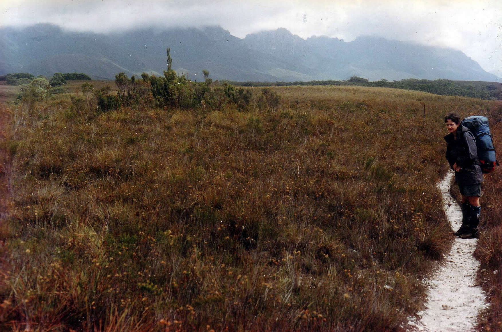
Arthur plains with Western Arthurs
Day 3, Thur March 5, Cracroft Crossing to Pass Creek
Supposedly an easy 2-3 hour day, but the bogs were very deep and wearying, finally arriving at the Pass Creek campsite at 2 pm after a 9:30 departure. A very cold day with rain showers and some sunshine. Met one other person going down and out who had been in snow this morning. Ali feeling the chill very much and losing co-ordination after a few hours. Just not enough energy food, so breakfast runs out by 10:30.
We are hoping that the weather clears by tomorrow as predicted, as we are hesitant about heading up the range in weather like this morning. Pass creek campsite is very sheltered in 10m high Ti Tree, but wind and showers continued through the night.
Soren arrived in late afternoon, also very weary and slowed down by the bogs and his huge pack. Apparently wheatbix and 10 rolls of toilet paper are essentials for him.
Day 4, Fri March 6, Pass Creek to Goon Moor
Still bleak and blowing, but decided to go anyway after leaving 20 kg of food behind. Someone had abandoned a 20 L canoeing drum which had been used as a rubbishbin. We cleaned and washed it, lined it with a plastic bag and repacked it with our spare food, keeping enough for the return trip to Federation Peak. Left it out of sight with spare fuel and the daypack, and covered in brush for our return next week.

On the way up Luckmans lead.

Just below the Boilerplates
Soren decided the weather was too poor and stayed put. We headed on up Luckmans Lead with vertical bog and wet rock. Parkas zipped and Ali in overpants, but we made it to Stuart Saddle with no great drama after a lunch in a sunny and sheltered saddle just below the Boilerplates.
The campsites here were very wet so we kept going for Goon Moor. A long and steep descent below the Needles, then a longer climb on scree and rubble to regain the ridge. Weather worsened, with strong gusts enough to unbalance us and bursts of hail mixed with the steady rain. Moving on the exposed side of the Needles was very unpleasant, so we were relieved to find the National Parks campsite just before Goon Moor. Platforms had been built into a scoparia forest with a water tank. One other couple in residence had been there 3 days waiting for a break in the weather. Our confidence boosted by this meeting as we had thought the weather annoying but not that bad.

Goon Moor looking north to campsite
A cold night with much heat lost through the floor. Inner tent soaked with condensation, but nothing frozen. Rain stopped around 1 and wind gone by 3. Morning arrived clear with high cloud.
Day 5, Sat March 7, Goon Moor to Thwaites Plateau
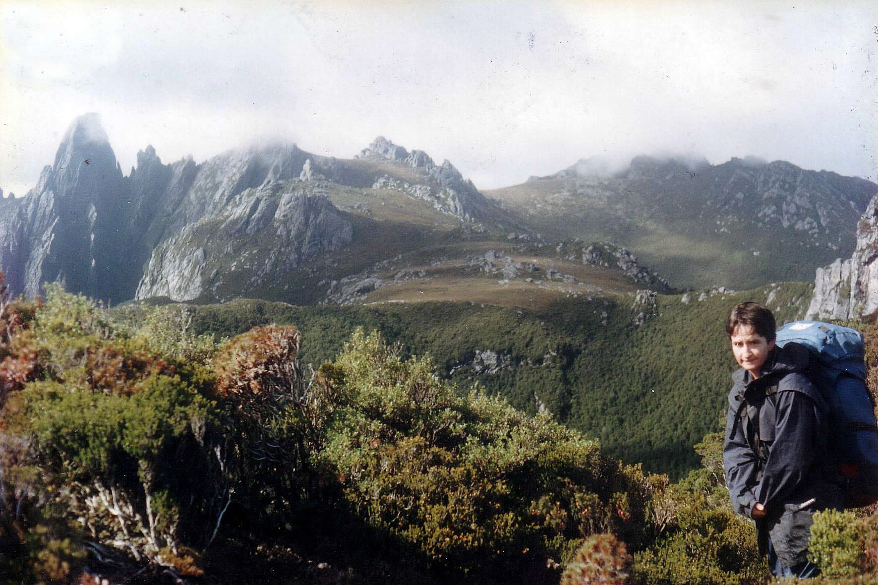
Final approach to Thwaites Plateau
A promising morning, superb by lunchtime. Windless and clear blue sky, but light planes buzzing all day. Very rough walking and scrambling around Four Peaks, with some climbing sections of 3 – 6 m, quite difficult with packs. Should be interesting on the way out with some pack hauling, but only had to pass Ali’s pack up/down a couple of times. 4 1/2 hours to Thwaites plateau but then had some wandering around before we found the campsites in a sheltered forest ridge on the NE corner.
Picked one on the edge and spread everything in the sun to dry. Even washed clothes and hair. Hot sun and little wind feels good, but by now the tent site looks like a Chinese laundry. The other couple who were camped at Goon Moor left their tent there and continued to Federation Peak planning to return on the same day. That’s too hard for us, so we’re gambling on the same weather tomorrow. They finally go past on their way back at 5 pm, we still have no cloud and a slight breeze. Unreal. A Swamp Rat had emerged and was ripping into our food bags within an hour of arrival, so it could be an interesting night protecting the food.
Day 6, Sun Mar 8, Thwaites Plateau to Federation Peak and return.
Another fine hot day so we’re breaking out the sunscreen and wishing for sunhats! Packed daypacks and headed for the peak by the Southern Traverse.
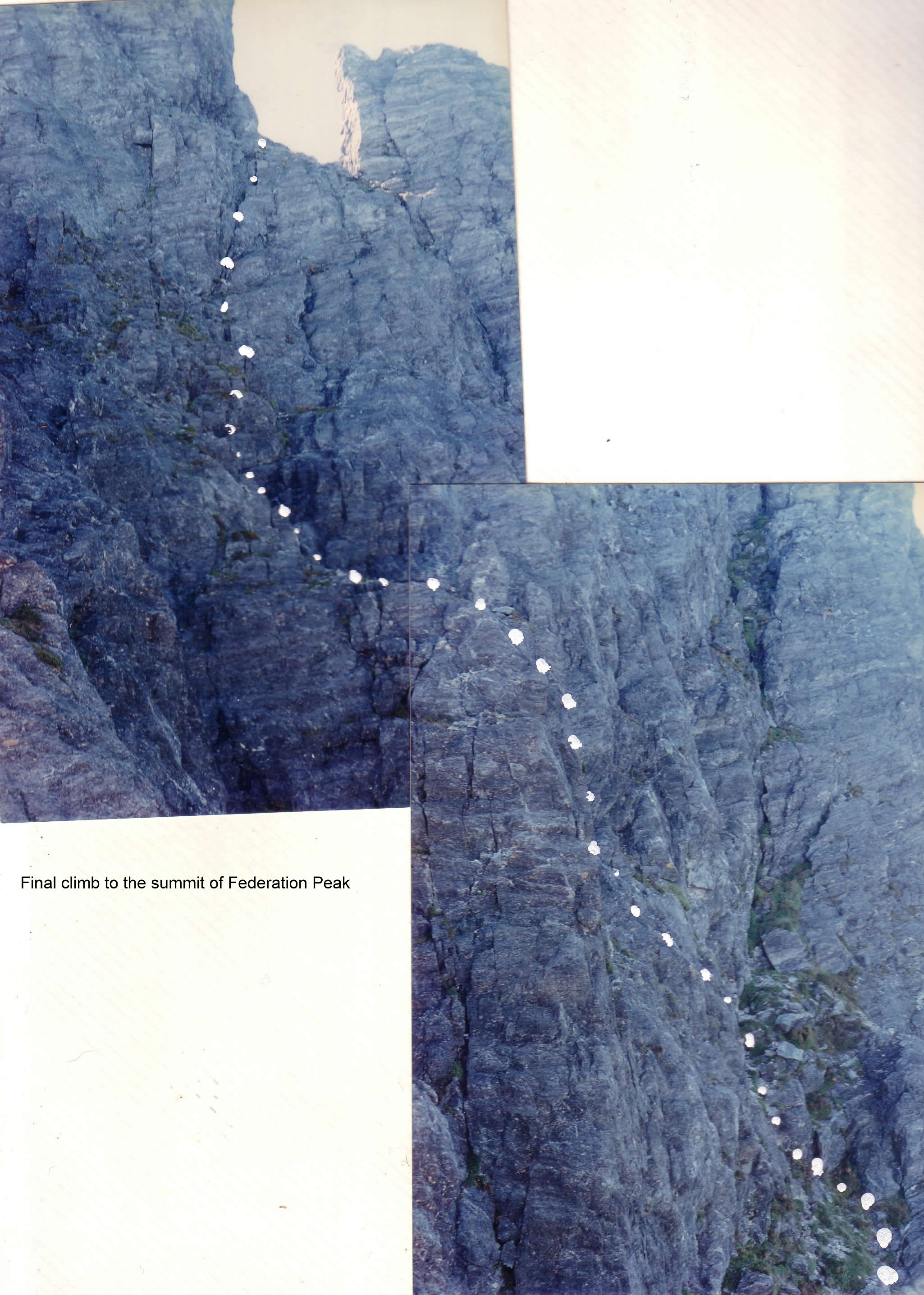
The final climb to Federation summit
Airy and scary, but mild compared to the final climb on the summit block. This involved several climbing moves up 2-3 m sections with 50 m vertical exposure and a clear drop to the lake 500m below. A fall would certainly be lethal, but the climbing is easy. The log book on the summit contains many comments re fear, especially the Bene Gesserit quote from Dune. Most people seem to worry about the going down, with one especially worried about what her mother would say. In the event, Ali had far less trouble going down than up, I guess, because there was no option.

On the Top
Splendid views from the top from Bathurst Harbour to Prion Beach to Hartz Range to Frenchmans Cap etc. Solid blue sky, but a cold wind, so we only stayed half an hour.

Hanging lake from the overlook
On the way back down to Thwaites plateau, we went over to the Hanging Lake overlook. There is a cabin with workmen installing tent platforms in the scrub below the lake. What a job!. I’m sure that Patrick or Jeff Fowler would love it. We’ve been impressed with the conservation measures in place to protect the bogs and gullies rather than the walkers. Stairways have been installed where gullies are eroding, rather than up cliffs where there is no damage from traffic. Any signs are just instructions to spread out or form up or avoid crossing this area.

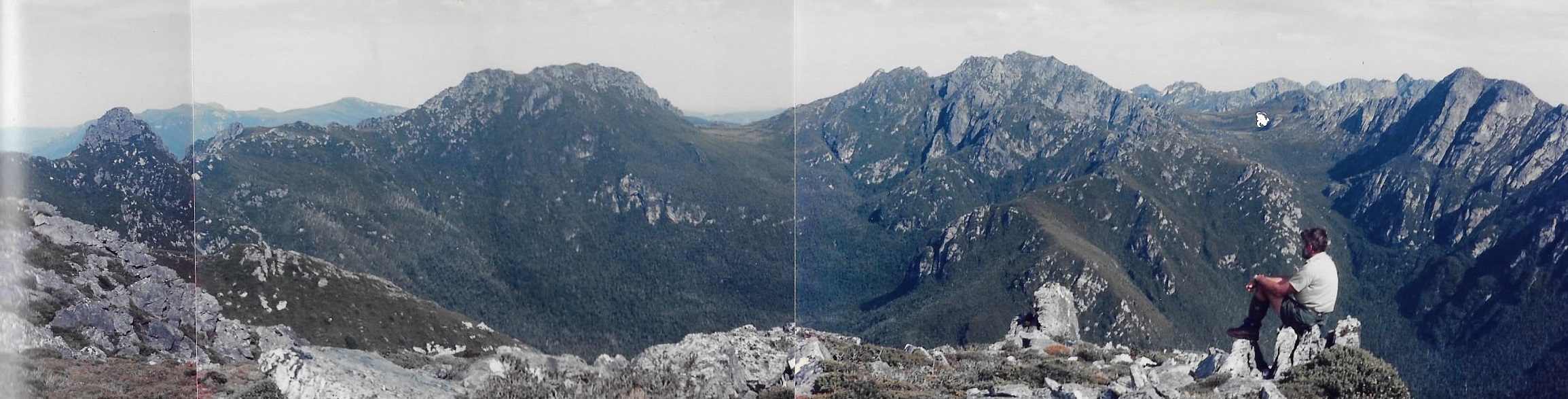
Eastern and Western Arthurs. Stuart Saddle on extreme right. Western Arthurs in background.
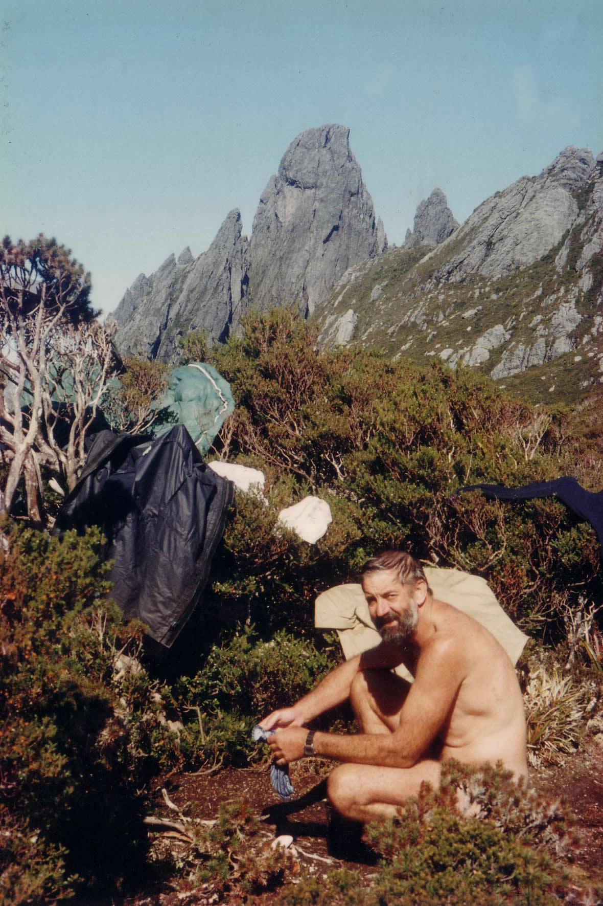
Laundry day under Federation
Arrived back at camp weary and elated with achieving the first goal. Now looking forward to getting back down to Pass Creek and up onto the Western Arthurs.
Day 7 Monday March 9, Thwaites Plateau to Goon Moor
Still blue and clear with a brisk and cold wind. Tiring walking going through the FourPeaks although the rockclimbing sections are much easier going this way. The very rough walking due to scrub, uneven ground and up/down nature made us decide that Goon Moor platform was far enough for today. Settled in by 2 pm and spent the afternoon sliding around chasing patches of sunshine coming through the dense ti tree. Well sheltered but shaded.
Ali’s sore muscles and my swollen knee boding ill for the long descent on Luckmans Lead tomorrow.
Soren appears to have disappeared, with it likely that Luckmans Lead too much for him and his enormous pack. The dense scrub bands were very difficult. We met another young couple doing Federation from Goon Moor as a day trip, but they were back by 4 and did not climb the peak.
Day 8 Tuesday March 10, Goon Moor to Pass Creek.
Windy but clear blue skies with some cloud building up and mares tails suggesting a change coming through.

Western Arthurs from top of the Needles
Passage around the Needles still very rough walking but coped well, taking 2 hours to Stuart Saddle. Located John Stuart’s tomb, pretty much as I remember it from 1967. Original punched plate, engraved medallion and now 2 Jesus statuettes. The rock pile sits in a glade on the western side of the saddle, with a view to the Western Arthurs. A good vibe place – now. We found it on my first trip by accident, lost in cloud. It allowed us to relocate the main trail once we knew where we were.
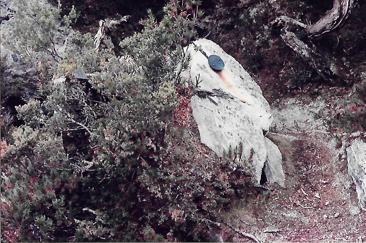
John Stuarts tomb RIP 1956
Still hard walking around and over the Boiler Plates and down through the scrub bands on Luckman’s Lead. Not carrying water and after 4 sunny days, the bogs have all dried up and we’re running dry ourselves. Finally found a puddle to drain with a cup for drinking. Back down to Pass Creek by 2 pm and glad of another restful afternoon. The drum of food remained untouched.
Day 9 Wed March 11, Pass Creek to Lake Roseanne
A hot clear day, hottest so far and a long slog up Lucifer Ridge.We were only carrying half a water bottle, so we were once more draining puddles in boot prints for drinking water. Very heavy packs again after replenishing from our supply, back to 12 days food and fuel supply.

A quick dip in Lk Rosanne. Numbing.
Arrived at Lake Roseanne for lunch, 4 hours from Pass Creek. A very quick dip in the lake, with a shampoo wash on shore lifted the spirits. A noisy group of 6 older men arrived and took over the campsite, so we packed and moved away to a more isolated spot tucked under a huge vagrant boulder. The sun disappeared behind the Crags of Andromeda by 5, so a long cool evening with the group chatting until 10:30 before starting up again at 5 am. Glad we moved a bit away.
Day 10 Thur March 12, Lake Roseanne to Prom Lake

West Portal and Crags of Andromeda waiting for tomorrow.

Camp under an erratic boulder. Hope that it doesn’t move again.
The camp at Prom Lake tonight is the white dot above my head, after the whole skyline over the Phoenix.
Clear skies all morning, with cloud and mare’s tails building all day. Not looking good unless it just blows through. A strong wind made walking on the exposed ridge top a bit tricky with us both being blow over a few times.

Absolutely knackered with Phoenix still to go
Our packs are still far too heavy despite dumping 5 kg excess at Lake Roseanne. Arrived at Prom Lake at 5:30 after 8 hours walking time. We are both feeling sore and exhausted after 4 long steep ascents through the day, completing Lucifer Ridge then West Portal, Centaurus and Phoenix. Phoenix is particularly aptly named with new summits continually rising before us. The trail itself was generally easy, and would have been a very pleasant day carrying a day pack. Good views of Eastern Arthurs and Federation Peak in one direction with Lake Pedder and the Scott’s Peak road blighting the landscape in the other direction.

Finally descending to Prom Lake after a long hard day. Haven Lake for tomorrow is just at Alison’s elbow.
Day 11 Fri March 13, Prom Lake to Haven Lake

Prom Lake to Moraine K
A strong northerly wind all night blasted the tent around but it stayed quite warm until the wind shifted to the south west and the temperature dropped suddenly. From Prom Lake to Lake Vesta was a pleasant 1 hour stroll through open moors and rocky gullies until the long steep climb up to the summit ridge of Mt Scorpio. We crossed the top of Mt Scorpio in blustery bitter cold wind.

Haven Camp
Escaping down Moraine K back to 7 mile creek looked tempting for a while, but enough sunshine came through to spur us on down to Haven Lake. Bodies and packs feeling more comfortable today from an easy 4 hour day after the hammering yesterday. Camp sites at Haven Lake a bit exposed to the blustery wind, but could be worse. My carry mat has been punctured and I am entertaining myself trying to patch it. Nylon shoelace melted into the hole worked for 2 days before cracking away, now trying with softer plastic and tape.
Day 12 Sat March 14, Haven Lake

Hangman
The weather final let us down with gales, sleet and hail for most of Friday night and Saturday. We decided to stay put in the relative shelter of Haven Lake in spite of the wet site and several rivulets running under the tent. Some leakage inside but not too bad. Very cold all day, so spent the time fully dressed inside sleeping bags playing Hangman.
Gales and sleet eased toward the afternoon, so hoping for better tomorrow. Living in the tent through this is rather like camping under a railroad bridge at peak hour or being the rat as in terrier shaking a rat. No luck on the carry mat, so it’s just like the old days learning to sleep on the ground.
Day 13 Sun March 15, Haven Lake
Sleet and hail continued through the night, easing around 8 am to a total white out. Cloud lifted towards the afternoon allowing a view of some of the nearer peaks, but we decided to stay put in the hope of better tomorrow.
Day 14 Mon March 16, Haven Lake to High Moor

Serrated ridge leading to the Dragon. High Moor just visible below the cloud.
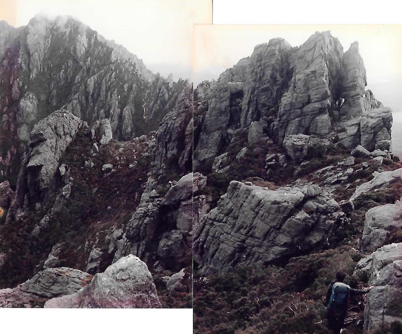
Still sleeting overnight and wind picking up again but morning cloud starting to break up showing some blue sky. Good enough to gamble on more improvement . The cold wind stayed for the day but only light showers of rain drifted through. The scramble up Mt Taurus and along its saw blade ridge was straightforward if gymnastic. The Dragon turned into an exercise in very steep eroding gullies scrambling on scree. Lovers Leap has been bypassed, so no problem here needing pack hauling anymore. Similar story for the Beggary Bumps, with a few exposed moves, but generally a strenuous but pleasant day in good weather.

High Moor Campsites
The High Moor campsite is exposed and wet, but a small mound allowed enough drainage, if a little small for us both to fit. A least it was an improvement on Haven lake.

Fully rigged for bad weather
Day 15 Tue Mar 17, High Moor to Lake Oberon

Route up Mt Capricorn. “Very Steep”
Howling gales and driving rain for a few hours but had mostly cleared by morning. Packed and off again by 9:30 with a few blue patches showing in the sky. These came and went throughout the day. A very steep climb up Capricorn, very exposed but nothing like the climb up Federation. The days walking was not as bad as we had feared, although we are getting sick of slogging up scree gullies only to go down another one to go around and up the next one. We reached the top of Pegasus to not recognise any part of it from my memory of spending the night up here in a cave in 1970 after being trapped by bad weather.
The route to Mt Pegasus (on left) is in there somewhere

Exposed traverse across Pegasus, High Moor in background
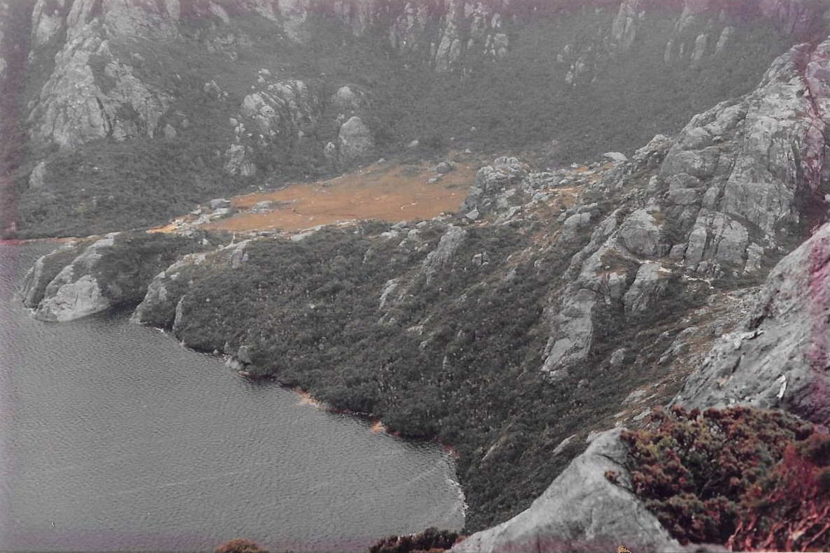
Lake Oberon with campsites in the scrub
The weather this time was also too poor to explore, so headed down to the tent platforms now installed at Lake Oberon. Another man and his son were heading east from the top of Pegasus at 2 pm with at least 5 hours to the High Moor camp. Didn’t envy them at all, especially as the boy seemed ill equipped for the rain and wind. A toilet at the Lake Oberon tent site made it a luxurious place, so I assume the overflow swamp had been getting badly damaged.
Day 16 Wed Mar 18, Lake Oberon to Junction Creek
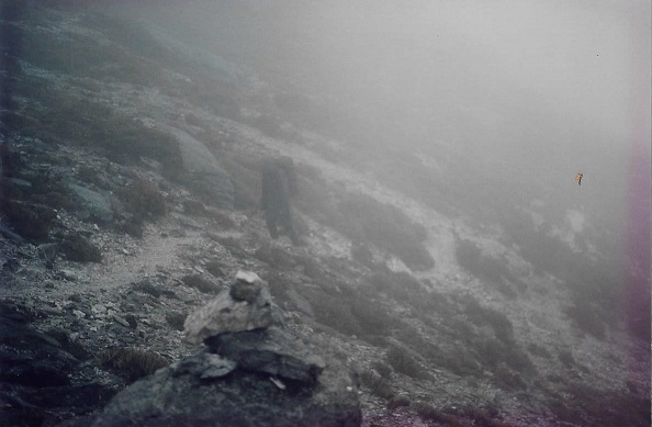
Ali in a cloud somewhere within a few kms of Lk Cygnus. Thanks be to rock cairns.
More gales and rain all night, so we are very happy to be installed in the shelter of the tent platforms. We only had about 50 m visibility for the entire day, so missed all the highlight views. Easy walking for most of the day with only 3 scree gullies to climb, one of which felt so loose it just needed a push for all the rocks to start flowing underfoot. We only realised we were at Square Lake when we crossed the inlet channel, and even then we had to follow a few paths to make sure. Lake Cygnus has now been bypassed by the National Parks boardwalk, but we did gain a few glimpses of Cygnus and Fortuna far below through the mist.

Heading down Moraine A

The sign is all that is holding Digby up
The descent of Moraine A took about 2 hours with 3 knees and 1 ankle suffering badly by the bottom. The last 3 km across the plain to Junction Creek was a trial but we made it after a 8 1/2 hour day. Our longest day for the walk. 2 lads arrived just after us who have the bus booked for a pickup tomorrow. Bliss!

Even a pick up at the end. Better than walking back out to Maydena.

Wow Digby – what a terrific story. You had a very tough trip and came out relatively unscathed. Thanks for putting this together, really enjoyed it.
LikeLike