Corsica May 2001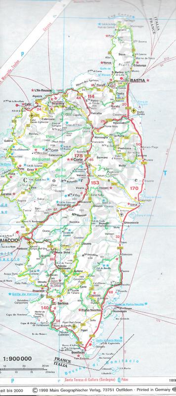
Route followed from Ajaccio
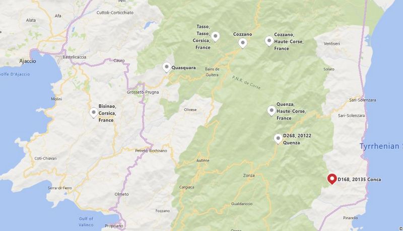
We actually went to Corsica pretty much by accident, as we had been planning to walk in the UK but all their footpaths were closed after a major outbreak of Mad Cow disease. Corsica and the GR20 was on our list and we had done two trips in France the previous year, so we thought our French might be still up to the challenge. After getting an update on the trail, however, we found that although the trail is usually open by May, the winter had been a snowy one and the high passes on the northern end of the trail were still closed, or at least requiring full mountaineering gear. We weren’t up for that level of difficulty, so we opted for an 8 day trip climbing up to the main range from Ajaccio in about the middle and walking south to Conca, planning to return to Ajaccio on other footpaths.

Water Taxi across to Porticcio
Our accommodation in Ajaccio had suggested that we catch the 9:00 bus around the bay to Porticcio, where the approach footpath actually starts to climb inland. When we turned up at the bus station, they were closed as the first bus wasn’t until 11:45. However the main tourist info desk suggested a taxi if we were in a hurry, or that there was also a “petit bateau” at 9:00. We wandered down to the main wharf to discover a tour and ferry operator who was indeed doing a water-taxi run across soon. This was all of a 15 minute crossing, zooming around all the cruise liners in the harbour and dropping us off in the town. We couldn’t find any signs indicating a trail, so we wandered around the coast, eventually finding a real signpost next to a cemetery.
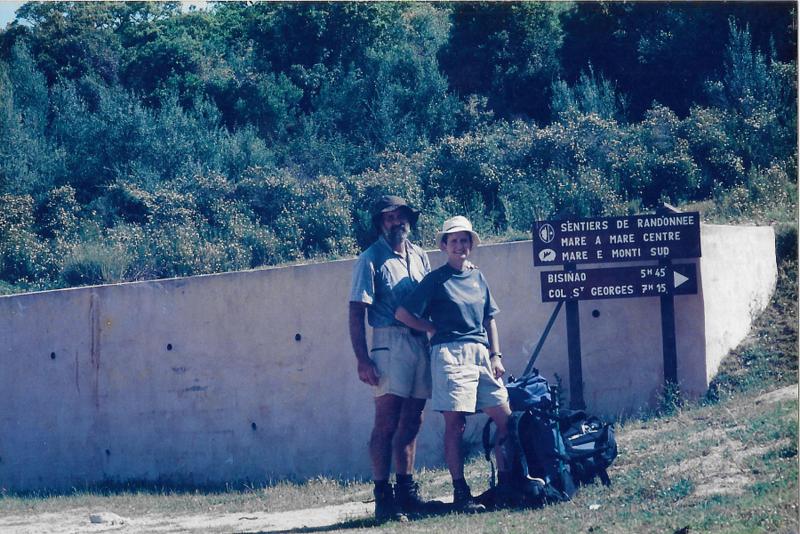
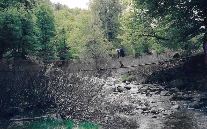
Start of access trail to GR20
Once on the trail, there were no more route finding issues, just too much orange paint on every possible spot on the trail. We spent the morning climbing steadily on a 3 km roadbash, with our feet just beginning to feel the bruising when the turnoff onto a footpath appeared.

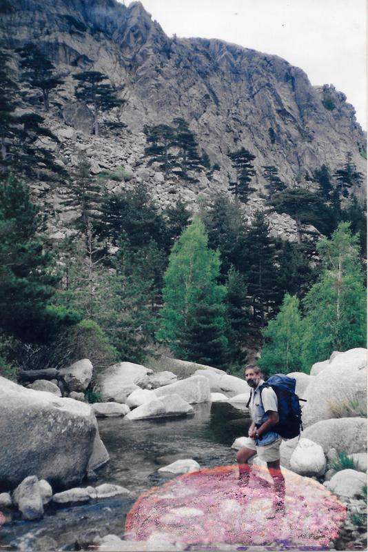
Alpine meadows
Another 2 km with a 400m climb took us to the high point for the day at 880m and a descent to 650m and our gite at Bisinao. There were 4 rooms, each with 4 bunks, and they all filled during the afternoon. The French couple in our room were asleep when we came in from dinner, and had left before we woke in the morning. Dinner was a very pleasant affair with 4 more French, 2 English and one Canadian sharing the chicken soup, lettuce and an omelette. We were also given a local digestive, Mir, a scented reddish liquor made from blueberries.
The tourist office in Ajaccio had taken our walking guide and organised our accommodation along the way so we didn’t have to make bumbling phone calls in limited French asking for a room. However the down side of that was that today was a very short walk between gites, so we arrived at the St George Col auberge before midday. The trail had been shifted some years before but we had the old map, but you would have to have been pig-headed to ignore all the trail markers and signposts. An extra 1 km of road-bashing was the result, which we had to walk twice, once yesterday coming down off the ridge and again to get back to the main trail today.

Our Gite was tucked in behind the Auberge du Col St George
The ridge walk was quite pleasant, wandering along with minor ups and downs through very Australian looking vegetation. The Mediterranean climate with sandy granitic soil means low nutrient and low water so the sclerophyll scrub dominates. The most common plant looked like ti tree but the flower didn’t appear to be in the same family so I had no idea what they really were. The high points on the ridge had a sandstone cap over the granite, but not metamorphosed at all, so they were laid down and eroded off long ago. A clear sky again, with a cool breeze and a hot sun.
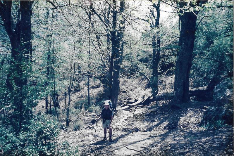
Chestnut forests
We were booked into the gite at St George Col, which appeared to have been abandoned in favour of the larger auberge in front. Both parts were run by the same family, but the gite had no other guests. Dinner was another grand affair with thick vege soup, cannelloni, peach sorbet and the inevitable cheese platter. We thought the other guest at the table was also family as he came over for a chat in French after the meal. We were able to exchange meaningful information, but only if they spoke baby French back to us. The barman took us out to his pear tree and showed us how he makes his pear liqueur. A bottle is placed on a developing pear, which is allowed to grow to full size in the bottle before it is picked and the bottle filled with liqueur brandy.
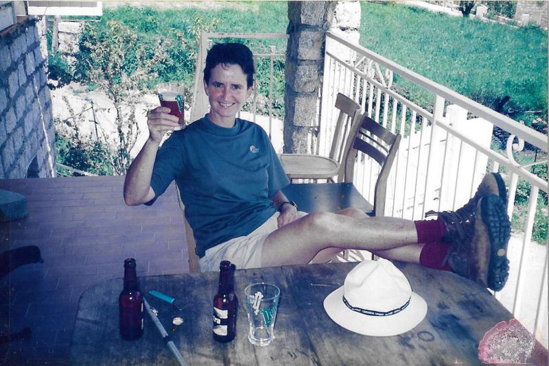
Looks like beer, hence the pink cheeks.
Day three was again hot and sunny with very little water along the way as we were following up a major ridge line with great views back to Ajaccio, so we were grateful to find a small flow at lunchtime, then a roaring spring about 1 km further up. The walking was mostly 200 metre climbs up and down through chestnut forest and open pastures with goats, cattle and pigs wandering at will. Shotgun shells littered the ground, at times making it impossible to walk without treading on them. Oddly enough we saw no other animal life.

Rather tame wild pigs
Quascara was set well below the ridge, with the descent again through chestnut groves, but the village appeared abandoned. We were unable to raise anyone at our gite, knocking on every door in the house until an old lady stopped to help. She took us a few doors up and located the mother of the gite’s owner who produced her daughter. All was ok, we were expected and dinner would be at 7:30, but she was unable to speak slowly enough for us to follow. Our “lentement, lentement”, was ignored and she’d just rattle on. The building had been built of hollow concrete blocks, badly rendered, so there were many holes through to the block core which allowed for nesting finches and other wildlife to take up residence throughout the walls, and ceiling. Digby had to hammer on the ceiling to get everyone to quiet down before we could get to sleep. Dinner again was a good meal, with wild boar pate, chicken pasta and an apple tart, but we were so weary after the afternoon lazing in the sun we were in bed by 8:30.
Breakfast in the morning was sitting on the dining table waiting for us along with some baguettes for lunch and our bill sitting next to the food with no one in residence. Once we’d finished eating we simply left the money on the table and walked out.
Starting to make some altitude
It was fast and easy walking through to Tasso with gentle climbing and descending along the ridges through abandoned chestnut groves and foraging pigs. In one saddle there appeared to be a birthing pen, where small animals could come and go, while the bulk of the pigs were milling around everywhere, well over a hundred of them. Cape Trib life had made it very hard to get our heads around pigs as farm animals, especially as they are just running wild in forest. At around midday we’d followed the main track down to Guiterra, where we had tried to book a night but no one would pick up the phone, so we were quite glad to have to carry on. Not so happy as we climbed back up out of Guiterra to discover a shortcut that would have bypassed the 200m down and up.
We arrived in Tasso and couldn’t find the gite, walking past a small school which had a phone on the front verandah. We were about to call and ask for directions when we realised that the school was the gite. Our bedroom was behind the school room which operated 3 days a week for 7 local small children. It was just like being back at Epenarra. Alison left a message on their whiteboard.
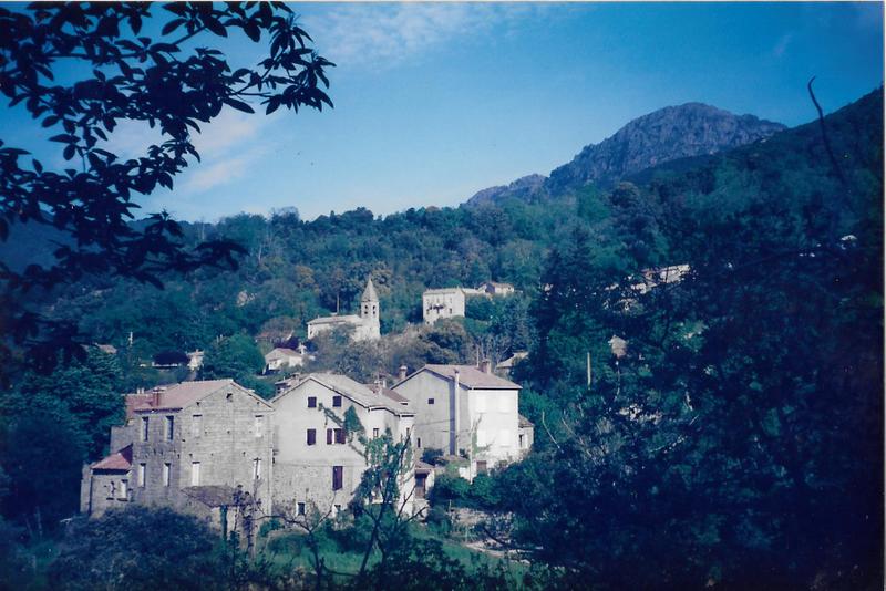
Beautiful village of Cozzano
The view from the school was across the valley to the main range, where we were to walk the next day, but we first have a 300 m descent to the river before climbing again to Cozzano. Again we were walking in forest on packhorse trails, but there were small graveyards all along the way, many of the grave-stones very old. Cozzano is a small town but there was a supermarket where we could buy food for the next few days in refuges. There were 6 old men sitting on benches in the square, studiously ignoring us as we got our food and repacked everything for the climb out.
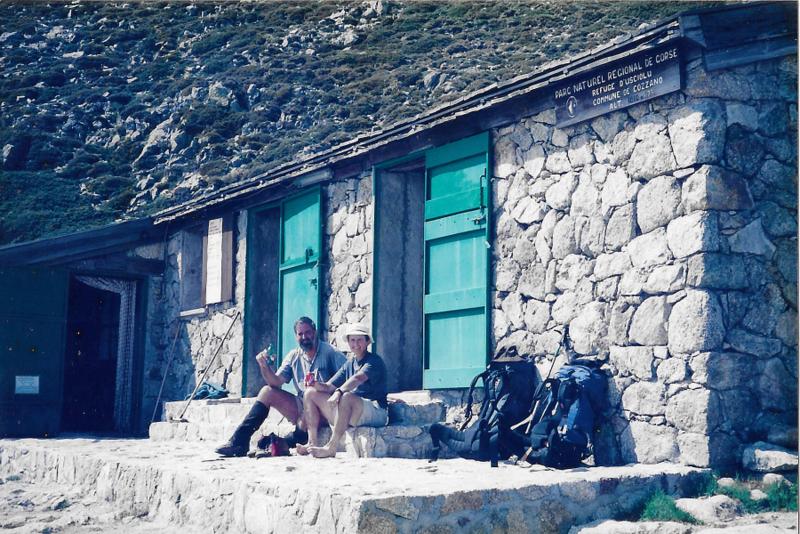
Arrival at the Refuge D’Usciolu
It was 1000 m climb up to the Refuge D’Usciolu, over about 4 hours, and we arrived just as the guardian was loading his ponies for the trip down, but he dug out some wine for us before he left. A notice on the door told us that the postman goes down every day, which was hard to accept as a commute. An English speaking German couple entertained us for the afternoon, while a French couple arrived later in a state of near collapse. After that a yummy dinner of rice and sardines with a bottle of red left us feeling quite mellow.
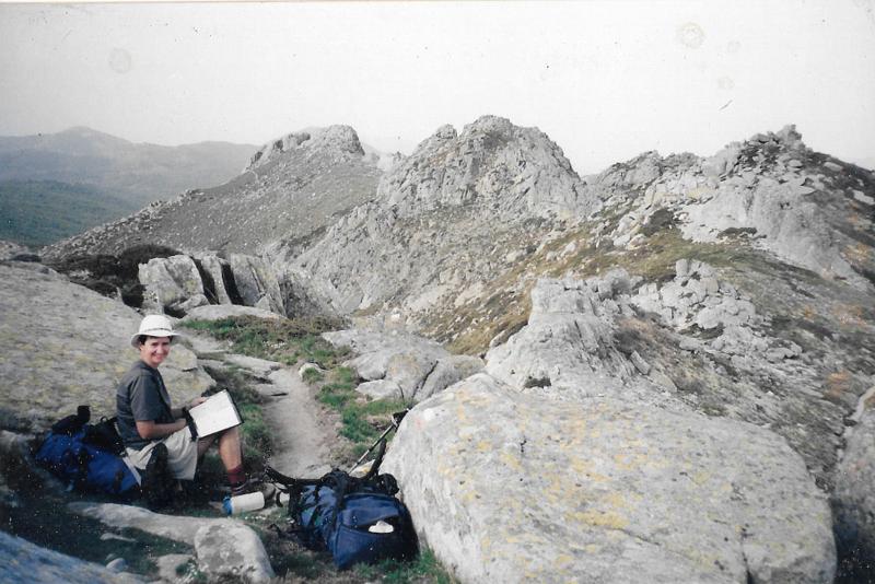
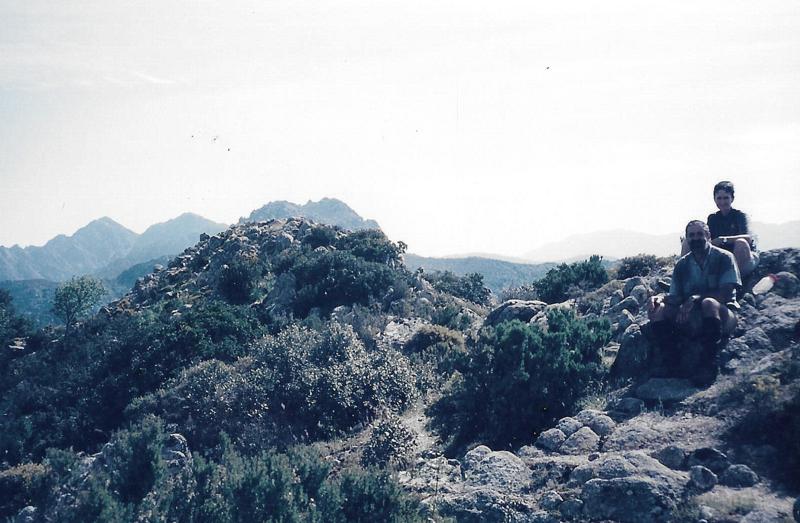
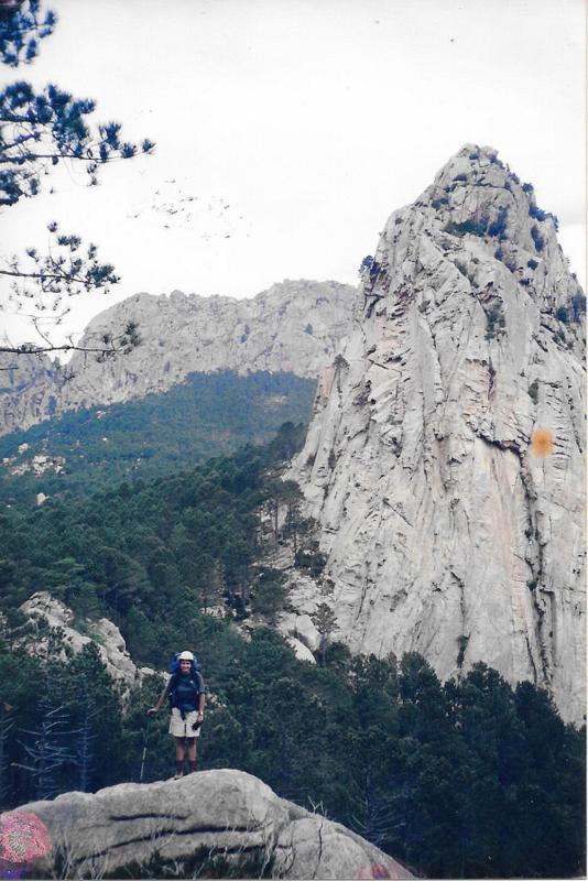
High level traverse
So we had finally reached the GR20, although the walking through to here had been really interesting and worthwhile anyway. There was a distinct difference to walking in mainland France, with fewer people away from the coast, the sclerophyll vegetation and the dependence on stone for construction. Not quite French and not quite Italian, and much more rural than anything we’d seen on the GR5.
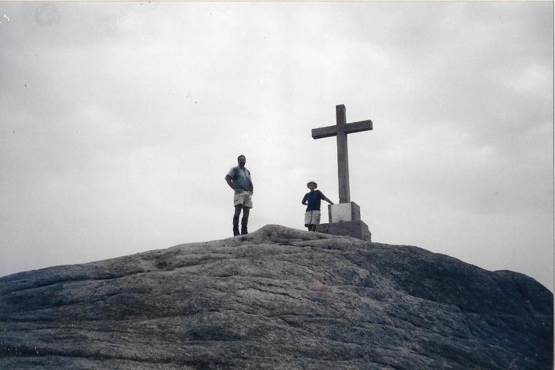
Summit of Mt Alcadine.

And down down down to the Refuge
The walking south from the Refuge was a spectacular high level traverse over granite peaks for a few hours before dropping to alpine pastures with cattle and pigs again. Mt Alcadine, the highest peak of the south was waiting for us then, with a 700m ascent to the summit and a very steep 500m descent to the Refuge Asinau. Our knees were very quivery by the time we reached the refuge, but not quite to the stage of having to walk backwards.
Frigid mountain streams
The refuge was crowded, with several Germans northbound and a group of French Park Rangers out there to count moufflon, the wild goat of the high country. They had brought too much bread, butter and jam, so we had a surprise resupply giving us fried eggs on bread for breakfast. We couldn’t see any moufflon from the hut.

Sometimes windy along here
The refuge was empty by the time we got away after our big breakfast, but the walking was a mix of steep descents and contouring on packhorse trails. At one place for several hundred metres, the trail downhill side had been built up 2m with a rock wall. Our guide book said something about the well-made sections being remnants of forestry exploration trails, but I could imagine some bored peasant whiling away the time watching his cattle with a bit of stonewalling on the side.

And down we go again
Our next night’s stop was at a gite/auberge at the Col de Bavella, which proved to be a tourist village with buses and people everywhere admiring rockclimbers on several cliffs surrounding the place. Judging from the cliff chatter, they were all English having a nice time in the sun. We watched for a while, but it’s not a spectator sport so we headed on down to our gite to find our names and room number on a board in the bar. The room had a shower, but it needed two people to run it as the hot water button had to be kept pressed in to keep the water flowing. We were able to cope. The bar was set up for about 100 people, with only a couple of tables occupied once the lunch crowd had gone home. We went over to the local patisserie for supplies for the next day, and the owner had to get up from his carefully placed seat at the bar to come and serve us.
The track for our last day down to Conca was I think the most spectacular for the whole walk, as it wandered through granite cliffs and pinnacles as well as alpine meadows with easy sandy footpaths and ridiculously loose scrambles. The path became a manufactured roadway as we descended to permit farmers to bring their cattle up for the summer grazing around Bavella. It looked like the way had received no maintenance for the last few hundred years, so although the stone walls and paving were still there, they did little to help the traffic.
Granite pinnacles overflowing with rockclimbers.
Our gite at Conca was also one of the best we used, so we were looking forward to a few days off before heading back across. We had an en suite private room, chatty hosts who spoke good English and a wonderful dinner of Moroccan meatballs and chilli sauce after a big green salad.

Cafe at Porto Vecchio
Our 3 days on the GR 20, of the 15 it takes to walk the whole thing, were at the easier end of the trail, fortunately for us. The northern end has daily climbs of 500m plus. Sadly we finished up taking a bus back to Ajaccio as we couldn’t find any gites along the walking routes back who could take a booking. We needed our friendly tourist office again.
