Tales from the Appalachian Trail
I’m hobbling on painful knees and ankles as I stagger on up the hill, exhausted under my 25 kg pack, and we’re only on day 30 into six months of hiking the Appalachian Trail in the eastern USA. It’s obvious that I’m not going to make it, although Alison had no intention of quitting, so it’s looking like I’m going to be supporting her hike as a driver backup. It’s 10:30 in the morning, breakfast has just run out, and my mood has plummeted into an abyss of negativity. Then there’s a road crossing with a Jesus box of free coke in a cold esky. I down two and the sugar hit is palpable. My depression evaporates and I power joyfully up the rest of the hill until the hit is gone, 30 minutes later. It is just so obvious that my depression and loss of confidence is linked to the inadequate calories and we just have to figure out another way to cope.
This is life on the AT, coping with pressures that started way back when the germ of an idea started to grow. The AT is about 3500 kms of footpath winding through the Appalachian Mountains from Georgia to Maine in the Eastern USA. The original idea for the trail began in 1925, with farmers forced off marginal land and a revegetation program begun to provide a forested playground for the east coast population centres. Hikers have been using the trail in growing numbers since the final section of the footpath was cut in 1937. Typically many thousands of hikers now start in the south on Mt Springer in Georgia every March/April, planning to get to the northern terminus on Mt Katahdin in Maine before the mountain is closed on October 15. That’s 175 days averaging 20 km a day without rest days, and you have 198 days from April 1st to do it. Starting in March has a high likelihood of walking in blizzard and snow, as does finishing in October. Walking further than 20 kms a day is an option, but with increased risk of damage to tendons and muscles. Typically 10% complete their hike in the time.
It sounded do-able for fit hikers in their 20’s, but we are well past 50 with 8 years since our last serious long hike. Alison has always walked slowly, so there is no chance of her walking more than 20 km a day, and I have an arthritic knee well past its use by date. Doubts begin to infect our attitude even before any commitment, so we decide to walk the Bibbulman track in Western Australia to see if we’re still able to cope with the rigours of life on the trail. This footpath has been modelled on the AT, is well maintained by volunteers, and is provided with shelters, water tanks and signage for about 1000 kms from Albany to Perth. With some new light weight gear, we walk it over two months and thoroughly enjoy ourselves. Planning for the AT starts to get serious.

Northern end of the Bibbulman Track
We order maps and guide books from the Appalachian Trail Conservancy and start reading up on the challenge. We need a six month visa which can only be obtained after a face to face interview at a US embassy where a retinal scan and fingerprints will be taken and checked at least 2 months before we plan to travel. That will require a return flight to Melbourne or Sydney from Cairns, so we decide on Melbourne in January as we can at least visit family while we’re there. Thank God we’re in a USA friendly country. Even after obtaining the visa, the immigration officer at the airport had to be convinced that the return date on our air ticket was genuine and that she could use that exit date on our passport.
By November, we are deep into logistics with air tickets booked for the Melbourne trip in January, with the plan to fly to LA then Atlanta, in late March 2010, once we have our visa. Mike and Theresa arrive at our farm to stay in our B&B and they discover our plan to fly into their home town of Atlanta. Nothing can dissuade them from helping us, and they insist on collecting us from the airport, driving us to their home to get organised and then dropping us at the trail head. This is our first experience of the American Way of Giving to hikers, and later we learn that there are many people like this along the trail, who are honoured to be called Trail Angels.

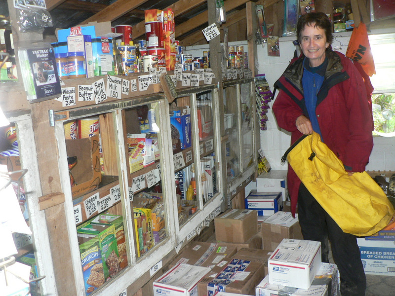
The food for the first week.
All the planning goes like clockwork and we find ourselves in the airport at Atlanta, with Mike cruising past every ten minutes or so to avoid having to park. He swoops in on seeing us with our packs and we’re off to a Texas Ribs Restaurant for dinner before going to his place in Gainesville. Our first sample of US food is memorable for the huge serving size, and the onions cut to resemble roses, then deep-fried in batter. We do manage to eat some.
The next day Mike takes us in Gainesville to do our food shopping and obtain a sim card for the state of the art mobile phone. The food and fuel are fine but the phone turns out to have an issue. Although we had checked that it would work in the USA, it turns out that the network on which it works is only available in larger cities and we will not be able to call international on it at all. So a new phone is needed, but we can’t buy one as we don’t have a USA address. Mike comes to our rescue, adding us to his family account with vodaphone so we can buy the phone most likely to have a signal on the trail and one from which we can call home. This is no longer a problem as US technology has caught up with Australia by 2016 and we have no problems with smart phones on the visit in that year.

Pack weigh-in.
How appropriate, it’s April Fools Day. “You’re not going to make it with those packs”, is the comment at our registration and weigh-in from the ranger at Amicalola Falls. This is where we decided to start our walk to Mt Springer, the official start of the Appalachian Trail, 9 miles away, uphill. He’s quite right, 25 kg for Digby and 18 kg for Alison is not sustainable, but we head out anyway. We are carrying seven days food, plus reserve, a huge range of clothes for all weathers, winter sleeping bags, and we are not yet trail fit.
We walk at first up a creek valley, and then slowly make it up the 375 step staircase alongside Amicalola Falls, where we find Mike and Therese waiting in the top car-park for a final good-bye. We leave them with several kilos of unnecessary stuff. This is the first of many cut backs that take place as we discover what we can live without.
“Haven’t used that this week, dump it”, becomes a catch-cry at every hostel and town along the way for the next few weeks. Hostels keep boxes full of discards for hikers to search through, dump what they don’t want and take what they need, but there is little left worth carrying. Shampoos and creams are the first to go, and there are boxes full of them. This is where we find half of someones dishcloth, a 30 cm square of yellow absorbent material that serves as the facecloth and towel for both of us for the next 6 months.
The pack pruning takes several weeks, but eventually we are down to a reasonable 15 and 12 kg, including 4 days food, clothing, tent, sleeping gear and cooking gear. Everything we need on the trail becomes not very much at all to live with, but the less we have, the simpler life becomes. Food, shelter, protection from the weather and a target for the day is all we need.

Dumping some of the excess.
I spent many hours assembling an itinerary for the entire trail, identifying the best campsite for each night with water supply and distance to go that day in order to make it to Katahdin by October. By lunch time on the second day we’ve had enough and stop for the night after 10 kms, well short of the 20 needed, and the itinerary becomes another thing to dump as it is apparent that at least for the first part of the trail it is much too optimistic. We are carrying maps for the first few weeks and a summary trail guide and that will have to do. Mike and Therese will mail the next set of maps on for us when we call them.

1st nights camp on Mt Springer in Georgia
2. Just keep going.
The trail itself is a 30 cm wide footpad running through forest whenever possible, marked by white blazes painted onto trees at head height, it seems at every opportunity. One of the debates among hikers is whether there are too many markers, as if you can’t see one, you are probably lost or at least off trail.
Many hikers save money and weight by not carrying any maps at all, simply relying on the blazes to point them in the right direction. As the full set of guides and maps must weigh around 10 kg and cost over US$200, this saving is not insignificant. As an old school hiker, I cannot imagine not knowing where I am on the map at every instant, and I always need to know how far it is to the next town or turn-off or whatever.
Mike and Theresa have all the maps for our walk bundled up into 10 or so packages that can be mailed to us as we approach towns near the trail that have a post office. There are also 11 guide books giving detailed information along the route about trail towns, hostels, food resupply places and the like, but there is far too much weight in these little manuals for them to be worth carrying. Fortunately there is a summary guide, which we do carry and tear out the completed sections as we go.

Part of the green tunnel in Massachusetts
There are 14 states along the trail, with each giving a distinctive flavour to interactions with the non-hikers that we meet. At first in Georgia, we have extreme difficulty understanding the language, with every conversation starting with us and the local person exchanging “What?” The translation being that “I know you said something to me, but can you say it again so I can understand you?” We also had to be told not to go straight into anything that we needed to communicate, but instead to let the conversation flow around in circles for a while before maybe allowing it to come around to the actual reason for the chat. We were then also given some lessons in phrasing with Yáll, and Allýall among others explained. As we moved out of the Deep South and into Pennsylvania and beyond, the harsher tones and sharper speech patterns much more resembled our own.
Attitude to alcohol was another major difference for us, as we have always been used to having beer and wine readily available, the idea that an entire county could be dry just seemed silly. A bus driver in Franklin pointed out all the tennis courts in town, explaining that the local council banned the sale of alcohol except for clubs with a tennis court. Many courts were built before the local council finally allowed stand-alone alcohol outlets to operate. Two other Australian hikers became famous along the trail for hitching across several counties in order to reach a booze outlet, so they could hitch back with their booty. These restrictions started disappearing as we moved north, but we were still quite excited at being able to order wine with a meal in Hot Springs in North Carolina. It wasn’t really until we reached the New England states that alcohol with meals could be taken for granted. Despite this area being famous for its apples, we were rarely able to find hard cider for sale. Shopkeepers would simply say that “it’s not the season”, as if cider was a fresh fruit drink.
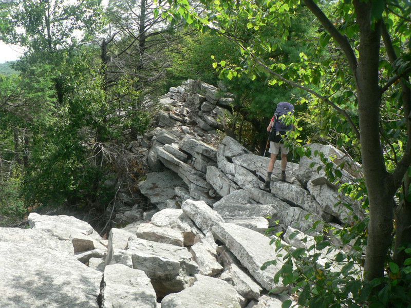
Some of the Pennsylvanian Rocks
The quality of the trail ahead becomes a topic of unending conversation for hikers passing or overtaking one another. It is rare on the trail to be able to walk without watching your feet, so dreams of wandering blithely through a forest fade as the loose rocks just keep coming and you can’t afford to turn your ankle. “If you think this is bad, Virginia’s ok, but wait until you hit Pennsylvania”, becomes a dominant refrain as we wander along the ridges of North Carolina and Tennessee.
At least there was no scrub bashing
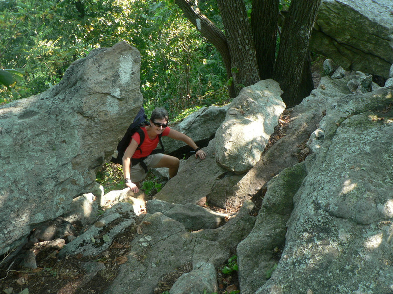
Virginia turns out to be just as rocky as further south, but the rockiness of the trail just keeps getting more intense all the way into New Hampshire and the White Mountains. Virginia, we discover, does have easier trails as they are generally contoured while the White Mountains just go straight up and down steep ridges, on rocks. This culminates in the Mahoosic Notch, where we walk up a valley which has been filled with boulders up to house size. The trail goes around, over and under serious rocks for 2 kms, but by this stage we can take anything the trail throws at us and we really enjoy the gymnastics.

Mahoosic Notch footpath
The rocks finally start to relent by the time we enter Maine, but now the hard work is due to water. Lakes are in every direction and if we are lucky the trail crosses between them on timber dams made by beaver. Maine has a “no bridges” policy so we get to wade several streams every day and soggy boots and wet feet become the norm. The boardwalks of New York and Connecticut are a distant memory.
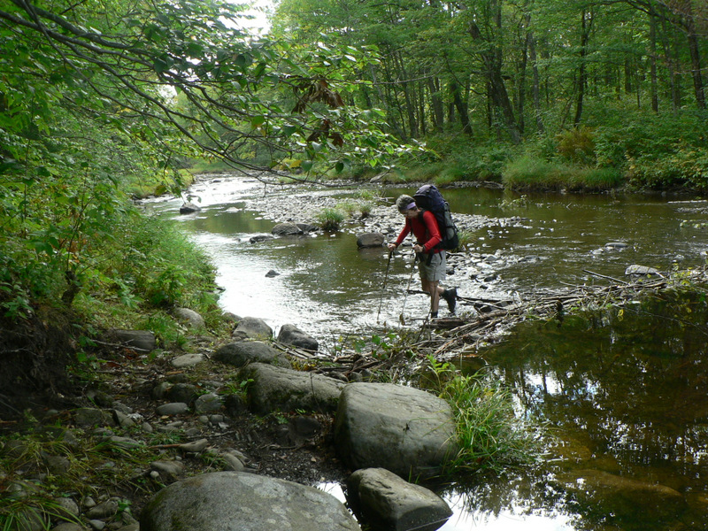
One of many creek crossings in Maine
The rocky trail means that we both wear out several pairs of boots along the way, and manage to survey many styles of footwear before settling on what works for us. The loose rocks mean that thin soles and lack of ankle support are out of the question, and while soft soles can help prevent impact bruising, they wear out too quickly. We see and hear about many hikers dropping out with foot problems caused by heavy loads, fast speeds and twisting on rock. Feet expand with the walking and boots that once fitted well are then too tight across the toes resulting in us both losing several toenails with them being pushed backwards, particularly when going downhill.
We both started walking in older boots, so blisters were not a problem, but suddenly became so out of the blue after two months of walking. We were somewhat shocked by the hot spots forming. A passing hiker explained it for us in this way. “It’s hot weather and your feet are heating up more than before. You are losing too much water and salt in sweat and both need to be replaced or the skin on hotter areas, especially feet wet from sweating, starts to delaminate, resulting in blisters. Drink more rehydration fluids and get salt balanced to correct the problem. Gatorade works well for this”. So we start drinking a litre of Gatorade or similar every day and our blisters disappear.

The 3rd pair of boots for Tripper.
3. Where will we stay tonight?
This question was the main reason for the production of the itinerary, but once that plan had been abandoned, where are we going became a dominant issue every morning. Such a simple question needs many issues to be resolved, including: How far can we walk today? Where can we expect to find water? Is there a shelter or camping sites? Do we have sufficient food to make it to the next town if we stop there?
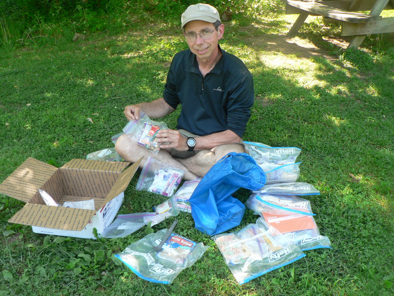
Stickbuilt with his mailed resupply.
The post-itinerary plan meant that we generally tried to plan on carrying 4-5 days of food from each re-supply town, where we could also have a night in a motel or hostel, shower and wash clothes and eat junk food. Most of the time this worked well, and by arriving in town by lunchtime, we could fill up on alcohol with lunch, dinner and breakfast, buy our food and fuel for the next section and just crash on a soft bed watching tv or reading a book, (as books were deemed too heavy to carry). Several B&Bs were so comfortable that we asked to stay an extra night just to let our energy levels build up. Thank you Duckett House BB in Hot Springs and Tree Streets BB in Waynesboro, two of the standouts among many.
Stickbuilt and Tater Chip with Wizard. Note all the trekking poles
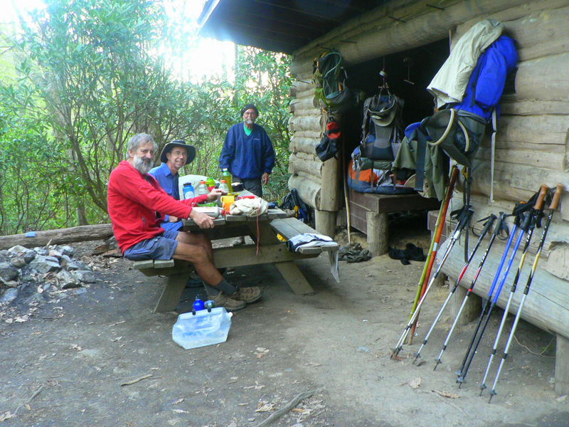
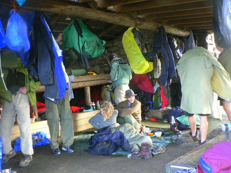
A typical shelter has three sides and an overhanging roof, with a picnic table under the overhang. This makes it possible to cook on the table under cover, while keeping food away from the sleeping area. This is important not just for the rats and mice that infest such places, but also to keep bears from being attracted into the shelter. After dinner, all food must be bagged and slung high up and away from the trunk of a tree every night for the same reason and there are many stories circulating about bear interactions. Several shelters have poles or cables to assist in getting food up and away. A problem bear might be trapped and relocated, but if it persists with bad behaviour, it will be shot and killed by rangers.
We met 12 bears along the trail, but all faded away as fast as possible except for one juvenile about the size of an labrador, who wandered up towards us to about 4 metres away, apparently before realising our presence, and changing direction. Still moving at a casual saunter, so he may become a bit too cheeky as he grows up. One of our walking companions had a sandwich snatched from under her nose as she was sitting for lunch at a picnic table. She thought she was hearing another hiker approaching, but instead it turned out to be a bear who reached across the table to grab the sandwich before running off. Now that’s cheeky.

Black Bear watching us go past.
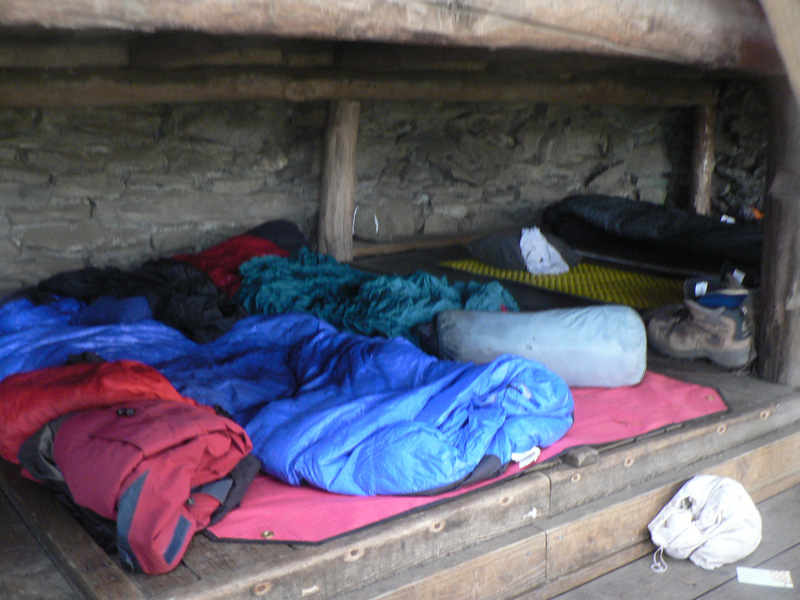
In the early days of the walk, shelters are spaced more frequently which helps to deal with the huge numbers passing through. Some hikers in trying to cut weight, dispense with a tent altogether and are rely only on the shelters, much against AT policy and advice, but deliberate disobedience seems to have cult status in some of the hiker groups. As hikers dropped out, overcrowding became less of an issue and the shelters more dispersed. They are designed with a knee-high sleeping platform around 2.5 metres by 5 metres, so able to sleep about 10 friendly hikers. There is often a second deck with ladders to help fit more people, but some older shelters can only fit a few people. Several had sleeping platforms made completely from round logs, like sleeping on a row of baseball bats. We tended to use our tent for preference, as it was warmer, quieter and more private, and many shelters were too exposed in bad weather. We even put the tent up inside some shelters for added protection.
32 people in the shelter designed for 18.
Shelters have been built 10-20 kms apart, usually within 500m of a water source like a spring or a creek, but by July many of the springs have run dry. Trail Angels maintain water supplies at road crossings, ensuring 5 litre bottles are kept full for hikers to help themselves, so we were often able to fill up our water tank and walk on to a more secluded camp out of sight of the road or press on to the next shelter if we felt the need for company. We arrived at one shelter in Pennsylvania to find that the spring 500m downhill had 1 litre of water left, but we had a phone signal so were able to call the Blue Mountain B&B 6 km north to find that they had a room and that we could arrive in time for dinner. A 24 km day turned into a 30 km day and we arrived with 15 minutes to spare, with the music from their Mountain Jam session calling us in for the last few kms.
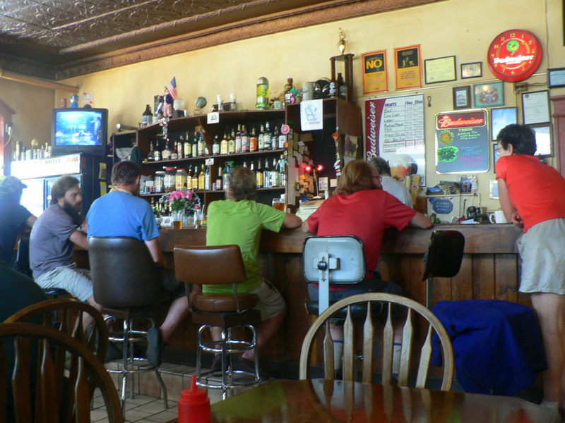
The bar at the Doyle was as Australian as any outback pub.
We use about 6 litres of water a night for dinner and breakfast, and carry 2 litres each for drinking during the day. The free running water throughout the USA has to be regarded as contaminated in some way (such as giardia or cryptosporidium and in some rivers, chemical pollutants) and should always be treated before consumption. We started the walk with Katahdin chlorine tablets but the taste of the water was unacceptable so we bought a pump-action water filter, which was very effective and simple enough until a rubber check valve tore and was not replaceable without sending the unit back to the manufacturer.

Water Treatment Second attempt.
As we couldn’t manage this while walking, we bought a UV treatment device. This treated 50 litres of water (ie 5 days supply) before the battery ran flat. New replacement batteries (US$12 each) were also identified by the device as flat and the unit un-useable from then on. We finally resorted to boiling or Aquamira drops as the simplest treatments that worked without burning my throat or affecting the taste of the water, and still use these when required. Many of the spring sourced water supplies were very strange to see for Australians, with clean water simply gushing from a hole in a hillside. The general attitude among hikers was that if you could see the water coming out of the ground, then it was unlikely to be contaminated by animals, had been filtered by soil and would therefore not need to be treated. This seemed to work for us, as the only times we got sick were after meals in towns.
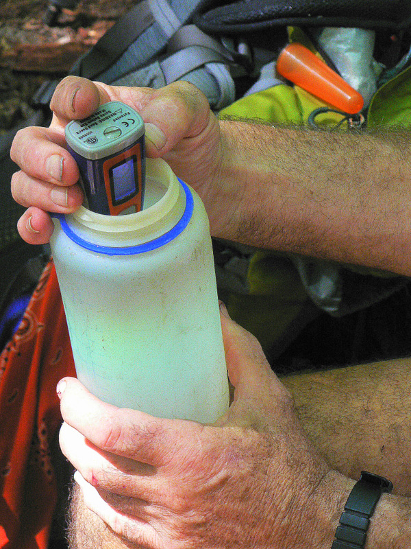
Water treatment, 3rd attempt.
4. What’s for dinner?
On other walking trips, we have generally aimed at carrying around a kilo of food per day for both of us, so a seven-day trip would have about 7 kg of food, plus fuel. This menu gives a typical picture of our diet while walking, with the energy (kJ) and weight (gm) shown.
Breakfast:
2 ea. sachets instant oats 1200 50
raisins/jam sachet 500 30
tea/coffee/hot chocolate 200 20
Cliff Bar (morning tea) 1000 70
Total 2900kJ 200gm
Lunch:
4 ea. dry biscuits or 2 tortillas 600 80
1 cheese stick 300 20
peanut butter or honey sachet 400 20
6 ea. slices peperoni 300 60
70g nuts and M&Ms 1500 70
Total lunch 3100kJ 250gm.
Dinner:
1 cup a soup 300 30
tea/coffee/sugar 100 20
1/2 pack Freeze dried dinner 900 100
OR continental noodle pack
OR 100gm salmon, inst noodle
Total dinner 1300kJ 150gm
So we are consuming around 7300kJ per day for a weight cost of about 600 gm.
Healthy living websites suggest that around 9000 kJ is a normal daily requirement and that if you are undertaking strenuous physical activity then you could need 13000kJ. Our actual intake about half of our daily energy needs, and this is not sustainable in the long-term. It’s little wonder that Digby is in trouble after a month of this diet, his steady weight loss leaves no energy reserve once the last meal runs out. We adapt by visiting town more often and filling up on high energy pizza, hamburgers, beer and so on, leaving town bloated and ill but able to carry on for a few days to the next pig out.
The help yourself store at Standing Bear Hostel
We also compensate by carrying more oatmeal, pasta, sugar and nuts, and being very selective on choosing energy bars, calculating out the kJ per gm for each brand until we discover that the Cliff bars are generally the tastiest and highest energy, and then just eat them.Many of the American hikers purchased or prepared all their food before the hike, and organised it into boxes for parents or friends to mail on for collection at a post office when required. This was not an option for us, so we simply had to find what we could at each resupply place. Many of the trail towns had been walmarted, meaning that large stores had been built on the outskirts of town, and the town centres had died, making it often necessary to walk several kms out-of-town to find a supermarket. As no-one walks anywhere in the USA, footpaths are also rare, making a shopping expedition more dangerous than walking the trail. The Doyle hotel in Duncannon was notable for being able to organise a hiker shuttle to the supermarket, and sometimes other hikers helped by hiring a car for a few day. Several times we found ourselves sometimes trying to resupply for a few days with what was available in a service station snack shop. 50 varieties of Jerky and power bars anyone?
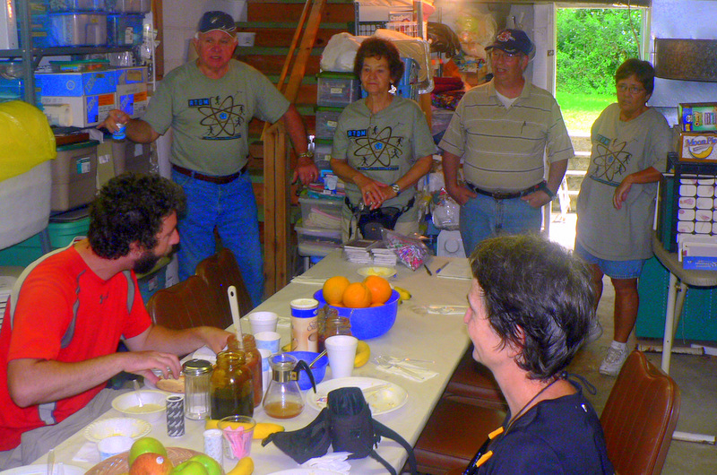
Teen Wolf and Tripper at a Trail Angel breakfast.
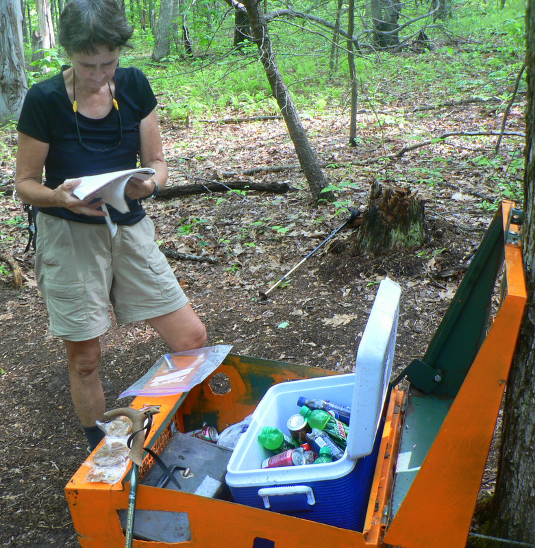
The Trail angel support offered to hikers became a much appreciated resource, but not one that could be planned for in any way. Excitement at the possibility of a Jesus box would start to ramp up as we approached any road crossing, reaching a peak as we see an esky tucked away out of sight of the road. Then the tension when opening it to see if there is anything left, and sheer joy to discover high sugar soft drinks or beer or cream buns inside on ice. Only once was there a crash of disappointment to find some idiot had filled the esky with zero calorie soft drinks, as if we were weight watchers. We were, but in reverse of the usual pattern, hunting calories in any form as soon as we arrive in a town.
As well as an esky or Jesus Box by the track, there were also many groups operating food stalls for hikers in grand pavilions in parks or church kitchens, or just simply offering salad rolls from the back of a ute. They were run by individuals, church groups, graduated thru hikers or hiker gear shops etc, sometimes planned to operate for a week every year, and sometimes just as a spontaneous gift. One graduated thru hiker shouted drinks for everyone in the bar of the Doyle hotel as we were relaxing before dinner; a church group from Arkansas drove hikers to a church for a breakfast of grits and bacon pancakes before returning them to the trail without a single mention of religion; a US version of a men’s shed of retirees offered hamburgers, hotdogs and beer around a campfire. One of the gear outlets (REI) ran a full-on camp kitchen at a road head handing out burgers and hotdogs with even a keg of beer.
Jesus box on the road to Damascus
The most memorable Jesus Box was off a road on the final approach to Damascus, a trail town which had just finished its annual hiker festival. The secure box was a bright orange steel fold out workman’s toolbox, recently filled, with a layer of ice on the bottom covered by soft drinks, while the fold out trays were all full of cakes, bars and lollies. A logbook inside asked you to leave your name and date, but the only sign that a church group was involved was the cross welded onto the top of the box. Bears were an issue in the area, so the box had to have a bear proof catch, which nearly defeated us as well, but we persisted. We had to wonder about a cache further on in Virginia where 6 cakes had been left at head height in a plastic shopping bag. No bears there apparently, but a house was visible through the trees, so we assumed that the cakes came from there. A hole in the ground under the cakes, proved to be a natural spring, with 6 cans of soft drink being kept cold.
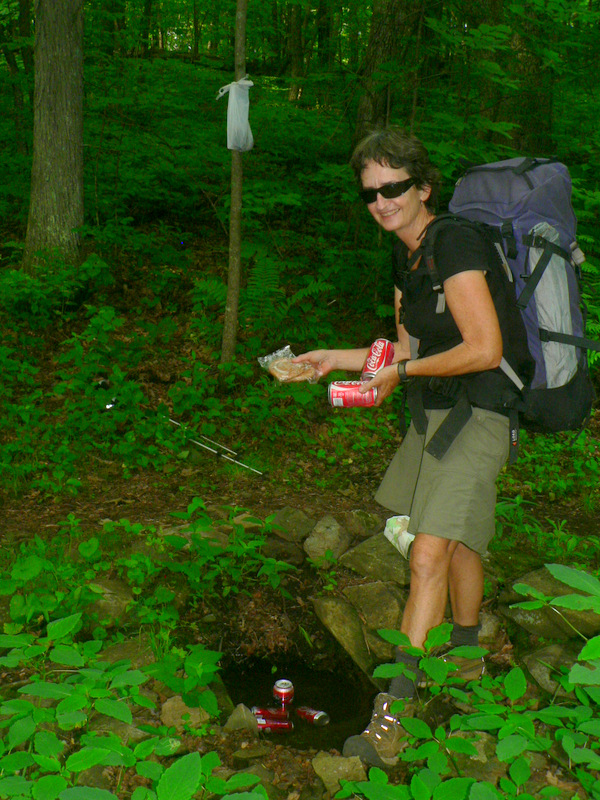
Trail Magic at a spring in Virginia.
5. What equipment did we use?
We arrived in Damascus on the Monday after the weekend hiker festival, but the town was still buzzing after several hundred hikers and friends had passed through. Gear manufacturers and retailers all had stalls offering repairs on gear and many deals were on offer, although some of the locals shops had closed for a rest after the busy three days. A parade through the town had the local firies on a nearby roof spraying all the walkers, claiming that they all needed a wash, and many did!
While the trail is hard on people, it is much tougher on the equipment used. That’s why so many manufacturers and retailers were present in Damascus, to ensure that their gear was holding up to the pressure. I carried an American made Osprey pack that I bought for the Bibbulman Track, as my much heavier, and tougher, Macpac was showing its age. Qantas managed to break one of the aluminium side struts, but the Osprey was still useable until half way through the walk when the other side strut broke. The battered pack was three years old, had worked for several thousand kms, and I had purchased it from Paddy Pallin in Melbourne, so I just thought that I would have to buy another one. Stickbuilt said “No, send it back to the manufacturer for repair, as they will cover it for life for any breakage”. He also lent me a replacement pack, took the broken pack and washed it before sending it back to Osprey.
A month later he brought the repaired pack back to me on the trail, not only with the frame replaced, but with a new waist band and patches over holes in the outer cover. We’re just not used to that level of customer service in Australia, so I was delighted when I had a similar experience with our Mont tent. Our two man tent was by far the best design I had seen on the trail, with ample room for Alison as well as my six foot frame, two doors and two vestibules. It could be pitched tent and fly together as one, or taken apart and pitched tent alone or fly alone. Sadly, the main floor leaked every time it rained, and no amount of seam sealant could fix it. We just had to cope with waking up with water on the floor. On our return to Australia, having completed the trail, I sent the tent back to Mont in Canberra to see if they could fix the issue. They did, by replacing the tent with a later model that had been redesigned to avoid the problem. That sort of treatment is why I am always prepared to pay over the odds for quality gear.

The Mont tent in action
Alison had bought a top of the range Wilderness Equipment sleeping bag for this walk before leaving Australia and was horrified to discover the same bag for sale at our first stop for half the price. Gear is so cheap in the USA where manufacturers have a population 10 times that of Australia and a much higher proportion of people needing outdoor equipment. We started with winter bags capable of keeping us warm in snow, but as the seasons changed they became far too hot and we were able to buy much lighter summer bags and gave the heavy ones to friends to mail on to us when autumn started to bite. Over most of the summer I was simply using a silk bag liner with a lambs wool blanket. We both used half-length Thermarest mattresses, and both survived the entire trip without damage or even a pinhole.
Set up for a cool night in a shelter
For cooking, I have used a liquid fuel MSR MGK for many years, but as airlines were being difficult about stoves in baggage, I had a new MSR Dragonfly sent to Mike and Therese just in case my old stove was intercepted. These run best on shellite, in the USA called Coleman fuel or white gas, but when necessary can be run on petrol or with a change of jet, on kerosene. I only had to fill my fuel bottle at a service station once, and it was a little tricky to use a bowser for one litre of petrol.
The new stove early on developed a blockage in the main fuel line that couldn’t be cleared by normal maintenance, and so was sent back to MSR for repair after I had bought another one to walk with. I never expected to see it again, but sure enough a month later the rejuvenated stove appeared at our friends place and was mailed home to Australia. We bought a 1 litre titanium cooking pot at our first resupply store as our aluminium billy from home was just too battered to balance well on the stove. This small billy was used for all our cooking for the entire trip, as well as for full body and hair wash, which we learned to do with 1 litre of water.

MSR stove with the old billy.
We started in spring and walked through summer and autumn before we reached Mt Katahdin, but there was very little change in the clothes we were wearing, just in the layers that were used each day. The cold conditions during storms, at altitude, and early and late in the walk were more challenging for us as our tropical conditioning has made us vulnerable to cold than normal people. The summer weather, often reaching 37C during the day, had Americans walking at night while we were well able to cope. We used thermal underwear only on cold nights, preferring to walk in running shorts and light top with over-pants and rain-jacket for bad weather. I used a synthetic thermal jacket as a second layer for walking in cold and dry weather, and rarely used the rain-jacket over that until the ascent of Mt Katahdin. I also used a bandanna as a hat, to mop up sweat, and to clean my glasses. I even filtered water through it one one stage.
North of Maryland, ticks on trail-side vegetation become a problem as they carry Lyme’s disease, which puts many hikers off the trail for weeks at a time to recover. On Stickbuilt’s recommendation, we washed our outer clothes with a contact tick poison and had no issues with tick bites.
We had light sunhats, while a stretchy headband worked really well at keeping my head warm, and gloves were essential for me due to poor peripheral circulation. One day walking into a cold storm, they had been packed away by accident inside the tent and I managed to get 3 fingers frost nipped, which took 4 months for the feeling to come back. Mud-gaiters were unnecessary, except in Maine, but even then they would only have been useful on a few days. We both replaced our heavy and long rain-jackets with much lighter jackets but still effective while new. They were OK for US conditions, walking on open trails, but wouldn’t last in Australia brushing against the scrub. We have both gone back to Australian made jackets as they are much better quality, but heavier.
I experienced a particular difficulty when my bikini briefs wore out in Virginia and I could find nothing to replace them as American males do not wear bikini briefs. There was no way I could cope wearing saggy baggy Y fronts or things more like board shorts, so I bought largish ladies briefs and put up with the lack of appropriate space. A few weeks of this and our US friends, Stickbuilt and Sandy, took us into Washington for some time out and found me a department store which stocked my preferred style of Calvin Klein bikini briefs. Much more comfortable, thank you.
We were overtaken by a ‘lone wolf” using two trekking poles as we struggled up a steep climb heading towards Damascus. Alison was most impressed by his cross-country ski action, with the arms working just as much as his legs. She had been walking with a single trekking pole to help her balance, but seeing this guy stride past was enough for her to realise that she could increase speed and improve stability by using two. She was able to buy a pair in Damascus, and while it took some time to co-ordinate with them, now she won’t walk anywhere without them. Her old pole was left in a hiker box, but had gone to a new owner within 10 minutes. Meanwhile I’m hobbling along leaning heavily on my single walking stick, unable to upgrade to trekking poles because I need the support. After the walk, and a knee replacement, I refuse to use any sort of sticks again, relying instead on my legs to do what they evolved to do. This debate between trekking pole users and non-users continues to entertain along the trail, and is one example of walking your own walk.
For every action that you can take on the trail, what you actually do boils down to a set of preferences and values established by your own experience. “Walking your own walk” gives you the freedom to listen to advice, without having to accept and follow it against your own judgement. For example; some of the thru-hikers were quite happy to yellow blaze when roads were convenient, rationalizing it by claiming that the ATC gives certificates for being a 2000 miler, while the trail is 2200 miles. Therefore they felt they could skip up to 200 miles and still be a thru-hiker. As far as the rest of the hiker community were concerned, they were walking their own walk, and couldn’t be blamed for cheating. If you make a decision and understand the consequences then you should be allowed to carry on without censure but advice needs to be given in identifying consequences that maybe haven’t been recognised.
6. What’s the language of the trail?
I have never come across a hike where so much language develops among those walking the trail. I guess it’s tied up with being able to recognise other people with similar goals. Thru-hikers tend to be different from section hikers who again are different from day hikers. The first and quickly established difference is the acceptance of a trail name, which becomes the only name you are recognised by for the duration of the hike. Alison became known as ‘’Tripper” after a spectacular trip and dive on day 2, while I was later named as “Wizard from Oz” as I had a grey beard and used a single walking stick rather like a wand. These blurred as time went by and we became generally known as the two Aussies. Later in the walk as particular friendships became established, real names became known to allow contact in the world off the trail, but years later we still know even those friends by their trail names. Other words develop to allow thru hikers to communicate simply.
The following glossary is a start:
AYCE: All You Can Eat, usually applied to Pizza
Blow downs: Late winter storms wreak havoc with fallen trees.
Blue blazing: The AT is marked by white blazes, blue blazes mark alternative routes. So blue blazing is taking the easy option.
Cowboy coffee: For those who don’t like instant coffee, add grounds to water and bring to the boil for 3 minutes. Strain through teeth or moustache.
Dumpster diving: Cheap source of food and gear.
Have a two for breakfast: Means two of everything; pancakes, bacon rasher, eggs, fries, sausages. Hungry hikers typically order a three or four.
Hiker box: A box of leftover gear at hostels for hikers to pick up stuff or leave it behind.
Hiker Trash: A single thru-hiker or group identifiable by smell, clothing, actions or language. Restaurants often offer a hiker trash room to isolate problems.
Jesus Box: A container of food or drink placed near the trail and kept supplied by a trail angel.
Lone Wolf: A 20 something solo male, typically carrying too much and walking faster than anyone else. Not sociable and prone to breakdown physically and mentally.
Mile: Quaint American measure of distance, approx. 1.6 km.
Nero Day: Most of a day without walking.
Night Stalkers: Walking by darkness with headlights to avoid summer heat. Typically inconsiderate and rude, often drunk.
NOBO: Thru-hiker heading north.
Pink blazing: Walking with a woman as companion.
PUD’s: Pointless ups and downs of the trail.
Ridge-runner: Usually thru-hiker graduates hired to patrol and police a section of trail. Very fit and scary people.
Section hiker: Hiking a major part of the walk, intending to finish the whole thing over several years.
SOBO: Thru-hiker heading south.
Stealth camp: Camping out of sight of passers-by, almost always illegally.
Thru-hiker: Starting at one end intending to hike the entire trail in one session.
Trail Angel: Someone who goes out of their way to help a hiker.
Trail Magic: Things appear just when you need them too often to be by accident. Serendipity works well for hikers.
Yellow blazing: Cheating by hitch-hiking. (Yellow lane markers on roads in the US).
Yogi: The act of begging from non-hikers without being specific.
Zero Day: A full day with no walking.
7. Trail people.
We were overwhelmed at first by the sheer numbers of people starting out on the same day as us. There were around 200 campers on the top of Mt Springer on the 1st of April, and I think we introduced ourselves to 30 or so while walking in to the campsite.

Hard to find a flat spot sometimes.
People all walk at different rate and have different levels of fitness so while we were walking in a swarm for the first couple of weeks, we didn’t get to know many people at all as the composition of the swarm changed every day. After Franklin and the first big climb, hikers became much more dispersed and several of the same people would be in our vicinity for a while allowing us to get to know them a bit more than just how they earned their name. Here are a few of them.

Sourdough, One Life, Stucco and Scatters around Tripper.
Sourdough walked for a while with us in the first weeks, but we didn’t see him until he again joined us for much of the rough hiking in Maine. He is a mature age nature guide based in Alaska, working on cruise ships to teach about the wildlife. His iphone contained his bird guide, with all the calls and we were most impressed. His partner was at home, but she is called Sweetdough to match him.
Stucco walked with us for many days, eventually summiting Mt Katahdin with us, although she took many days out from walking as well. With Scatters, these two showed us what young and powerful women can do, so they became our Warrior Princesses.
Scatters left all her gear spread around the camp, but refused “spreads” as a trail name. Her parents adopted us for a few days in Maine where we stayed with them in their “cabin”.

Turtle eating with Craftsy and Snickers and three unknown males.
Snickers was addicted to the snack bars, but was only walking the trail for credits on a college course. She dropped away after the minimum time and because she was missing her boyfriend.
Craftsy really impressed us as she had made all her own equipment including her pack and tent.
Turtle met us near the start and always seemed to be around and although she walked much faster than us she finished at around the same time, she just kept on leaving the trail for R&R.

Stickbuilt with us on the top of Mt Katahdin
Stickbuilt was close to us in age and became a good friend, walking with us for many weeks at different times and taking us off to his home in DC for R&R. He had to drop out of his thru-hike after a nerve pinch became too painful, but came back just to summit Katahdin with us. He walked with Tater for many of the early sections.
Tater Chip had the surname of Lay, one of the potato chip manufacturers. He lived in Alabama and had an accent thick enough to cut with a knife. He swore that we had the incomprehensible accent.
Food Network gained his name by sounding like a BBC presenter, and loving his food. He was a source of much entertainment as he was carrying a ukulele and knew the speaking parts of many tv shows.
Fog was a Friendly Old Guy doing the trail for the second time, as his first thru-hike as a lone wolf went too quickly for him to enjoy.
Zan became famous for allowing himself to be picked up by a predatory woman and having a very noisy night in his tent in the middle of a crowded camp site.
Chicken Pot Pie was the collective name of a mixed group of 5-6 hikers determined to party as much as they could along the trail. Famous for one night using the same tree as the centre point for the cluster of hammocks. Sadly the tree collapsed half way through the night to much uproar. Salty and Tiny Dancer with Clare the Sheltie were members of this group.

Redstick, LJ, Red Lobster and Wizard
London Joe and Red Lobster became one of the lasting love stories on the trail, developing and maintaining a friendship through to marriage after their hike. Their daughter had her first birthday in 2016.
Redstick had painted his wooden walking stick, so was easily identified. We just kept seeing him at odd intervals.
Canada Geese were the only other older couple on the trail who we met, walking even more slowly than us, but I think they were doing a long section rather than a thru-hike.
Lift ‘n Step was the only other Australian hiker we walked with for a while. We saw her story in many shelter log books, but never could catch her until very late in the walk. She rescued my camera from where I had forgotten it, and got it back to us a week later.

The Barbarians chatting with Tripper
The Barbarians were a family group supporting their 7 year old “Venato” who wanted to thru-hike. The other members of the family came and went along the way, but we spent some time with them in the White Mountains.
Boomer is another Australian whom we saw a couple of times at the start of the walk, but he disappeared from the log books, so we never found out if he finished. He rejected Skippy for his trail name and insisted on Boomer as it was more manly.

Worn Heel, Jaybird and Doc at camp with Wizard.
Doc walked with us for many days through Virginia, but vanished after contracting Lyme’s disease from a tick bite. As retired Vietnam medic, his trail name was inevitable.
Jaybird was in her 70’s and hiked with minimal gear, eating food that did not require cooking, but which involved eating lots and lots of nuts. She was then working as a librarian, and looked like a pampered aunty, not a long distance hiker, certainly not normal hiker trash.
Wornheel worked as a cobbler, and was walking a long section with us for quite a while, He taught us to look on the walking as a holiday, not a job, and enjoy life along the way.
MOM was well over 80 and walking no more than 10 km a day, expecting to take many years to complete his thru-hike. He says he would rather die on the trail than at home, so his name came from Miles Of Miracles.
Miss Janet is one of the most well-known Trail Angels, working when she can and volunteering when she has to anywhere along the trail. She taught us the American language meanings of biscuits, scones, cookies etc.

Devils Thumb in North Carolina
8. The scenery
While there are many areas of outstanding natural scenery along the way, there are also many days of walking with not much of interest to look at. The trail does stay away from built up areas, stays in forests and follows mountain ridges where-ever possible, but connecting sections do go through corn fields or follow rear boundaries of private properties.

McAffee Knob in North Carolina
Every State seems to have its own signature walking. The Smoky Mountains National Park in North Carolina was the first really spectacular mountain area we walked through, but the Roan Mountains and the Balds in north Carolina, Virginia’s Blue Ridge, LeHigh Gap and Kittatinny rocks in Pennsylvania were standouts.

Sages Ravine was as close to rainforest as anything we saw.
Sages Ravine on the Massachusetts/Connecticut border was just like home and provided training to cope as the track became rugged and remote.

Coming down Mt Washington
The 10 days spent traversing the Presidential range, summitting on Mt Washington will remain an overall highlight, but then we reached Maine. The Mahoosic Notch and the 100 mile wilderness were just outrageous.

9. The Aftermath
Walking this trail is our single most significant life event, changing our outlook on living in so many ways. At that time we had been settled at Cape Tribulation for 20 years and had no intention of doing anything differently. Some good friends, Rosemary and Keiran, had looked after everything perfectly; the farm, the B&B, the farm tour, our dogs and home, so we should have been able to go back to where we had been. But we were no longer the same people and needed more time to simply enjoy “smelling the roses”.
We decided to sell up and began renovations of our house, planning to put it and the farm on the market by 2012. Then life got in the way, beginning easily enough with my knee replacement. After having let me walk the trail with limited function, my surgeon decided that this would be a good time to get it done, and booked me into hospital for November 2010. Hyper-fit and slim, the surgery went perfectly requiring no rehab and I was home and hobbling after a week and almost walking normally by February.
Then things start to go seriously pear shaped.
Alison finds herself on a whole new journey for survival – in a space of 10 days she is diagnosed with breast cancer, been into hospital, and had the breast cancer excised as well as a lymph node. The results of the tests from the tissues that have been cut out are all positive. The statistics are confronting but odds are good that she will still be alive in 5 years time.
The Oncologist says she is very fit, much less than physiological age and that it will stand her in good stead. On the scales she is still trail weight at 56 kg. It is amazing that 10 months after the AT the residual physical fitness is still there. But the mental toughness is weakening. It’s one thing to focus on a mountain 2000 miles away and walk to its summit, quite another to be a hospital ‘case’, and not quite sure how or where this journey is going to end. It is adjusting the mental perspective,with chemicals pumped into her body that are going to make her even sicker. This will increase her chances of survival but they will make her sicker before she can get well. The chemical treatment is known as TAC – the same initials as the ATC. The chemicals are so dangerous that she needs to be checked by a cardiologist before they can inject the chemicals to make sure her heart can cope.
Then there is a Cat Scan to see if there are any other cancers in her body. This is the ‘baseline’. In one week there are more doctors than she has seen in her whole life. They all ask questions and fill out a questionnaire: “Does she drink alcohol”? – ‘only Marlborough Sauvignon Blanc’.
By the end of 2014, everything is looking good again, we’re both fit and well, we’ve sold part of the farm and had a new house built in Mossman. Planning begins for another long walk, this time for 2 months in the High Sierras, doing a 500 mile section hike of the Pacific Crest Trail in California. We drive to Melbourne in December for Christmas with family and I start puffing too much on short walks. Back home and my doctor sends me off for a check up with a cardiologist. A severely blocked coronary artery is diagnosed on Tuesday, confirmed with an Angiogram on Wednesday and a stent inserted on Thursday, home on Friday. Hmm, maybe not the USA this year, so we stay in Australia and walk much of the Heysen Trail over June and July. We both get back to walking fitness easily and decide that the Sierras are still quite possible for 2016.
And that’s another story.
