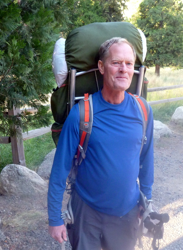
PCT Journal 2016 Alison and Digby took 50 days to walk from Walker Pass to Donner Pass through the High Sierras following the Pacific Crest Trail in July and August 2016. This is the day by day account of that trip with some of the photos added throughout.
Tuesday 12 July. Finally after 31 hours travelling from home we arrive in the Town House motel in Lancaster CA. We did manage a few hours sleep on the Nadi/LA flight so not feeling as bad as expected. Dinner of enchiladas, bean slop and rice at a seedy Mexican diner nearby, then collapsed into bed by 7:30 local time. Getting dark by 8:30 with about an hour of twilight. The town is about 10 mi x 10 mi with huge malls, shops and vacant land scattered randomly throughout. The residential areas have shady avenues of older and smaller houses than the east coast, but the outer edges of the community are a sun blasted desert flat with a few shrubs near the highway.
Wed 13 July. We managed to walk around 7mi around the town to obtain a sim card, our groceries for 4 days walking and a few odds and ends. Finding the gas bottles was a problem but eventually found a sports store with the right type in stock. Couldn’t find an adaptor for my camera charger, but the usb chargers for Ali’s phone and camera were common. Trail magic started working as we arrived back at the motel to find a mobile electrician parked next to our unit. He obligingly fitted a usa type plug to my charger cord, problem solved. Charged us $5 but paid him $20. However no trail angels responded to our need for a lift out to Walker Pass, so Ali arranged for a taxi to collect us at 8 tomorrow for $175. That way at least we can start walking on Thursday and not have to wait another couple of days for bus connections.

Starting at Walker Pass
Thur 14 July, Day 1 to Joshua Tree Spring, 13 mi.
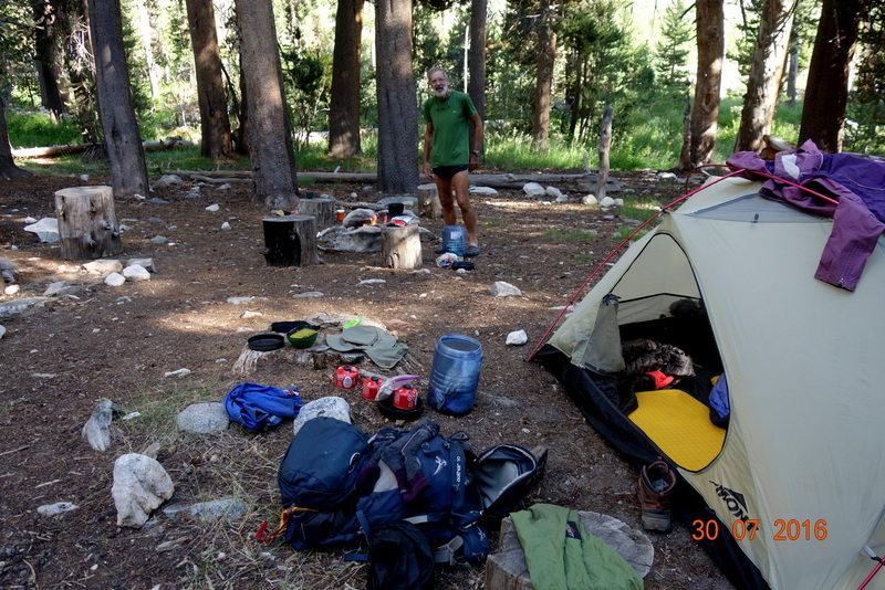
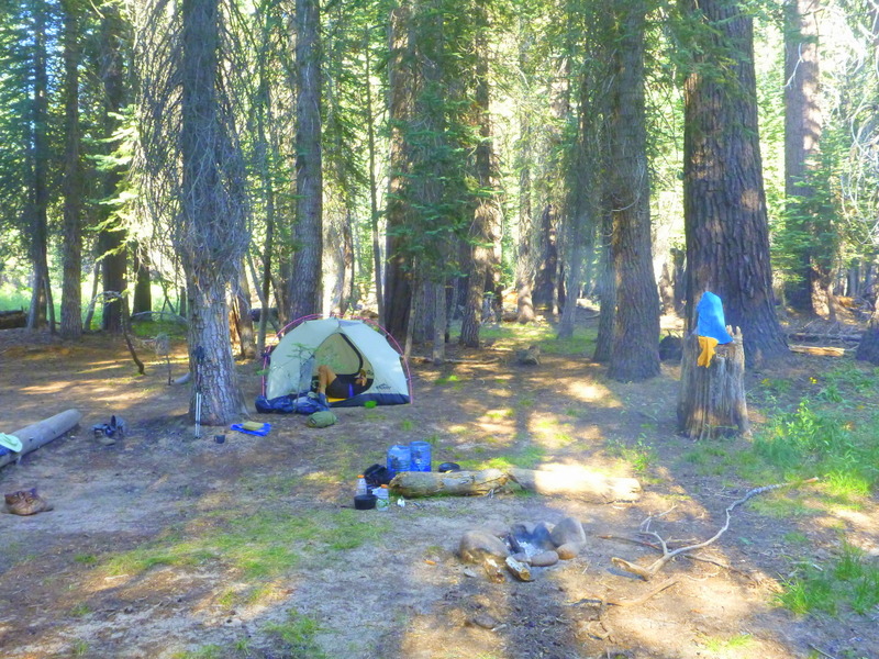
After several phone calls, the taxi operators daughter Joy finally collected us in her car and delivered us to Walker Pass to start walking by 10:30. She left us feeling abandoned in the desert with the empty road, barren landscape and intense sun with a shade (as if there was any) temp. of at least 40C. Unfit with full 4 day packs and 17 litres of water on board. What have we done? We stagger along at 1 mi/hour up a gentle climb of 1500 feet. The trail is easy walking and clearly marked but the load means that we are struggling to make the distance. We finally make it to the dry spring for the first nights camp at 7pm. We used 8 litres of water just to stay hydrated during the day, but we’ve enough for breakfast and dinner and still have 6 litres for tomorrow to get to the first water, another 6mi. Dry country with sagebrush and few animals, but we do see our first deer and a squirrel.

Well graded track but still climbing.
Fri 15 July, Day 2 to Spanish Needle saddle, 9.2 mi.
After a late start, we carry on up over a saddle then drop 900 feet to several crossings of Spanish Needle creek with the tension rising as the first crossing was dry, the second a wet pothole and the 3rd just flowing at 1 l/min several hundred meters up from the track. We refilled all containers, which was just as well as this source had run dry by the time we left after lunch. Back with full water load we start climbing again, crossing a good flow in the same creek several hundred feet higher but continuing on up 1200 feet to a dry saddle by 4pm. We decide to camp here as we have enough water and the next few camps are dictated by the water availability. From here we should be able to make it to Kennedy Meadows in 3 days at 10 mi per day with good water at each stop. Another hiker, Todd, turned up travelling at double our speed after starting at Mohave Jawbone canyon.
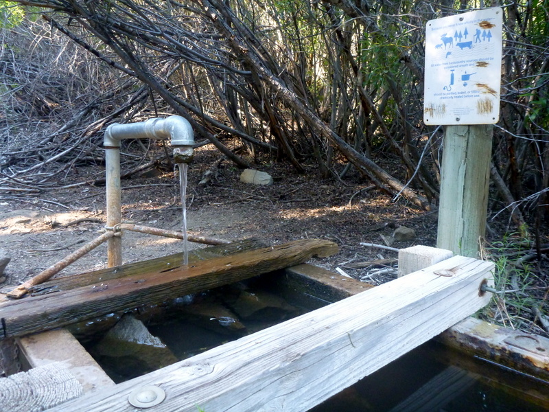
Foxmill Spring
Sat 16 July, Day 3 to Foxmill Spring, 14.6 mi.
A brisk night with a steady wind had us snuggled down shortly after sunset, 8:30. Getting up for a pee is becoming less common, partly due to the cool nights and partly the dehydration. We’re both suffering pack soreness, but legs and feet seem fine. My nose and throat are having problems with the dry air, and I have had to keep sucking water to soothe the throat. We’re off walking again by 7:30am for a couple of hours in shade on a fairly level trail before dropping to the Chimney Creek campground and lunch by flowing water. The campsite was burnt out in June but the PCT was not damaged. We start climbing again after lunch following a valley before turning into a gorge in a metamorphic zone with a creek far below. Our camp is a barrel spring forming the source of this creek at an abandoned Barites mine. We find Todd there resting, having waited 11/2 hours for us to catch up before he headed on for another 10 mi. We manage our first billy bath and hair wash in bitingly cold water from the spring. More mule deer, one a 10 point in velvet, and a weasel today.

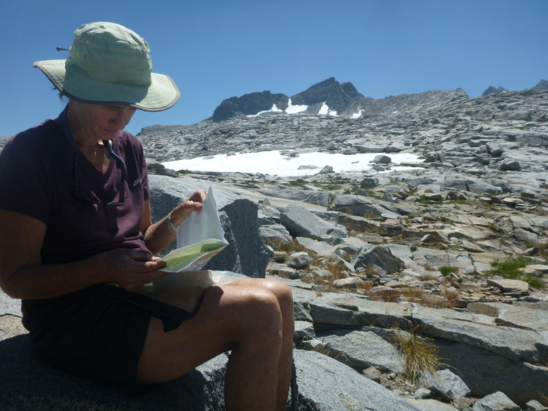
Afternoon Yoga
Sun 17th July, Day 4 to the Kern River, 15.4mi.
We managed an early start by our standards, 0700, to try and make the 1500 foot climb to the high point for this section before the heat of the day. A false start as it happened as Ali left her poles behind and I had to run back for them. The trail had us gently climbing for a few hours up to an absolutely barren summit zone as this area had been burned in a hot fire in 2000 that sterilized the ground. Even after 16 years there is very little visible regrowth with a few pines in small clusters. No shade in this area so we started the descent to the Manter River. A rattlesnake dozing on the edge of the trail was almost trodden on by Ali as she went past, rousing it enough for it to rear into striking position as I approached it. I stopped fast enough and gained eye contact whereupon it decided to go off sideways, it was still rattling at us from the bushes 5 minutes later as we waited for heart rates to come down. Phew. Freezing cold water in the creek gave us a numbing footbath, revitalizing at least the feet for the 5 mi to the South Kern River and camp. Poor and stagnant water by the campsite, but adequate, and we are grateful for the Aquamira treatment drops. Sadly, I find many toilet sites around the camp area, with apparently few hikers going more than 20m from the camping area, and even then inadequately burying waste. Another rattlesnake cruised past the tent on its way to find some frogs for dinner, it rattled at us, but was not a threat. Several squirrels running around the old pines at the camp.

Barren tops
Mon 18th July, Day 5 to Kennedy Meadows, 4.5mi
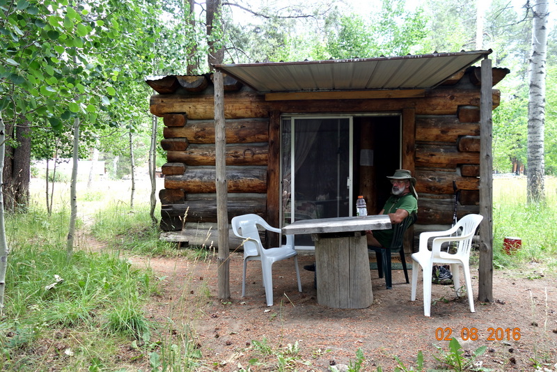
A 4 mile stretch to a bridge on the main road that seemed to go forever, then another .5mi up the hill to the store. A lovely welcome from Scott, with our food resupply waiting for us, as well as Todd and a couple of other hikers for company. We spent the afternoon on the shady deck watching the passing tourists, disposing of hamburgers, chips, hotdogs and margaritas after showers and real toilets. Todd did a shakedown for Dave Rummel, a 67 year old non-hiker who wanted to live the dream he’d been watching and reading so much about. He’d aborted his start from here and managed to hitch back but had left his poles behind as well. He mailed many kg of gear home but was going to try again from Lone Pine after buying new poles. We may see him later at Muir Trail ranch where he’s booked for the 29th. We camped above the store by a huge tipi where the other hikers had settled in.
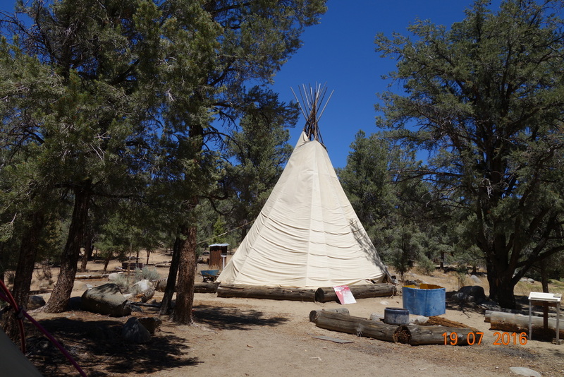
Kennedy Meadows Campground
Tue 19th July, Day 6 Rest day
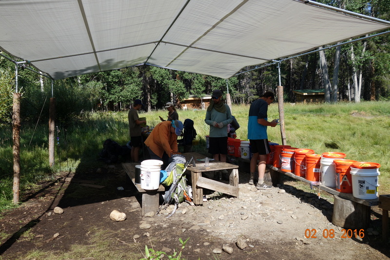
We took a very relaxing day for my birthday, hanging out on the deck boozing while doing repairs on Ali’s boots that were delaminating at the heels, my sleepmat with a hole, and my pack shoulder straps coming apart. A few too many repairs for so early in the trip. An exciting start to the day was seeing a juvenile bear sniffing around the cabins nearby. As soon as it realized I was watching it took off like a shot. Alsatian sized and tan brown. Our borrowed bear proof drums organised through Grumpy Bear’s didn’t materialise, so Scott very kindly lent us two of his, one brand new. Our load tomorrow has 27 lb of food, 3 gas bottles to get through 12 days to the Muir Trail Ranch, and 3 litres of water each. Heavy but not as bad as at Walker Pass.
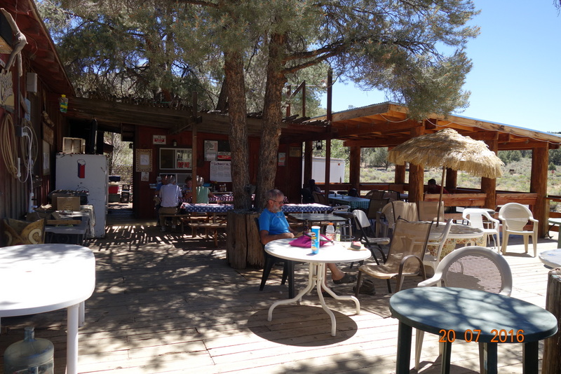
Kennedy Meadows Store
Wed July 20th, Day 7 to Upper Kern Bridge, 15 mi.
We leave the road and won’t see another for two weeks until we get to Reds Meadow. Its hard work with the overfull packs but we manage, initially on an easy trail but eventually we pass through the burnt out Clover meadow giving us full sun on a hot day. Some of these high pastures are leased to cattlemen, so we start to see the odd cow and buildings in the distance as we skirt the edge of Beck Meadow. The old trail follows this meadow around a spur, but we get to go up a good 500 feet and down again to the river to camp by a foot bridge. There is a good water flow here but the many cattle in the creek and nearby mean that it is heavily polluted, with strings of green algae everywhere. Our appearance upsets one group of 30 head who casually amble off out of sight and several dozen cliff swallows with mud nests under the bridge. The swallows continue to twitter and swarm until full dark. We are beginning to see more wildlife during the day, I guess because there is much more water around. A king snake and several squirrels in the forest areas and then 3 chipmunks buzzing around the bridge footings.

Loading all food into the bearproof drums
Thur July 21st, Day 8 to Death Canyon, 14.3 mi.
Climbing all morning, with steady and steep gradients near the top of the climb. Chipmunks and squirrels by the dozen throughout the forested areas interspersed by the open and lovely meadows. Poor water with stagnant pools and brown algae all along 3 crossings of Cow Creek, but we found a good flow of clear water on the 4th crossing. The last meadow had a wooden causeway for us to cross without getting wet, but as the swamp was bone dry, it seemed redundant. We were curious about a large hole near the middle under the timber, but as we had a break on the far side, a huge marmot came into view, feeding on the grass and shrub flowers, presumably the owner of the hole as there was no cover elsewhere.
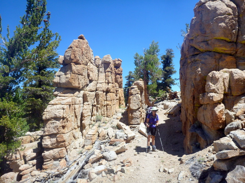
Rock Pinnacles
Fri July 22nd, Day 9 to Dutch Meadow, 11.7 mi.
Another long and dry climb past 22 switchbacks to a main ridge saddle at 10,500 feet, which allowed us a view out over the plains to the east. A footpath off to one side of the ridge looked suggestive, so we followed it to find a phone signal waiting out there, enabling us to check our mail for the first time since starting. Good to find that Cheryl is managing the house-sit well and that Clare Bear is ok. We continued climbing past another 7 switchbacks to 10,700 feet before starting to descend with US military planes zooming past at high speed at eyelevel with deafening noise in their wake. Certainly couldn’t hear them coming. There seemed to be three of them following one another about 5 min apart, presumably from the Andrews air base on the plains below. Finally hit bottom at Diaz Creek (dry) before a final climb up to the Dutchman’s Meadow and camp by a good stream entering the meadow at a corral.
Stuff everywhere, amazed that it all fits in the packs.
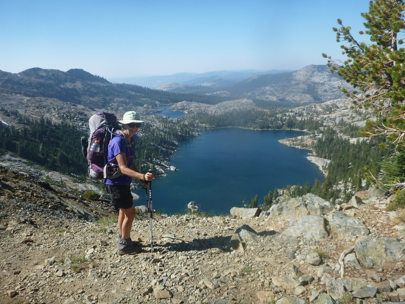
Sat 23rd July, Day 10 to a small tarn, 10.2 mi.
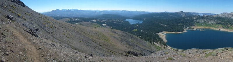
Another steady climb up to Mulkey Pass, Trail Pass and Cottonwood Pass where a major flow of people and pack teams start to arrive on the trail from Lone Pine via Horseshoe Meadows. After seeing very few people to this point, we are in shock after 22 walkers and 10 pack horses and mules go past while we are having lunch on the pass. We carry on the Chicken Spring Lake hoping for an early camp and find ourselves in competition for camp sites, so we head on another 2.5 mi to a pair of tarns above and below the trail. The lower one is dry but the upper one proves to have good water after I scramble up a steep 200 feet or so to check, so we decide to camp by the trail. Good meeting other walkers to chat to, with Alison meeting Patty, her daughter Hilary and friend Amanda just starting out on the trail north. We also come across an academic and his assistant taking samples from trees to determine the dendrochronology. They tell us that they have identified living trees well over 1000 years old and dead ones to 5000.

Cirque and tarn
Sun 24th July, Day 11 to Crabtree Meadows, 13.6mi.
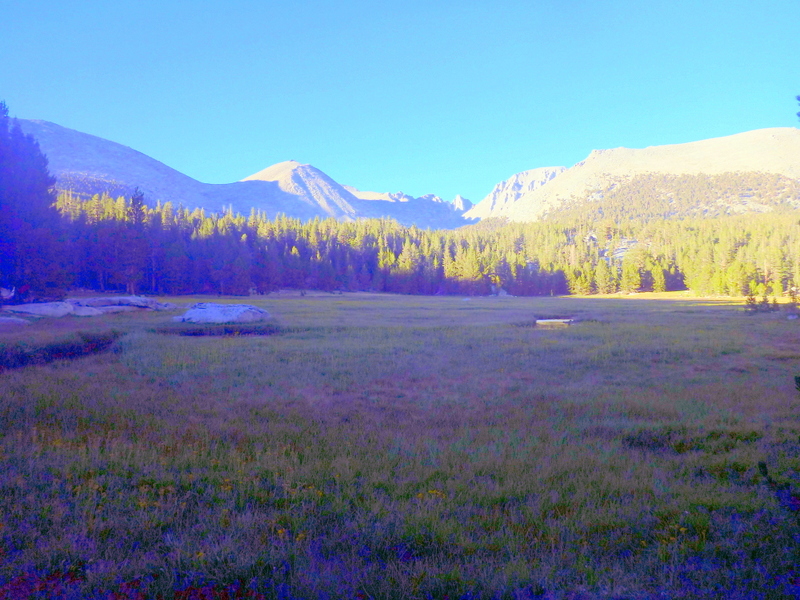
We managed a good nights sleep at 11,300 feet and now starting to feel comfortable with the packs as their weight diminishes and our fitness improves. Seven miles downhill this morning may also have helped. We come down to Rock Creek, our first real flowing water for washing stuff, good to get clean for a bit. Then back to the steep climbs, with 800 feet before lunch and another 600 after before a rough and rocky descent to Crabtree Meadow. Helicopters buzzing around all afternoon, we hear later are looking for a lost hiker, who was found dead after a fall off Mt Whitney. It looked like a good camp with a bear box and a view across the meadow to Mt Whitney with deer and marmots everywhere. The Whitney stream was flowing strongly with cold clear water so we were able to have a good wash and only a few other hikers were visible. However the meadow is a frost pocket so we had our first really cold night after not even bothering to use the tent fly so far.
Crabtree Meadow and Mt Whitney.
Mon 25th July, Day 12 to near Forester Pass, 12.2 mi.
There was nothing moving in the meadow this morning with it being so cold, although there was no actual frost on the ground. We were off and climbing again by 7:15, eventually making it to 11,800 feet, well above the tree line with rock and peaks in all directions. We stopped at a creek crossing for lunch and met Amanda Gehrig, our first ranger, checking bear boxes and clearing out abandoned rubbish and food. She invited us to help ourselves from the leftovers, so a windfall of several bars and bags of nuts were very timely, as we’re just beginning to wonder if we have enough food to get to Muir Trail Ranch as scheduled. The campsite was sheltered in a boulder cluster, with a flowing stream nearby, but still another 1400 feet to climb to the top. I’m getting a bit of vertigo from the low blood pressure but we seem to be moving well if slowly. We had around 100 people go past us southbound on the John Muir Trail (JMT).

Camp at 11800 feet in the last trees
Tue 26th July, Day 13 over Forester Pass and down to Vidette Meadow, 9.2 mi.
We had a poor nights sleep again, with both of us tossing and turning all night, this time I think due to the altitude. We won’t sleep this high again. The 2 mi to the top took 2 hours of gently climbing through an incredible amount of rock work and stairways all done to keep packhorses safe. A couple of sections appeared to have collapsed and we wondered how the horses coped. We had the pass to ourselves although one walker passed us on his way down and there were many coming up as we went down. The trail down was very rocky and hard on the feet so we decided to stop at the bottom after 7.5 mi rather than get some more height for tomorrow. We found a lovely campsite in tall forest beside a babbling brook with no other hikers nearby. Sadly there was a lot of algae and sludge in the creek in the quiet zones, so the nutrient load must be very high. Lots of bear boxes along Bobs Ck, to cope with the number of hikers. We passed one camp with 12 people and 6 horses as well as 125 hikers southbound, and we stopped counting at 3pm.

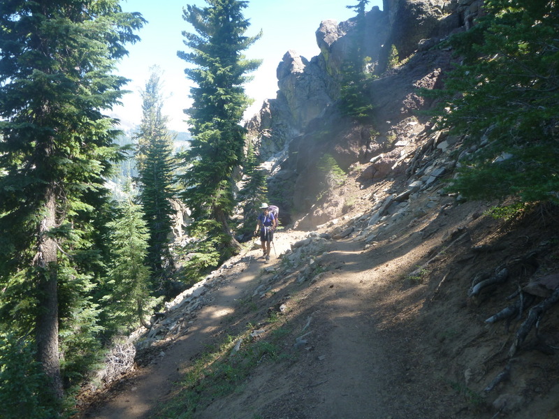
Carved path up Forester Pass
Wed 27th July, Day 14 over Glen Pass and down to Woods Creek Bridge, 13.5 mi.
Climbing all morning again, even overtaking 5 people (very strange for us) and being overtaken by 4, with the steady flow of southbound JMT people never ceasing. We went past another horse team camped in a beautiful glade a few miles above the bridge. We wondered where they crossed the river as the bridge was a suspension bridge unsuited for stock (unlike Nepal) as signs only permit one person at a time on the bridge. The campsite was very crowded, with about 14 tents scattered in the area even before we arrived making it difficult to even take a pee. We managed to get a fire going to cook breakfast as fires are not permitted above 10,000 feet and we need to conserve gas so we can use it when we need to. A storm started to develop in the afternoon, with thunder rumbling in the distance, but only the lightest of rain sprinkles at ground level.

Pathway zigzags up the cliff
Thur 28th July, Day 15 over Pinchot Pass and down to the South Fork Kings River, 11.4mi.
We woke to clear blue skies and we managed to be off and walking by 6:45. A steady uphill grind for 7.6mi had us to the top of the pass by 12:45, but we decide to head on down another mile to Lk Margorie for lunch. Clouds rolled in while we were sitting on the lakeshore and a bit of spitting rain had us hauling out unused parkas and swiftly putting lunch away. Then the main storm rolled in with thunder and lightning on top of us with hail hammering down. We were able to find a small copse of trees for shelter while we pulled on all our wet weather gear, meanwhile the temperature had also plummeted to freezing. We saw one bolt of lightning actually hit the top of the mountain across the valley, starting a small but loud rock avalanche. We eventually felt safe enough with the main storm a few kms away, to head on down to more secure shelter, often through drifts of hail on the ground several inches deep, allowing us to settle in by the river by 5 for an afternoon nap.

Fri 29th July, Day 16 over Mather Pass and down to Deer Meadow, 11.7mi.
The storm cleared away overnight giving us clear sunny skies again but with a wet tent and no fire possible. Skipped our cup of tea but cooked oatmeal for breakfast, hoping to make the gas last. The trail gently climbed until the last 500 feet getting us up onto the pass before lunch while the storm clouds gathered again. We continued on down to the Palisade Lake just in case the weather went worse again, but nothing eventuated this time. Yesterday was quite sufficient warning about what can happen in these mountains. Lunch by the lake again in a replay of yesterday and then on down the “Golden Staircase”, 3mi and 800 feet descent zigzagging exhaustingly on cliff faces until we reach the tall forest around Deer Meadow. We need to be able to have a cooking fire, which means an existing fire ring with no other occupants, so the next 6 possible campsites are rejected making us a bit depressed until we see a possible site well off the track 300 m below. We find an abandoned maintenance crew campsite with old bear box, good water, fire rings in tall forest and no one else around. Perfect.
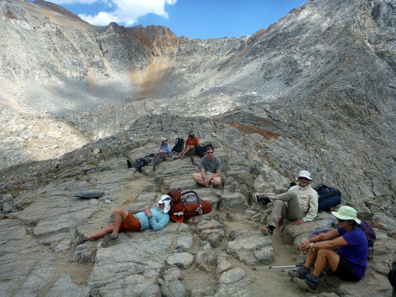
People collect on the pass
Sat 30th July, Day 17 up to near Helen Lake just below Muir Pass, 12.7 mi.
We slept very well with no disturbance from other people or wildlife. A ranger later tells us that the site is no longer in use as it was deemed too hazardous with the big trees. Ah well, we survived. On down the hill to the roaring Mid Kings River to follow upstream for the rest of the day, climbing 3500 feet to the last of the trees in a sheltered grove at 11,400 feet, just below Lk Helen. We passed lots of deer in the forests today, many with spotted fawns. Todd from Kennedy Meadows went by as well, after having had some time out, now in a hurry and needing to do 30 mile days to get back on time.
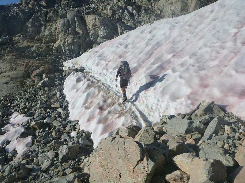
Snow crossings
Sun 31st July, Day 18 to San Joaquin River, 15.9 mi.
Another 600 feet to the top of Muir Pass, going past several more lakes that were not Lk Helen. (Evoking memories of a trip to Moroka Gorge (in Victoria), we were sure at the time that we were either above, below or in the gorge). We finally reach the 1931 stone hut on the pass after 2 hours and start the long descent through a series of spectacular hanging valleys, the last with a sheer waterfall. Mash and peas for lunch with our last freeze dried pack for dinner means that we will arrive at Muir Trail Ranch tomorrow with little more than peanut butter and coffee, so we’re hoping our resupply has arrived. A wade across Evolution Creek revitalized our feet for the last mile.

Muir pass shelter to honour John Muir
Mon 1st August, Day 19 to John Muir Trail Ranch, 7.3mi.
Having eaten our last food we head off down river early, hoping for our resupply to have worked and maybe a room if they have one available. Worry evaporates as they do have a room for tonight, our food drum is eventually located and we also have access to a vast array of hiker boxes full of discarded supplies. There is even enough gas for us in partly used containers, luckily so as the shop here has run out. We spend the morning sitting around laying out our food, swapping stuff, eating spare chocolate and reading in their library while waiting for our room to be made ready. Room and board for US$175 each and we take it happily as we need a night off. We revive in a natural spring hot tub, hand wash our clothes and stuff ourselves at dinner with soup, chicken, veges, bread and coffee. Horses are their love and their business but hikers generate their income. We watch their 50+ herd trot past us at dinner on their way to their night camp in the meadows above.
Muir Trail Ranch hiker boxes
A cabin for the night with a real bed

Checking our resupply
Tue 2nd August, Day 20 over Seldon Pass and down to East Fork Bear Creek, 11.6mi.
We actually get to sleep in, in a real bed as breakfast doesn’t start till 7. Greeted by pancakes with maple syrup, sausages, scrambled eggs, fruit, yoghurt, muesli and coffee or tea and once that was all down there was all the meats, salads and breads to make lunch, with fresh fruit. Somewhat bloated, we finished packing and weighed the packs in at 12 and 18 kg. Not too bad with bear drums, 2 litres of water each and food for 4 days to Reds Meadow where we are planning to head out for a few days off at Mammoth Lakes. Then the climbing begins, 3000 feet today, steep for the first 2 mi before easing into the switchbacks up to a very pretty lake popular for day walkers from the resorts. Up and over the pass and descend on a very rocky trail for 5 mi to camp by Bear Creek. Met 2 Aussie girls on the JMT, Lisa Traill from Cairns and her friend from Brisbane. Lisa teaches outdoor ed in Cns and is a coag member so we may even meet again.

Tricky crossings
Wed 3rd August, Day 21 over Bear Mountain to Pocket Meadow, 12.4 mi.
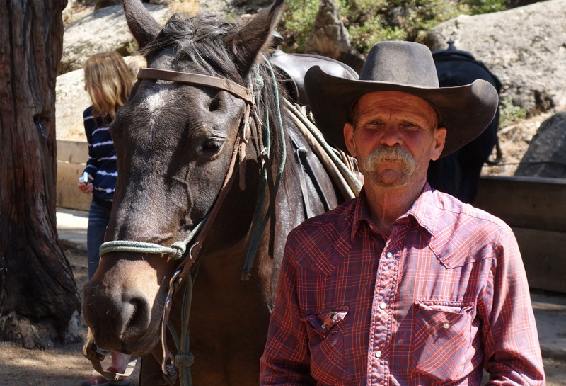
A very cold morning despite the surrounding forest, with a knee deep wade through Bear Ck to start the day, before several miles of deep sunless valley. We get to climb the 900 feet up over Bear Ridge before descending the same amount through 59 switchbacks to Mono Creek for lunch. By now the day has heated up and we’re back to struggling uphill for another 800 foot climb until we find a very pretty campsite by the creek. Manage an almost swim and wash in the creek. No sign of any bears despite the names. Two pack teams went by on their way to Viridian Valley resort, both with one rider and 2 mules. They seem to specialize in taking the bags of walkers out to a spot and dropping them there for several days before collecting them for return to the resort.

Pack team with guide
Thur 4th August, Day 22 over Silver Pass to Purple Lake, 12.8 mi.
Silver Pass is visible in the distance for quite a while before we finally drag ourselves up to the saddle, only to find we have another 200 feet to climb up the side to get around cliffs on the descent. We are compensated by the great views from the final top down over an Indian family of lakes. Chief, Squaw and Papoose, that we get to walk by on the descent. We come across a commercial walking group of 12 people northbound on the JMT with several Aussies from Perth heading for the same campsite by Purple Lake. Their leader is Richard whom we meet again a few weeks later. The lake is rather crowded so they finish up on the far side from us while we camp near the inlet on a rather rocky site which we manage to smooth out with clothing. A pair of pack llamas is also resting nearby when we arrive, but they depart soon after before we manage a photo.

Purple lake camp
Fri 5th August, Day 23 to Reds Meadow and out to Mammoth Lakes, 13.6 mi.
This was a very long day but after the short climb out of Purple Lake it was all downhill. The last 7 mi was initially through a wasteland of sandy trails and dying trees then a burn zone which had had very little tree regrowth even after 15 years.
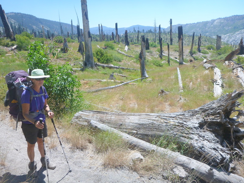
Fire storm in 2002 with little recovery
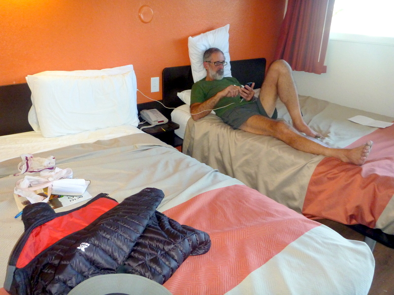
Reds Meadow Resort was a shock. There are 70+ people in the queue ahead of us for the bus down to town and another 100 or so milling around the café and store. We wait and the third bus fits us on for the 7mi up to the Mammoth Lodge and Ski Village, where we have another queue for the bus down to Mammoth Village where there is another queue for the trolley bus to the main part of town. This all takes about 2 hours so we finally arrive at the Post Office at 4:05 to find that it closed at 4. We have to wait until Monday to collect our bounce box and mail it on home. Ah well, three nights off may be a blessing, and the motel next door to the PO had a room. It seemed to be the only one in town as there is a beer and blues festival on the weekend but while normally rooms in the motel 6 chains are cheap at under $70, this one is capitalising on the festival and charging $150 a night. We manage a great dinner at Angels Restaurant with Guiness and Sav Blanc. The other bit of excitement on the trip down was seeing a large bear a few hundred metres off the road in silhouette standing on a fallen log.

Reds Meadow Bus queue
Sat 6th August, Day 24 rest at Mammoth Lakes.
We had to learn how to cope with the traffic as a 4 lane highway bisects the town. The pedestrian crossings needed lots of nerve but we just had to remember that pedestrians have right of way and American drivers are much more polite that the Australian ones. Another Aussie girl from Perth on reception at the Motel. Found the outdoor suppliers and bought new shorts and sleeping sheet as mine were falling apart, and found a good supermarket for the food and other supplies. We also found a breakfast café called Base Camp with lots of climbing gear of my vintage up on the walls, but it mainly felt like the Rum Doodle restaurant in Kathmandu. Hundreds of mountain bikes buzzing through the town as all the ski fields double as MTB trails over summer. We spent the evening in front of the tv watching the Olympic games opening ceremony until we fell asleep.
Sun 7th August, Day 25 rest at Mammoth Lakes.
Breakfast at Base Camp, Lunch at Freedom Bar with guiness on tap, and dinner at the Good Life café which was good and simple but I now have diarrhoea, possibly the booze. Mooched around and watched Olympics. Called home and Stickbuilt.
Mon 8th August, Day 26 Agnew Meadows to ponds near Thousand Island Lake, 6.3 mi
A last breakfast at Base Camp then the Post Office to collect our box of spare stuff, to which we added the used maps and guide and sent home for $75. The trolley bus at 9 connected to the bus up the hill and we were dropped at Agnew Meadows road at 10:30 with no complications. 1200 feet of climbing on switchbacks, constantly meeting Mike and Sandy doing this section for the 14th time! They were going on the Thousand Island Lake but we decided to stop at 3pm at a set of pretty tarns loaded with ducks. We set up camp on a flat spot only to discover a trail crew camped another 100m deeper in. They all wandered past on their way to camp followed by a ranger who after checking our permit insisted that we move further from the water and further from the trail. So pick up tent and move another 30 feet away to another flat spot. Ah well, at least there was a place to move to, but it’s a bit of a joke trying to preserve the wilderness experience in such a populated area.

Some of the islands
Tue 9th August, Day 27 over Donahue Pass to Lyell Fork Base Camp, 12.1 mi.
One mile over to Thousand Island Lake and back into the southbound stream of JMT hikers. Up 600 feet, down 600 feet up 1400 feet to Donahue Pass with another ranger waiting on top to check permits. She even had to tap the packs to check that we were carrying bear canisters. She was actually living up there, with a camp set up in a rock niche a few hundred feet below the pass. Very difficult 2000 foot descent with loose rocks and steps but we eventually made it to a huge meadow and a stream suitable for camping. We set up a bit too close to an old horse camp, with dung all around, but cleaned enough out of the way to cope. We had several deer in velvet approaching to 20m completely unfussed by our presence. Horses with bells on seemed to gather around the tent at about midnight, but then passed on snorting and stamping only to return and do it again at about 4, I guess on their way back to shelter in the forest. The night was freezing cold with a frost on the tent and ground by the time we emerged. That slowed us down, eventually getting away by 8.

Tuolumne river falls
Wed 10th August, Day 28 to Tuolumne Meadows Camp Ground, 9.7 mi.
Easy walking down the valley with little of note. The campground covers several square kms with hundreds of sites for caravans and winnebagos and 36 for backpackers on a hilltop with no car access. Free of charge for PCT and JMT hikers but many other people leave their car outside and also walk in, therefore qualifying as backpackers. We arrived at 3 but by 4:30 the place was full and people were still arriving and starting to share sites. We eventually had three other tents with 5 people sharing the bear box and picnic table. We were able to manage a good resupply at the general store as well as hamburgers and chips for lunch. The stores were also running flat out with the crowds, as well as an armed park ranger policing the cars overflowing the carpark. No phone signal here but we did manage to use the public phone to call and confirm delivery time at Sonora Pass where our next resupply is to be delivered. The granite domes in this area are spectacular, although we won’t be going down to see the main ones at Yosemite itself. That’s 30 km off our trail. Lembert’s Dome near the camp has a pair of climbers about 500 feet up, and there are lots of ads for climbing partners on the store noticeboard. Sent a postcard to mum and dad. Had sausages and veges in bread with a bottle of Yellowtail merlot with crisps for dinner.

Tuolumne Meadows campground, bear boxes and picnic tables
Thur 11 August, Day 29 to meadow beyond Glen Aulin, 11.1 mi.
Eggs and bread for breakfast after a mild night in the forest but it’s good to get away from all the people and cars, even the JMT hikers head southwest to Yosemite leaving the PCT for us again. Heading out by 8 past Lembert’s Dome and passing several other smaller domes while following the Tuolumne river as it cascades down to the Glen Aulin Campground. This proved to be a walk in camp with minimal facilities and no food on sale so we continue without the hoped for burgers. Some passing hikers told us that water was available further on at a meadow, freeing us from the need to carry enough for the night. A couple of hours climbing brings us to an open meadow and flowing water so we look around for a campsite, finding one of the best we’ve so far used for the trip. A terrace overlooking the meadow but set back in the forest with a fire ring and lawn for the tent. A billy bath by the stream after a hot days walking and then able to sit around a fire had us rapidly relax back into contentment. We were watching the peace on the meadow when a beautiful silver grey coyote emerged from a gully and charged to take a ground squirrel. Shook it a few times, then trotted back into cover. Just like watching a wildlife doco.

Granite domes in Yosemite NP.
Fri 12th August, Day 30 to Matterhorn Canyon, 10.5 mi.
We actually had sun on the tent when we got going this morning, but it was still very cold, with frost on the meadow and Ali in jacket and pants for the first few miles along the meadow before walking became more difficult on the rocky ground of a descent into Virginia Canyon. Then we were climbing 1000 feet on switch backed trail but badly broken and eroded by horse teams, we even met 12 horses in two teams on their way down. We overtake an older couple, the man with probable Parkinsons, walking with their son and a service dog to help, as well as a southbound PCT hiker walking from Donner Pass to Whitney. He tells us to hitch down to Truckee on the old Hwy 40, not 80. Lunch on top in barren ground amid granite boulders and pine trees. Down on dusty and sandy trail to Miller Lake and another coyote, this one ill and limping with patchy yellow and black fur. Much more like my idea of what a coyote should look like compared to the one yesterday. We continue on steeply down to Matterhorn Canyon and a large open campsite in old and dark forest by the river.

Sat 13th August, Day 31 over Benson Pass and down to Benson Lake, 11.0 mi.
The forest allows us a good nights sleep but we still have to rug up when we set off with a cold wind in our face. Down the valley for a mile before the climbing sets in, steeply at times but still heel to ground walking. Benson Pass is very desolate with just granite and pines, looking as if it has been overgrazed. Another difficult descent on sandy ground with rock ramps made treacherous by the sand. We make it to Smedberg Lake for lunch, meeting a group of 6 day hikers who are camped in the meadow above us with horses for the entry and exit of the region. They also repeat the recommendation that we camp or at least visit Benson Lake, 2 mi past our planned stop and a half mile off the trail. We descend very steeply down to the turnoff and head in to the lake expecting crowds, but find ourselves alone at the lake on a huge sandy beach. The cold wind makes any thought of a swim silly, but we find a campsite on the back of the beach and settle in to watch the sunset. No chance of a fire with that wind, so a bit disappointing really.

Benson Lake
Sun 14th August, Day 31 over Seavey Pass through Kerrick Canyon to Stubblefield Canyon, 9.2 mi.
A shorter days walk, but several long climbs (1400 and 800 feet), and rough rocky descents made it a hard day, good to have finished by 3:30. We only met 3 people for the day, a solo walker coming down from Seavey Pass and a father /daughter pair. Jeff Kidd from Tahoe gave us his number and said to give him a call when we arrive for a ride down to town. The 4 miles along Kerrick canyon had a bad wrap from the guide book, but it proved to be a very pleasant stroll through good looking forest gently dropping 1000 feet along the way. The 1400 foot climb up to the wind free pond was also a good trail that we were able to power through at a cracking pace, taking 2 hours for the 2.5 mi. The pond had hundreds of dragonflies hunting across the surface. We settled in to a good campsite in a grove of large pines with the river and a fire ring. A loud thump during the night had us worried about bears, while an owl kept hooting in the late evening and again in the morning.
Mon 15th August, Day 33 past Wilma Lake to Grace Meadow, 0.8 mi.
Another morning starting with 1200 feet of steep climbing followed by a wander through granite domes and ponds. We are starting to tire of the routine and thinking of quitting early, but meet a group of 3 hikers with recommendations about Kennedy Meadows North resort and suggestions for skipping some bits, while still hiking the Desolation Wilderness further north near Donner Pass. Taking a break at the resort was not on our plan but it sounds like a good place for a rest day. We carry on for the day up a gentle climb to find Grace Meadow and camp on a ridge again overlooking the meadow and its stream. Hoping for more wildlife activity but nothing else happens apart from a few hikers wandering past and storm clouds building to the north.

Emigrant Wilderness
Tues 16th August, Day 34 to Kennedy Canyon, 13.6mi.
It was a very social day today starting with Jamie and Carson doing the same section hike as us, but southbound starting at Donner Pass. Then we meet Richard coming towards us leading another group of hikers south, again including several Aussies. He recognised and greets us straightaway with “the DownUnders “. We set up camp at Kennedy Canyon across the river from a large group all sitting in a mosquito net shelter and are later joined by Neon and Real Deal, late northbound through hikers about to flip flop as they are not going to get far enough before the snow starts. They went past us yesterday as we were dozing at Grace Meadow, and we actually caught them up! Some rough walking today getting past Lakes Harriet and Dorothy but generally gentle climbs through forests, with several of the water sources dry. We pushed ourselves to make it this far, so we have a good chance of getting all the way to Sonora Pass tomorrow, camping just before there and collecting our resupply from the truck at 10:00 on the day after.

Lunch site looking down to Sonora Pass
Wed 17th August, Day 35 to Sardine Creek near Sonora Pass, 10.5 mi.
An interesting days walk, starting typically with an 1800 foot climb but on a very gentle grade over 4 miles, much of it on a closed 4wd track. Very little growing on the volcanic slopes, but in some sheltered areas there were knee high but mature pine forests. Once up near the ridge lines, the views were stunning down to Lakes Kennedy and Leavit and others, 1000’s of feet below as the glacial valleys have near vertical sides. We made it up to a high notch for lunch and managed a phone connection, and were able to check on the emails. The headline on Crikey was “Abbot to challenge”, but we couldn’t download the story, so had to wait for several days before we found that it was just a beat up. We carry on down the ridge before dropping off to one side to track around a 0.5 mi amphitheatre down to Sardine Creek and a ridgetop camp 0.5mi before the road. The storm that had been threatening all day broke just as we got the tent up, but the rain didn’t even wet the ground.

Sonora Pass camp at Sardine Creek
Thur 18th August, Day 36 to Kennedy Meadows North, 1 mi.
We arrive at the Pass carpark by 8:30 to wait for our resupply truck. A southbound hiker, Double Zero, arrives and tells us he has a pick up arranged and there may be room for us down to KM North. Casey arrives with our box of food at 9:30 and waits around for us to give him back the trash, then we get to go down to KM with Double Zero and his friends. Perfect timing.

Double Zero
The road down is very windy, but the hand made wagon trail is still visible nearby for much of the descent. The resort has space in the hiker dorms, and we get to share with 2 Amish boys and Robert, another southbounder, who is dubbed as Retro by Alison for his 1970’s pack.
Retro aka Robert. Note the pack
Good meals with beer and wine in hiker company. 150 horses in the packing business with around 50 staff operating tours for 5 months before the snow shuts them down. There are 3km of National Park campgrounds along the creek before the resort, which has 30 or so cabins and 20 beds in dorm rooms for hikers. Very well organised general store as well as the restaurant and rooms, but the mobile Sonora resupply business is being threatened by them, and has this year been prevented from operating their truck as a hiker resupply shop and can only fill pre placed orders. Roast turkey with veges, soup and dessert with wine is too much for our shrunken stomachs.
A packer at Kennedy Meadows Pack Station
Fri 19th August, Day 37 rest day at Kennedy Meadows North.
Breakfast with endless coffee set us up for the day and we watch as the boys all set off. Double Zero and Robert are driven back to Sonora Pass by Barman Frank, who will also take us tomorrow for $30. The Amish boys waited till lunch, then ambled off to hitch up. Their food supply seemed to be purely made up of lollies and snacks. We wandered the resort, chatting to stablemen and a couple of families fishing in the river. A great place for kids and lots of day trippers and families passing through. We chat to a couple over a slow meal, and later discover that they have paid for our lunch. Lovely people. We spent the afternoon reading, when not drinking or eating. Only 2 hikers passed through today, John whom we first met at KM south has teamed up with Jonah a German hiker. We discover that Neon and Real Deal spent wed night here and continued north on Thursday. We decide that we’re finished with the bear drums as they are no longer compulsory, and mail them back to KM South intending to bear bag from here on. As we haven’t yet seen a bear on the trail, this seems reasonable and it will save us a couple of kilos each.

Volcanic landscape
Sat 20th August, Day 38 to the ridge above Carson Creek, 11.1 mi.
Frank (smelling of booze), was having his breakfast coffee in reception when we came down, so we were able to leave by 7:45. He’s a retiree from a cropping farm living in one of the monster caravans for the season. He gets us back up to the pass ok, and we find the spot for an internet connection to send mum birthday greetings, then we’re off and walking again up into the mountains. It’s amazing what a difference a day off makes, as we’re looking forward to getting back into it again. Steeply, of course, through a violent landscape of volcanic plugs, towers and needles to a ridge crest where we plunge 2500 feet over 7 miles down to the Carson River. The valley is mixed granite and volcanics with many dead trees and broken boulders making the walking quite difficult and indirect. We get to the bottom of the valley and unexpectedly find ourselves climbing steeply again back up to a ridgetop not mentioned in the guides. Two miles and 800 feet later we’re back on a plateau with very little water. Fortunately we find a small meadow and creek with a good campsite and fire ring nearby before we run out of energy.

Looking back to the pass we left this morning.
Sun 21st August, Day 39 to Wolf Creek, 11 mi.
We woke to a cloudy sky after a warm night, probably for the first time this trip. We’re now walking through a strange landscape of granite ridges and loose broken granite with no large formations until we go past a large dome of broken basalt, then another one a few hours later. Just like Black Mountain near Cooktown. Good views in the afternoon all the way back to the ridge line above Carson River where we topped the ridge after Sonora Pass yesterday morning. Then we drop into Wolf Canyon with thunder rumbling all around, but nothing eventuates although we’re glad to be down among the trees. Pack covers and parkas on just in case as the wind is still very cold. Back in cattle country now with a 4km square barbed wire enclosure but cattle still fouling all the springs, streams and campsites.
RV camping lakes below
Mon 22nd August, Day 40 to Kinney Lake, 11mi.
It stayed clear and warm all night, then a light shower at 5, but not even enough to wet the tent. Still threatening weather, but able to start waking in shirt sleeves only to dress up half an hour later as the temperature plunged. It seemed like a lot of uphill today with 2 climbs of over 400 foot and another of over 800 foot so we were worn out on reaching the lake. Our original target was a mile earlier at Lake Sherrold, but several hikers recommended going on to Kinney. It was a spectacular spot on a promontory overlooking the lake, but a cold wind and thunder rumbling on three sides kept us feeling under threat. Lots of people today, with day walkers and weekend warriors out of Ebbett’s Pass, but we also met another elderly couple doing our walk southbound who gave us their spare Gatorade as they has just resupplied at the pass. We find ourselves walking in the midst of a large group of college students who have just had the weekend at Noble Lake and upset all the campers nearby with their noise.

Domes of loose volcanic rock feels like we’re in Cooktown
Tue 23rd August, Day 41 to Lily Pad Lake, 13 mi.
The storm had all blown away by morning with the sunrise light glowing off the range to our north. The landscape today was a spectacular mix of granite, conglomerate and volcanics, with what appeared to be volcanic conglomerate plugs rather than the usual sedimentary conglomerate. Easy meandering around the mountains at first, with the trail easy to walk on compared to the broken rock further south. Lilypad lake deserves the name, but there were no flowers, just the leaves, and set amidst rounded granite boulders, with the pines and the water was really typical of the region.

Lilypad Lake
Wed 24th August, Day 42 to Frog Lake, 12.4 mi.
Back to a really cold morning again, with us off by 7:45 but hunting patches of sun for the first hour or so. We are gently climbing through forest and granites before emerging on the naked slopes of the Nipple, then another 400 feet sidling up and around the loose volcanic rubble with Blue Lake campground straight down a thousand feet or so. A freezing cold wind makes it hard to maintain balance on the trail until we get down to the Lost Lakes and shelter for lunch. Climbing again after lunch up and over a ridge to the first water since this morning, but we need to carry on downstream then up 800 feet to Frog Lake. Camping is not permitted at the lake so we collect water and move on down a few hundred metres to find a good spot in a grove of trees away from the trail. We were a little bit excited to see a bit of bear poo on the trail, but that looks to be the only evidence of bears on the trail for us on this trip.

Stealth Camp near Frog Lake
Thus 25th August, Day 43 to Echo Summit and hitch to South Lake Tahoe, 14.6 mi.
An easy stroll to start the day on a wide path down to Carson Pass and an Info Centre staffed by volunteers offering free Chocolate Brownies and Cantaloupe to hikers. The pass is named for Kit Carson, a scout who brought a military group, led by Col. Fremont, over after which it became the main route through to California.
We continue on over a small hill before a long and gradual descent of the Truckee River past the historic Meiss cabins and then up to Showers Lake, where we meet a couple of National Park Rangers with their dog on a cleanup patrol. On up to the ridge crest to start an hour or so of very rough trail on broken granite to reach Echo Summit by 3:30. We pass a couple with two retrievers who are having trouble on the rock, but they do make it down about an hour after us. Echo Summit is a snow play area in winter with many acres of bitumen carpark with restaurant etc., now empty. We stand out on the road to hitch for a half hour before trying to call for a trail angel, only to find that AAT has disconnected my phone despite paying in advance. Back to the road and the hitching to be collected by the second car, a PCT trail maintainer in his spare time. He drops us at the Motel 6 in South Lake Tahoe, a better room at half the price of our last Motel 6 in Mammoth Lake. An hour on the room phone with AAT and my phone is working again. Dinner is an Indian Takeaway with Guinness and Cider, so all is well with the world.
Fri 26th August, Day 44 Rest Day.
We mooched around the town, checking out several cafes for a serial breakfast, located the Lake of the Skies Outfitters for freeze dried food, a supermarket for the rest of our food for the next section and a thrift store to buy some books. The 6 lane highway through town is hard to cross to get back to the motel, so we grovel under the road bridge across the Truckee river. Pizza for dinner!
Sat 27th August, Day 45, Rest Day on South Lake Tahoe.
We called Jeff Kidd, whom we had met several weeks ago on the trail, who offered to collect us and take us out for the day with friends on his boat on the Lake. He drove us about 10 miles around the lake into Nevada to where his home made pontoon barge was moored. Four friends of his joined us, Stacey, Robin, Matt and Celeste, with dog, and we headed out across the lake on his part house boat, part trampoline!, to an inlet with a heritage house and a now abandoned Tea Room ruin on an offshore island.
Vikingholme was built by a Swedish eccentric, and has been well cared for, now offering tours. Grass roof, spectacular carved wooden fascias and door frames. Then back on the boat to a secluded beach for swims in the frigid water (not us), with Jeff impressing everyone by jumping off the top deck onto the tramp and somersaulting into the bay. No other attempts. Good people, good chats ranging all over but maltreatment of Black Bears in Nevada especially dominated. Apparently problem bears from the suburbs are being relocated, but into hunting zones where they make easy prey and few survive. California by contrast has more bears but had relocated 13 bears last year and all are still alive. Thai for dinner with Jeff then back to the motel to pack and order a taxi for tomorrow back up the hill.

Captain Jeff Kidd
Sunday 28th August, Day 46, Echo Lake to Dicks Lake, walked 12.7 mi, boated 2.6 mi, driven 2.3 mi.
The taxi delivered us to Echo Chalet for $60, in time for the first water taxi of the day to the far end of Echo Lake for $28, to start walking by 9:15.

Water Taxi across Echo Lake
School goes back from summer break tomorrow, so there are people coming at us all morning on this heavily used trail. We pass at least 50 people by the time we reach Aloha Lake, more rock than lake, then we seem to leave the crowds behind as we head down to Heather Lake for lunch and meet Henry, a Golden Retriever who was determined to share our lunch as well as get some of those pesky ducks. He did sit for his biscuit, but then dived into the lake to emerge and shake all over us. Somewhat soggy we head on down to Louisa Lake, before starting the climb for the afternoon up to Dicks Pass only to discover that we have to climb another 200 feet to reach a ridge where we can begin the descent around cliffs. Down 500 feet to the lake and a secluded campsite in the trees set back from the lake, we’re finding it better to be a bit further away from the water and the other campers.
Lakes, lakes and more lakes
Monday 29th August, Day 47 to Richardson’s Lake, 11 mi.
This was probably our easiest day on the trail, after a warm and dry night. There was some dancing on the rough granite trail around Lake Fontanellis, but the trail wandered down hill for much of the day with only a few small and gentle climbs. Sadly the campsite lake was a play area for trail bikes and off road vehicles, but we were able to find a campsite above the lake and out of sight of the passing bikes. At least they had gone by sunset and we had a pleasant night on our own. A couple of hikers went by late in the afternoon, but didn’t stop to chat.
Endless switchbacks
Tuesday 30th August, Day 48 to a saddle in the Granite Chief Wilderness, 12.4 mi.
Up and away by 7:30 continuing down the hill, passing Autumn Leaves, a southbound thru hiker about our age. Down to Miller Creek then a 4 mi climb to Barkers Pass, a road crossing, before continuing up to a higher pass, then finally reaching the highest pass after 1400 feet of climbing. We can see Lake Tahoe off to the east through bushfire smoke coming from somewhere unknown, before heading down past several water sources and a possible campsite before stopping for lunch. I backtrack ½ mi to ensure we have enough water for the night as there are no more sources shown on our map. We are beset by yellowjacket wasps over lunch and collect several bites before heading off to get away from them. After climbing another 600 feet along a spectacular ridge crest, we find a suitable flat spot to camp just below the trail in the shelter of some pines.
Gondola towers
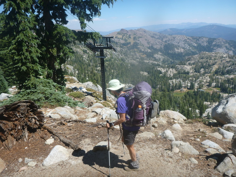
Wed 31st August, Day 49 to near Tinker Knob, 14mi.
The walking today is on the edge of civilization, with ski gondalas overhead and vast expanses of accommodation down below to our east. Bare volcanic slopes decorated with radio masts roads, fences and ski towers, but all wilderness to the west. A freezing cold wind took the edge off our excitement as we walk the bare ridgetop in parkas and mitts. Ten miles this morning before lunch is probably a first for us on this trip, although that was the norm on the AT. We drop 600 feet from the Squaw Creek lunch spot and start the climb up Tinker Knob, the last mountain for this trip. Water is in short supply on the mountain, with none available near the main campsite. Southbound hikers have advised us of a flowing creek a mile past this camp, so we are relieved to find it still flowing well, with a flat area a couple of hundred feet below. Wasps are still being aggressive, with both of us bitten several times. There is a remarkable Organ Pipe cliff line above the camp, about 3 mi in length and several hundred feet high. Probably some good climbing in there. We’re feeling almost lonely today, as there is no-one else at the campsite and we’ve only passed one early morning thru hiker and 5 day hikers.

Ali on the way down the last few miles
Thur 1st September, Day 50 to Clair Tapaan Lodge on Donner Summit, 9 mi.
We toiled up the last 500 feet of Tinker Knob in a bitter cold wind with our down jackets and mitts remaining on for several hours as most of the walking was on the exposed western side of the range with little tree cover. Bean and Daddy Longlegs come by on our descent, they had left at dawn from the Donner Pass. Both of them are in shorts and tshirts and not cooking to save weight. Ye gods, we’re too soft.

Mr Bean and Daddy Long Legs on Tinker Knob
More and more day hikers come by, including some trail runners and a school group. We boggle at Roller Pass, where wagons were dragged up a near vertical slope by oxen. 30%of immigrants came this way. Their story is put into the background as we learn the story of the Donner party, who got lost in winter in these mountains.
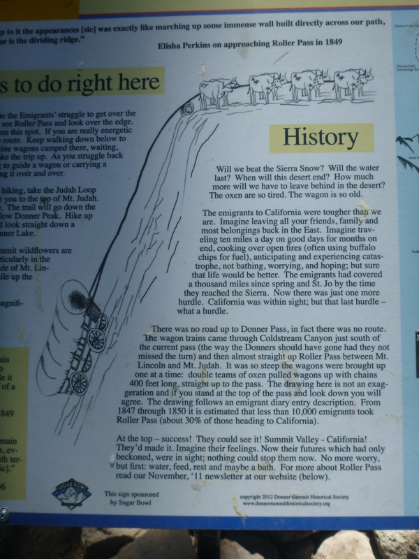
Could we do this today?
A burger and a free beer at Donner Ranch Bar and Grill to celebrate the end of our hiking for now, then on down the road for the last mile to the Clair Tapaan Lodge run by the Sierra club and the tiniest room we’ve had since Indonesia in 1974. Cassandra on reception has offered to drive us down to Truckee after breakfast tomorrow. From there we are booked on the train to San Francisco and some urban time before flying home next week.

We made it!
In summary, 500 miles in 50 days with 5 rest days, if only we were still 50 it would be really neat.
