2023
Friday May 31.
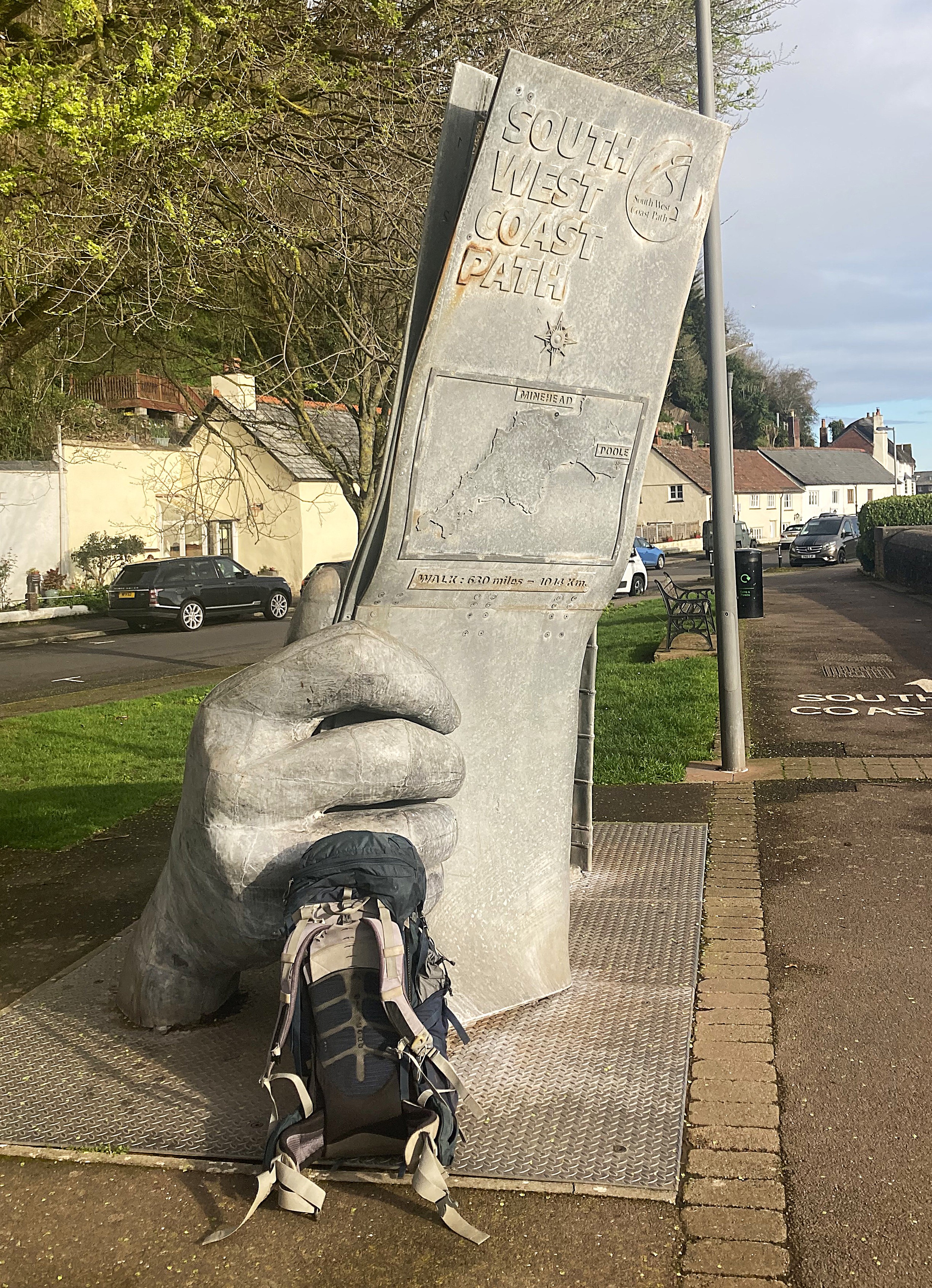
It had been a hard journey, 38 hours since leaving Corryong to get to Minehead in the UK and my BnB. I booked two nights to recover with Steve and Helen looking after me in their Waverley Bed and Breakfast.
Nothing had gone wrong for the trip; my bag turned up; all flights and buses were on time. The plane from Hong Kong was almost full, so there was very little room to move about. Isometrics and small wanders eased the pain somewhat. Watched a few movies, with Everest being the standout. I was in tears for Rob Hall and Jan. I gave up on Banshees of Inniskillen when it went silly with the chopping off of the finger. Where the Crawdads Sing was almost as good as the book, but that level of bigotry and hate has faded at least a little. Maybe not in the USA. I enjoyed Elvis, as it seemed fairly honest about his failings as a person. The odd blend of gospel, blues, hard rock and sex that was so offensive at the time. His military service was used as a compromise for being lewd, so odd today to imagine that level of hypocrisy. Again, maybe not for the USA.
Once landed and reunited with my bag which managed to follow me through the three flights, the Heathrow express to Paddington ran every 15 minutes or so, with a wait of a few hours for the train to Taunton to avoid the high peak hour prices. Before 9:30 was £80, while the 9:37 was £45. The 10:37 was £25 but I was worried about a late arrival at Minehead.
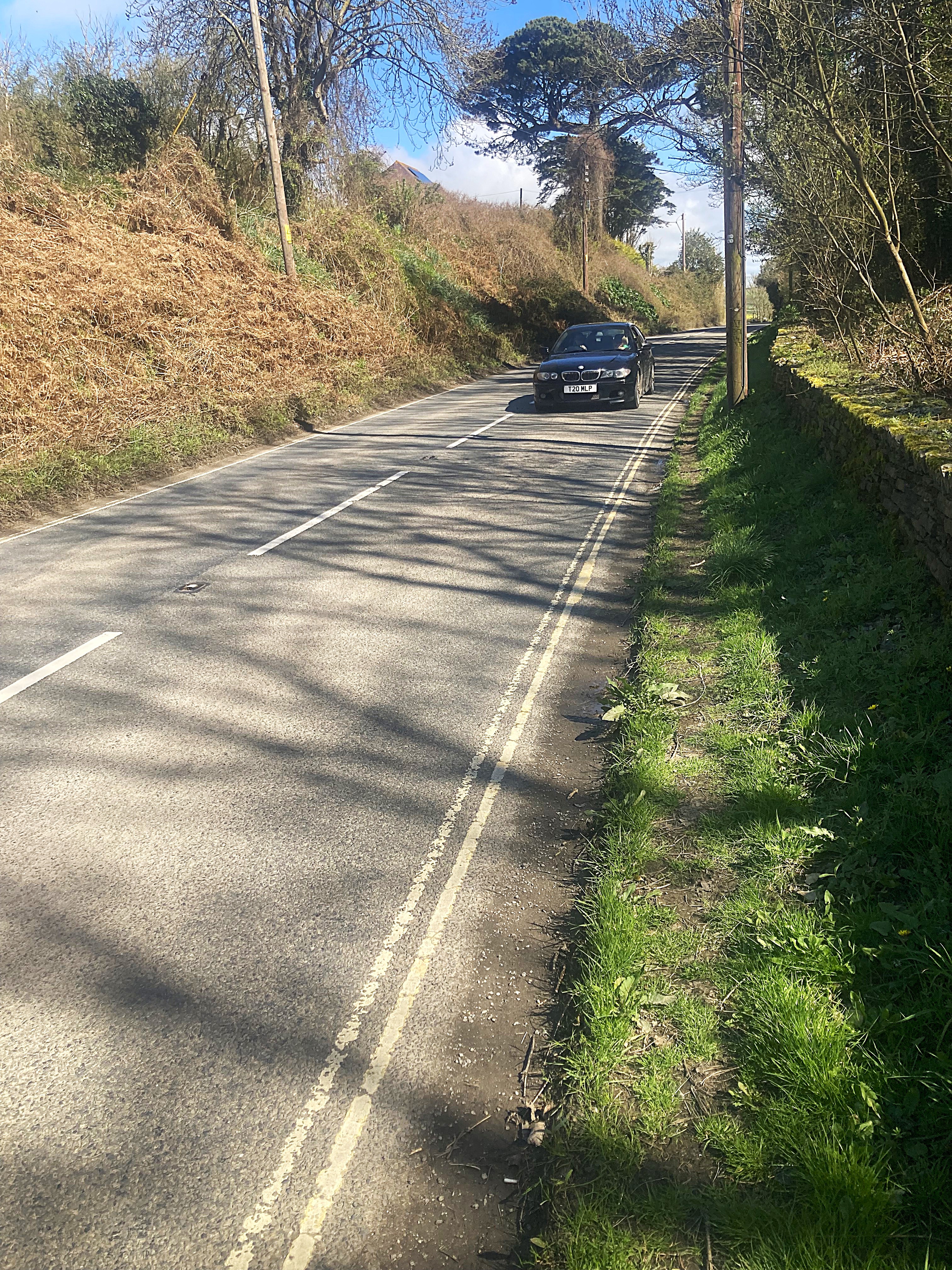
There was a distinct lack of information about the final leg from Taunton on the local bus to Minehead. All sources had the bus leaving from its depot near Taunton castle, about a mile from the station, so I walked there, caught the bus after a wait, only to be taken back to the station for its first stop enroute. The narrow roadways of the UK had me closing my eyes on approaching traffic, the bus often giving way to oncoming cars, but even a cyclist was game enough to ride along.
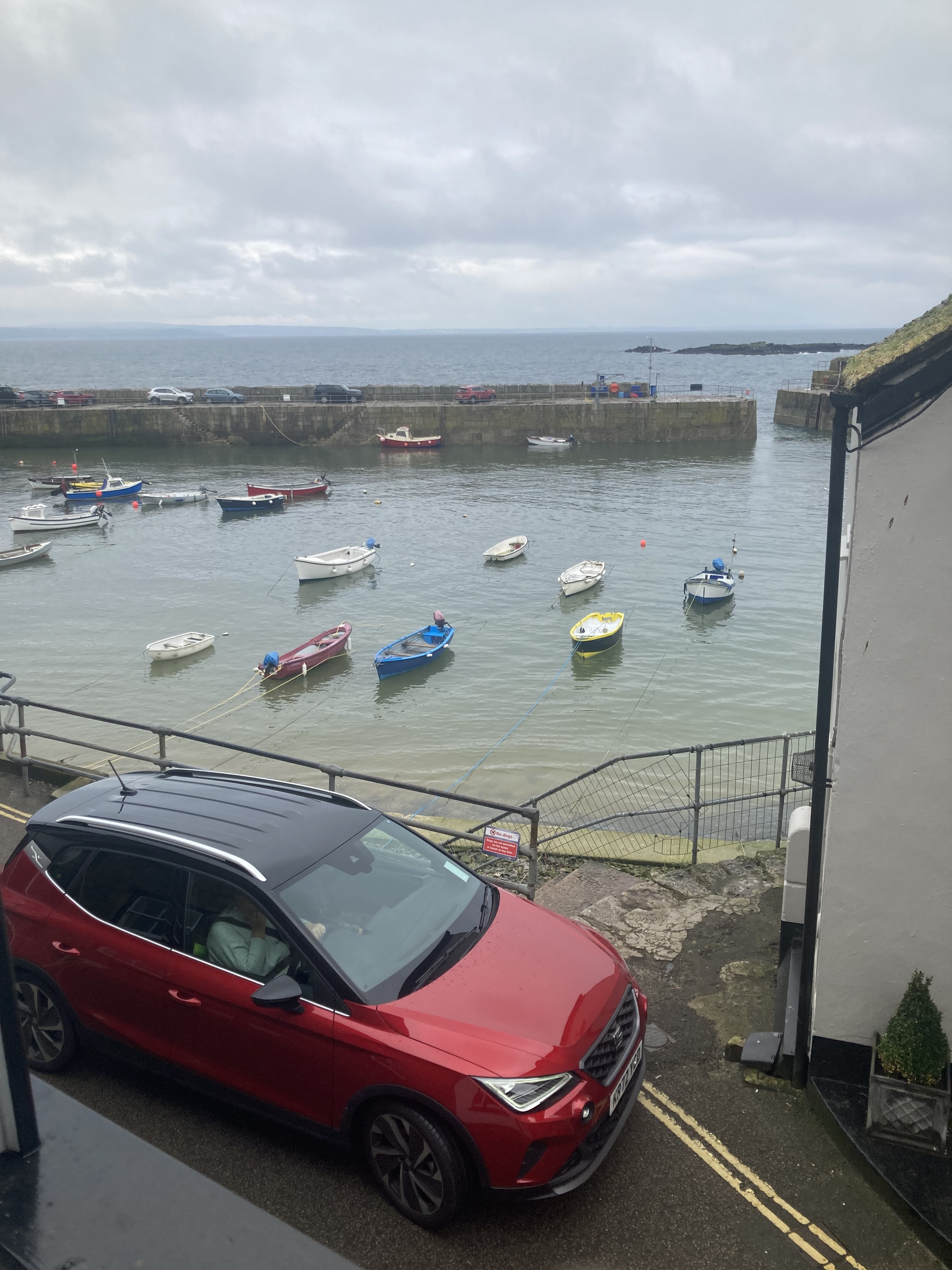
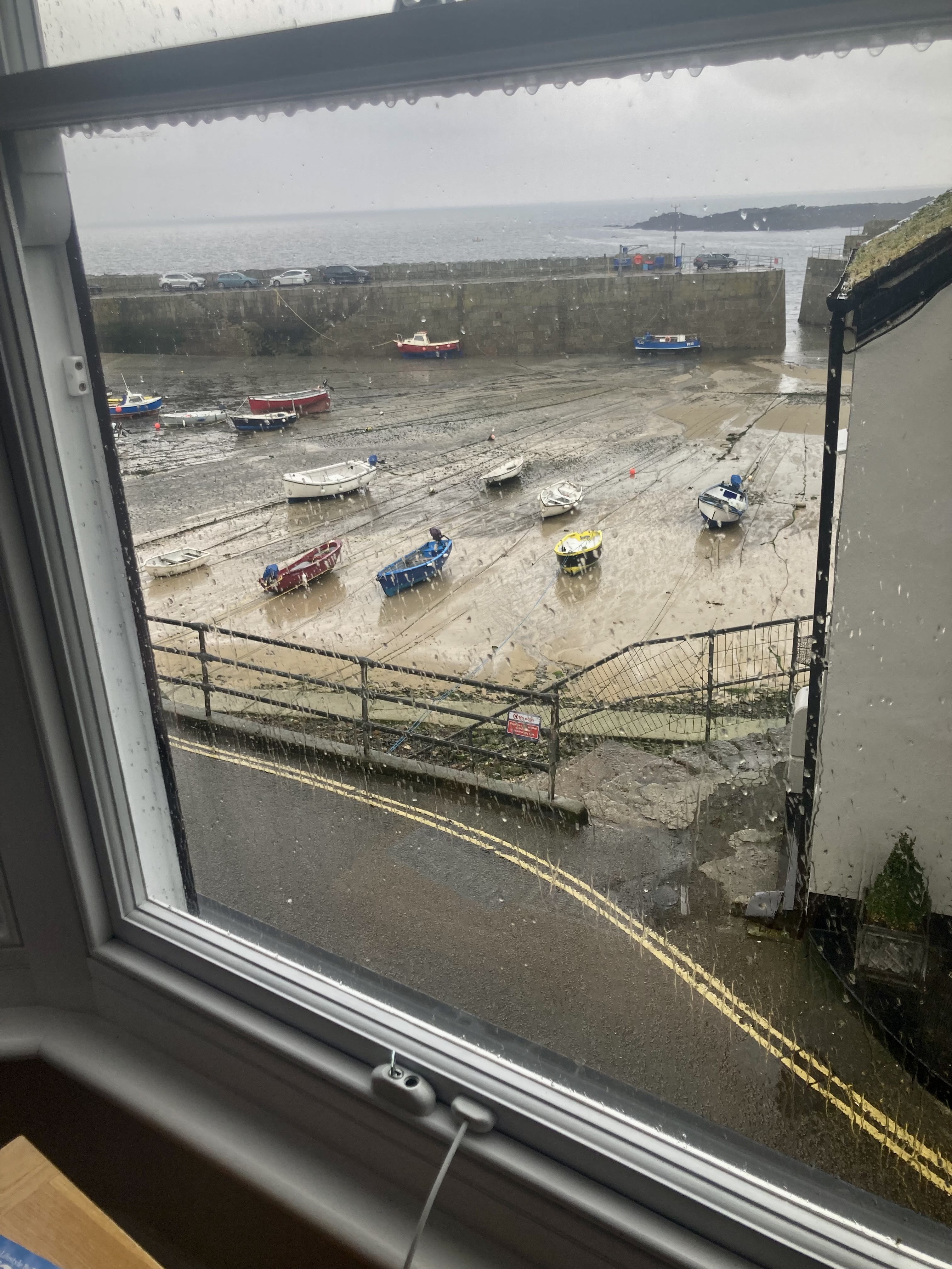
It had been bleak and cool all day with a hard drizzle, the sea and sky the same colour grey. After a shower and snooze at the BnB, I went down to the Stones pub for a meal, then a walk around town and it’s brimming canal. I saved the beachfront for tomorrow in the hopes of a weather shift.
Sat April 1.
Slept pretty well, right through to breakfast at 8. My body clock seemed to reset ok. Poached eggs and cereal with two other families and a single hiker.
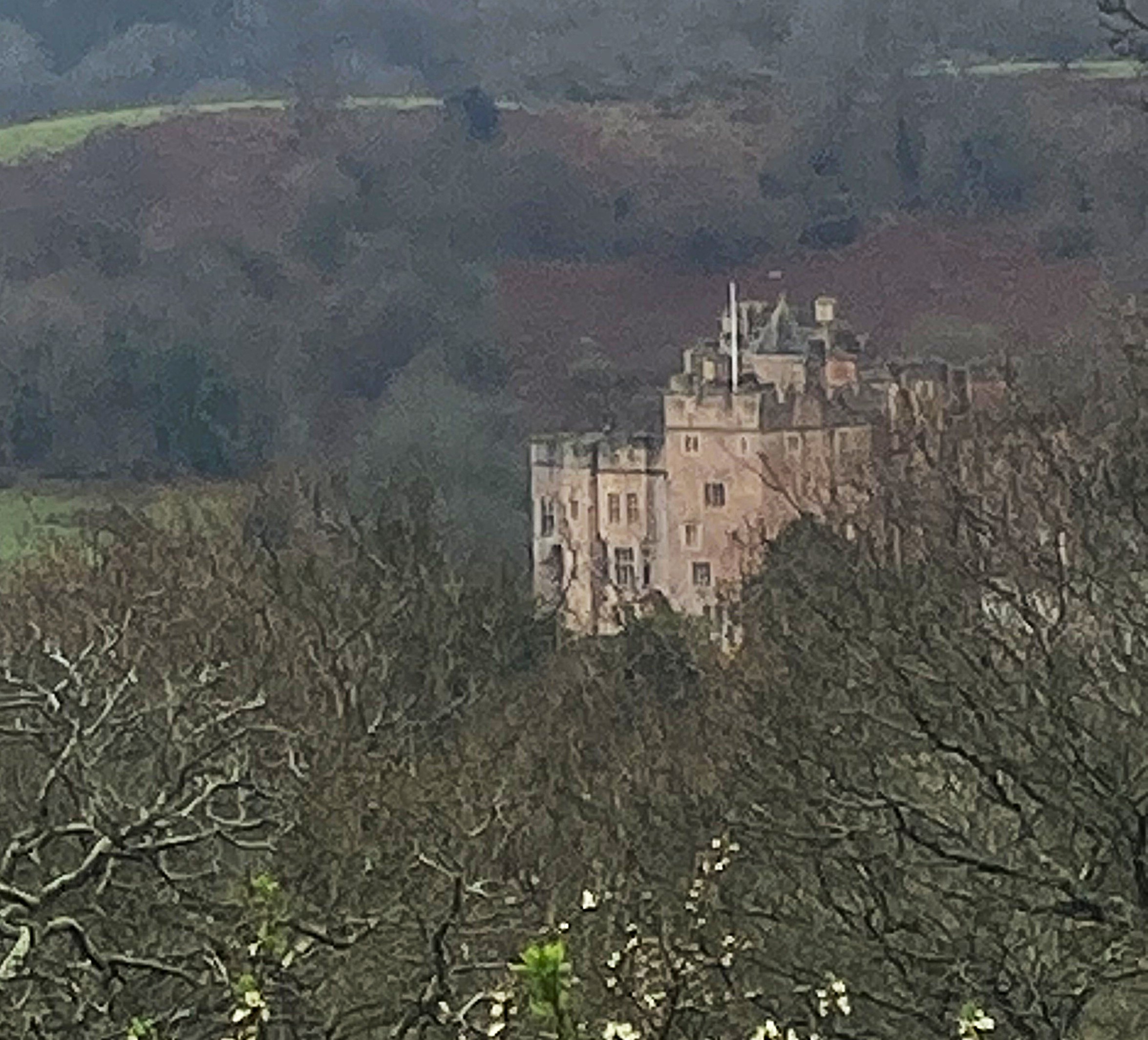
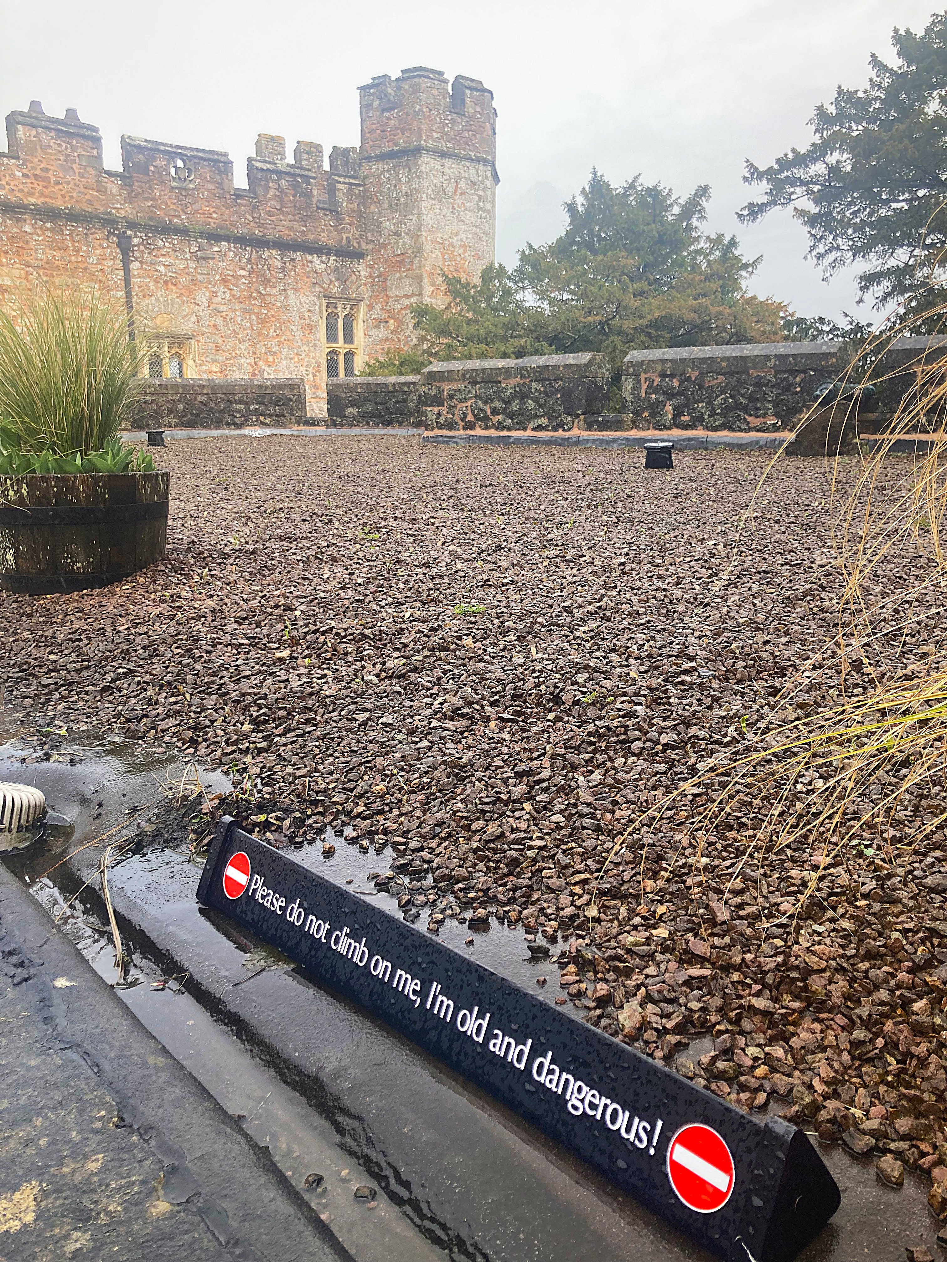
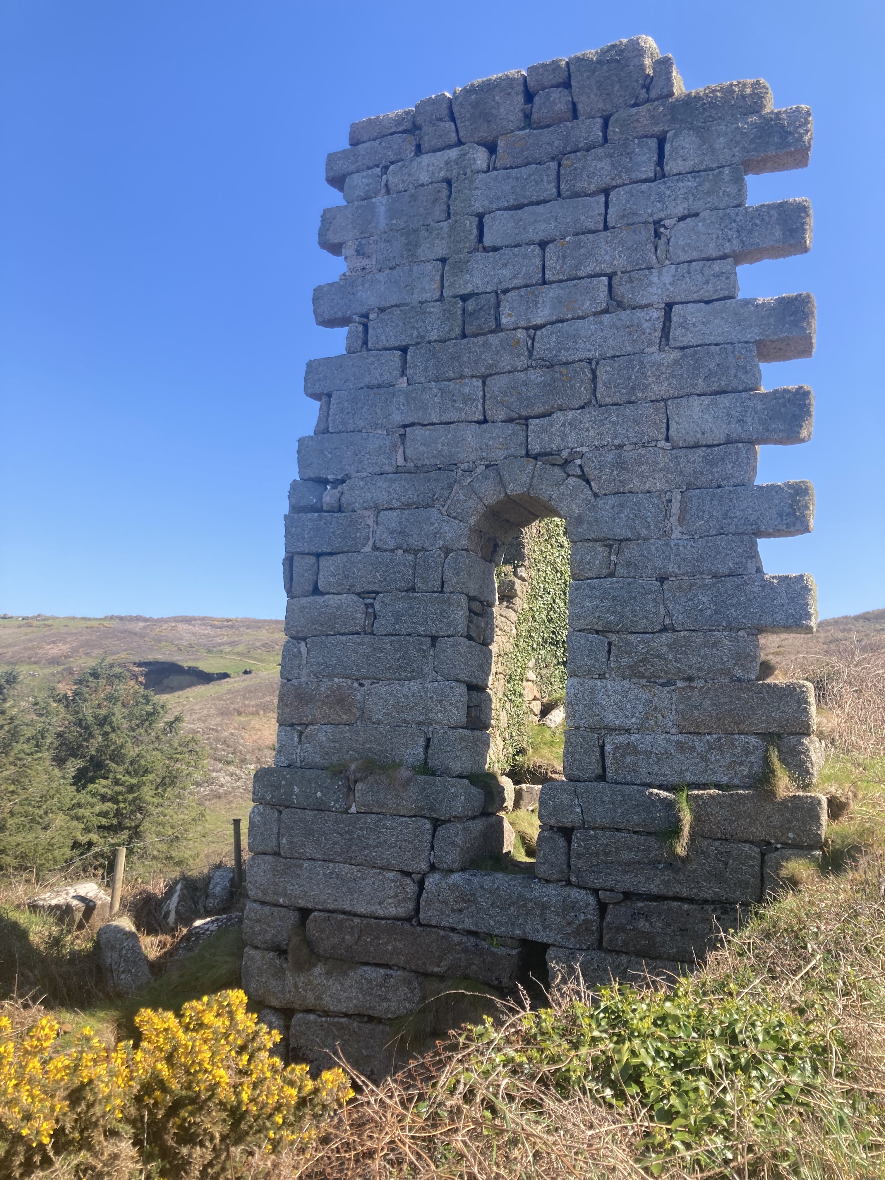
Headed off for a day walk on footpaths to Dunster castle and its tower on a nearby hill. The tower looks very military, but it was only built as a folly for the view and entertaining guests. The castle itself is really just a substantial home, owned by one family for the last 600 years, and modified by every generation. Now it is owned and protected by the National Trust, even the 1960’s Laminex and lino kitchen. It looked to give opulent and comfortable living at about 1920’s standards, the date of the last renovations except for that kitchen!
Another bleak day until about 2 when the drizzle stopped and the wind eased off. So down to the village for fish and chips on the foreshore without a parka for the first time.
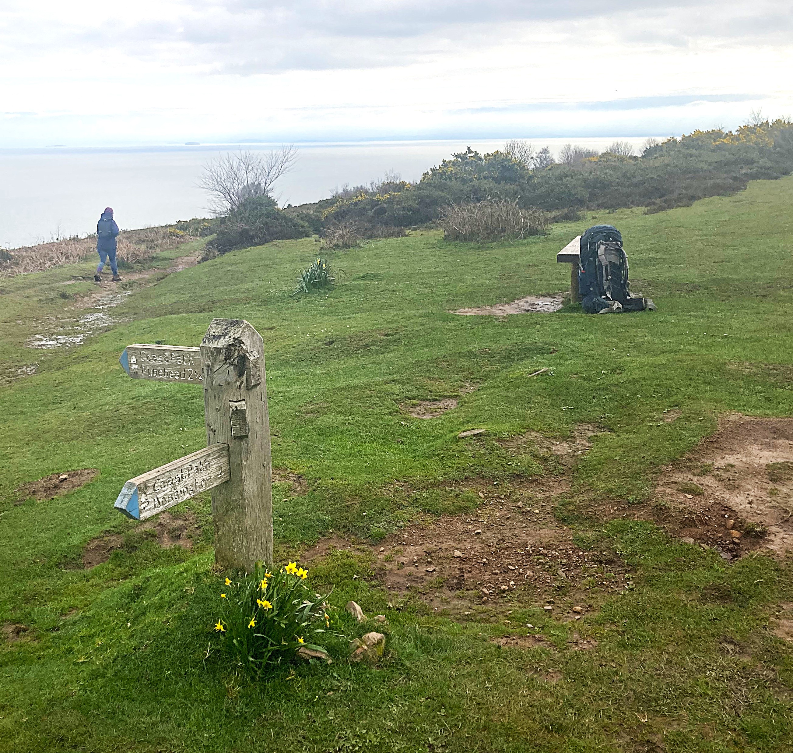
Sunday April 2. 17 Km to Porlock Ship Inn.
Clear skies with glimpses of sun, but a biting wind kept temps down to around 10. It was quite difficult to find a clothing balance between sweating and chilling, but I didn’t need a parka at least.
The walk along the coast started with a 300m climb, of course, through gorse on muddy tracks to pastures dotted with a few sheep and cattle. Then a long ridge descent to Bossington and a tea shop for lunch. Curried parsnip soup and toast.
I was booked in at the Ship Inn at Porlock weir and arrived there in the early afternoon to discover that I am actually booked at the Porlock Ship Inn, about 3 km away. This wasn’t a problem except I chose to walk the direct route there along the narrow windy road, dodging cars all the way. This could have been avoided if I’d bothered to check my map a little more carefully. The Top Ship pub was expecting me so I quickly settled in for a shower. Muddy to the knees from splash, and regretting that I’d left my long gaiters at home. No Guiness but St Austeyns stout seems an acceptable substitute, so a beer and a snooze for the afternoon after booking in for dinner. I turned up on the dot for my time slot to discover a seething mass of people, with several layers standing at the bar, every table, except mine, occupied and a wait queue in the garden. A dog under every table, not a woof to be heard. Sunday lamb roast came with six veges and a Yorkshire pudding, followed by apple crumble. so off to bed feeling bloated.
Monday April 3. 20 km to Lynton
The earliest the pub could manage breakfast was 8:30, so I booked anyway hoping to get away by 9. Poached eggs again on grain toast after an adventurous attempt to eat honey frosted cornflakes. Not my favourite.
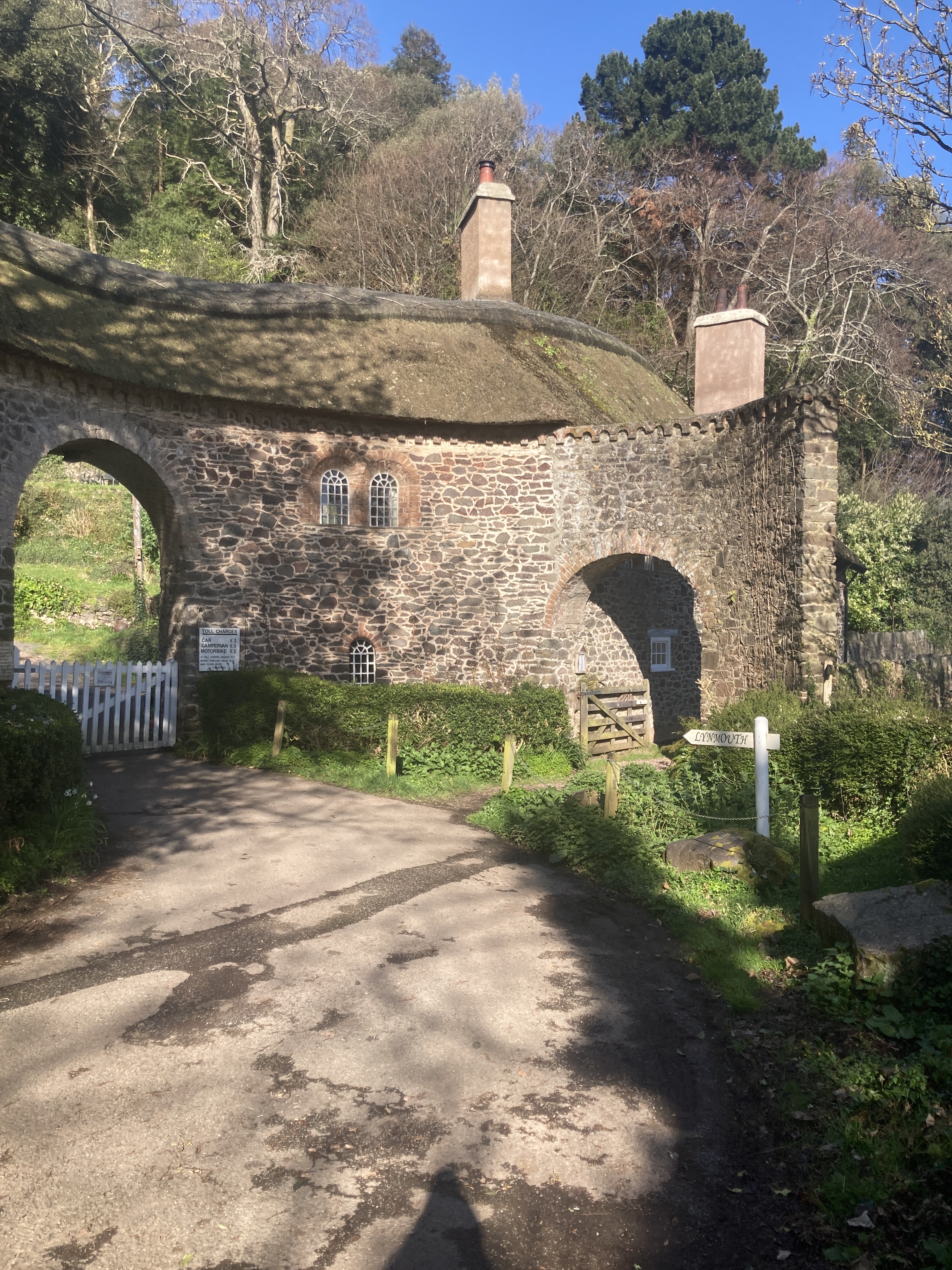
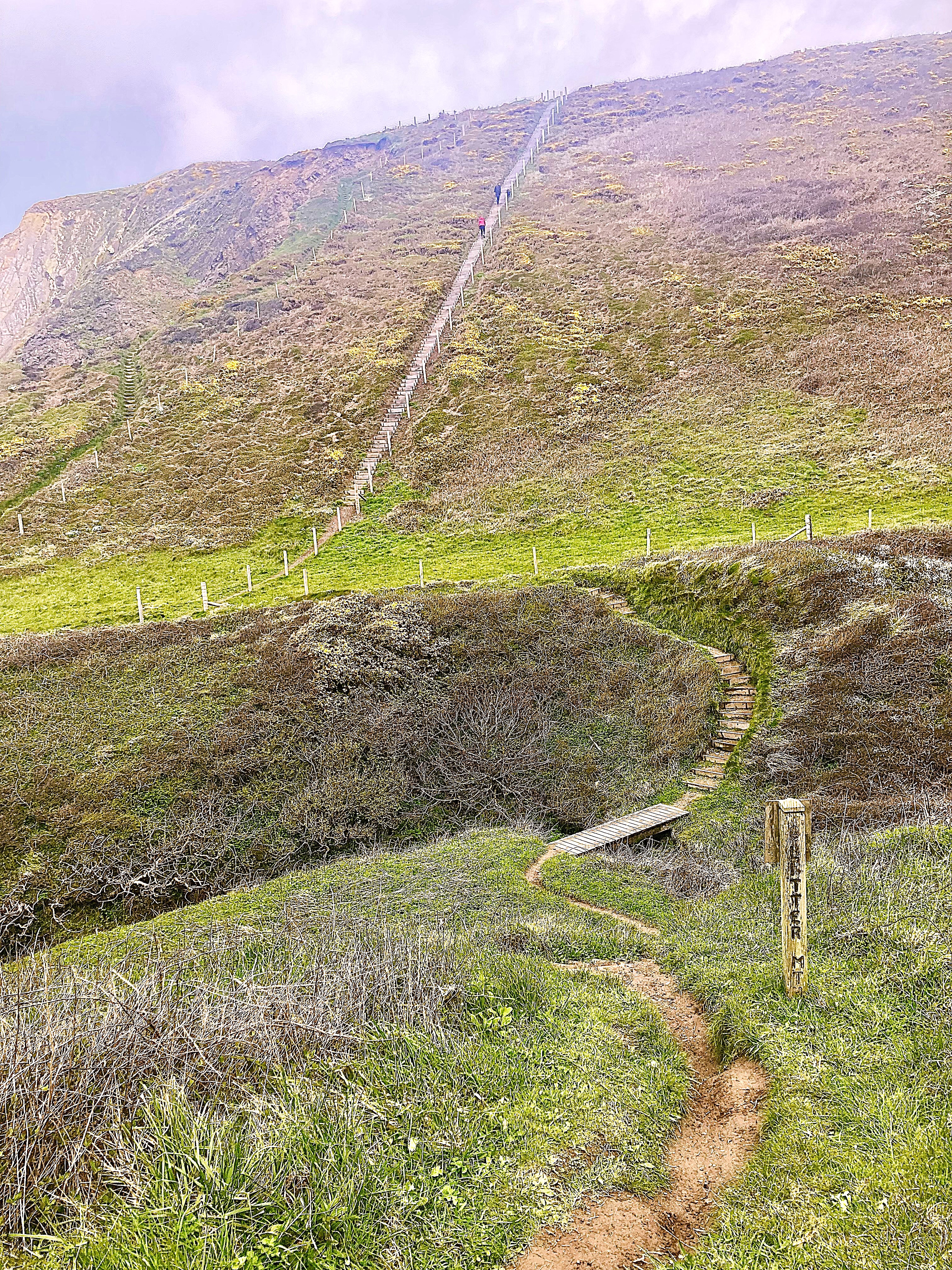
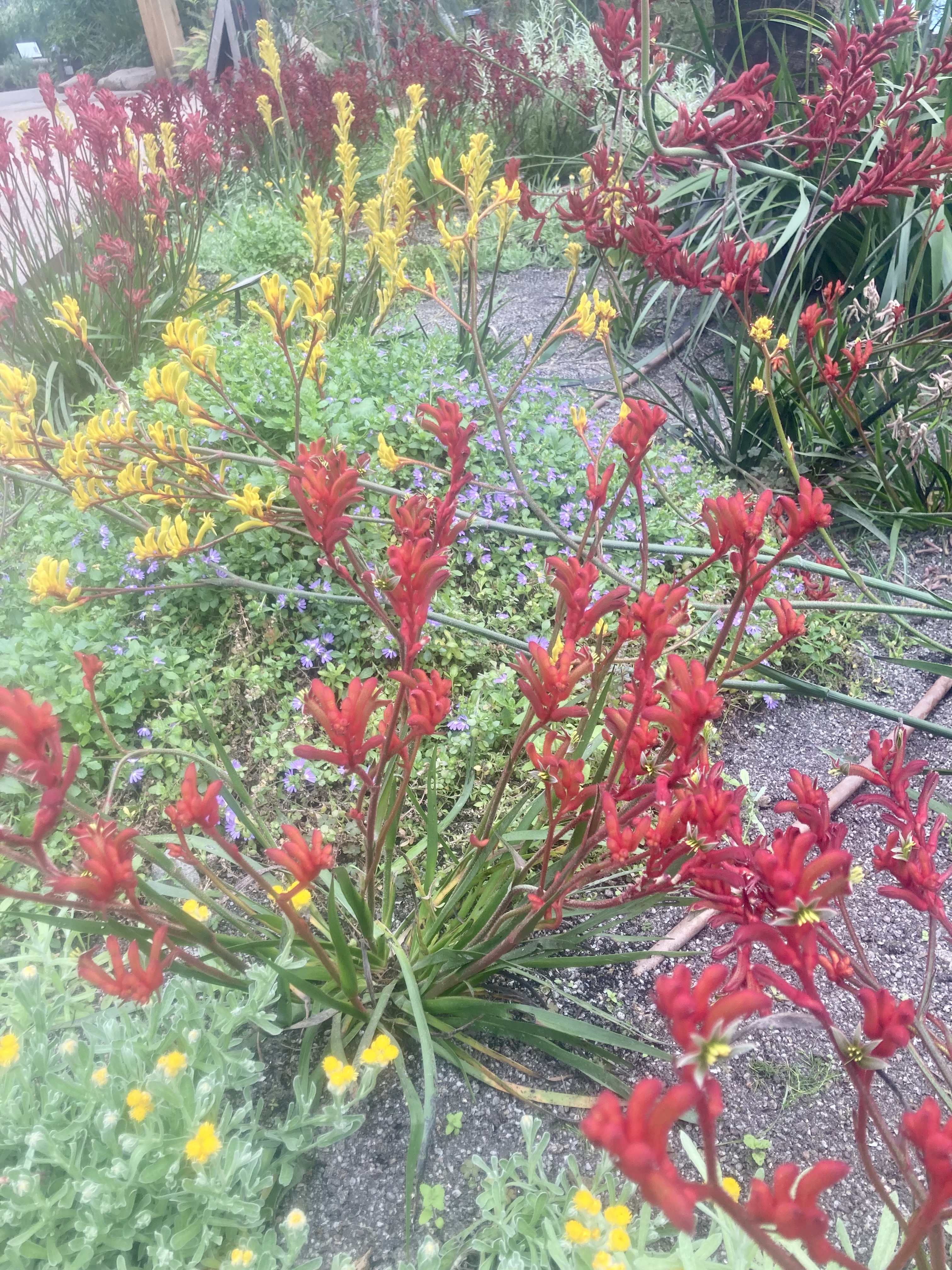
I found the footpaths leading back to Porlock weir, and was able to stay well off the main road, joining the trail at a toll road, gated with a £2 honesty box. The path sidled up and across an escarpment, never actually topping out until it approached Lynmouth where it had to cross a headland. I think the path was once a packhorse trail, deliberately left below the top to avoid the wind and to avoid being seen. Staying out of the wind was a real blessing as most of the trail was in shade and when it emerged into the blast, the Atlantic wind sucked out all my warmth. The forest was mostly composed of rhododendron, considered a weed here, so a mass flowering would be stunning but the only flowers I saw were reds and pinks on single trees in private gardens. Some prickly holly with bright red fruit added to the colours on display.
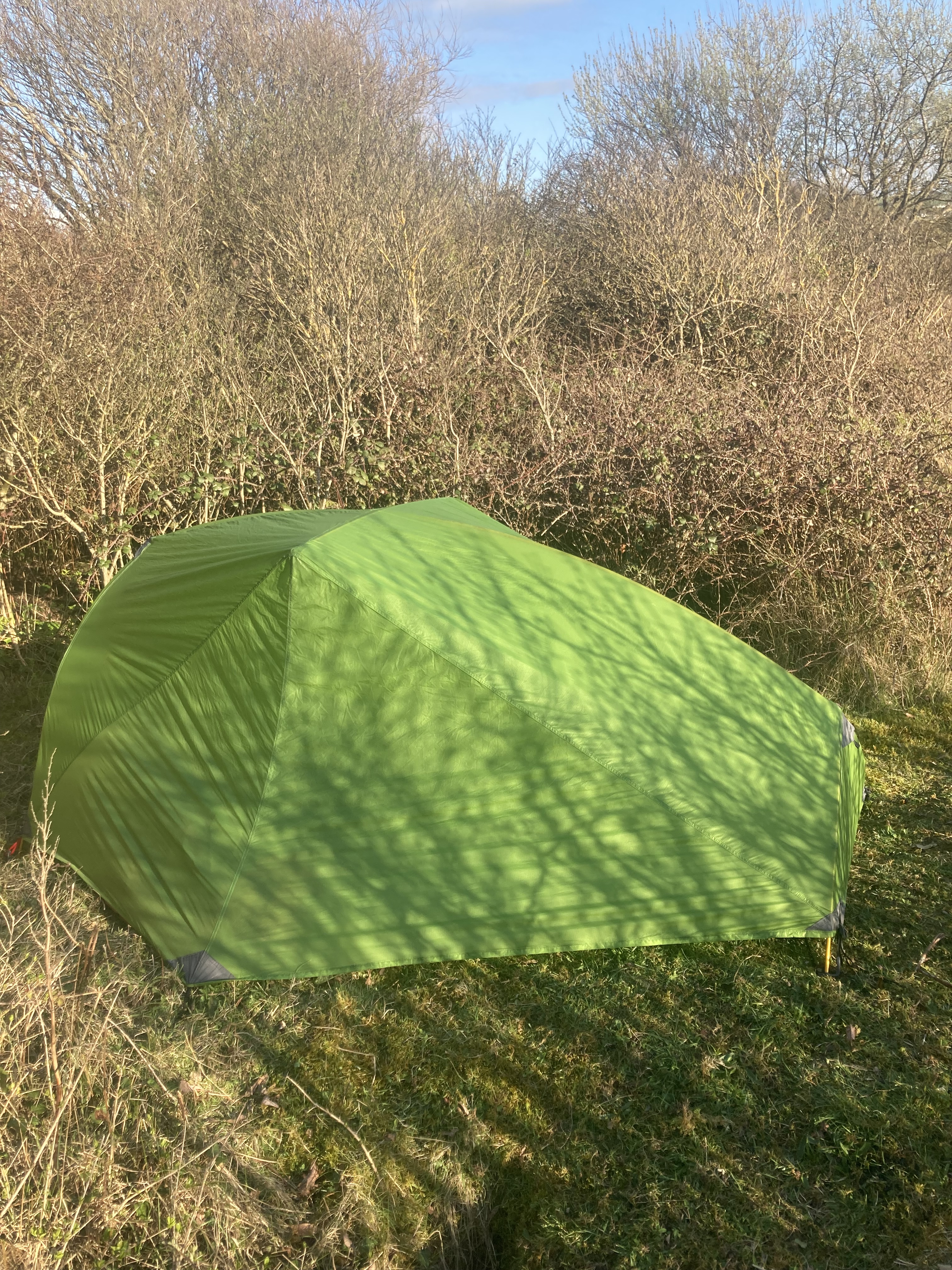
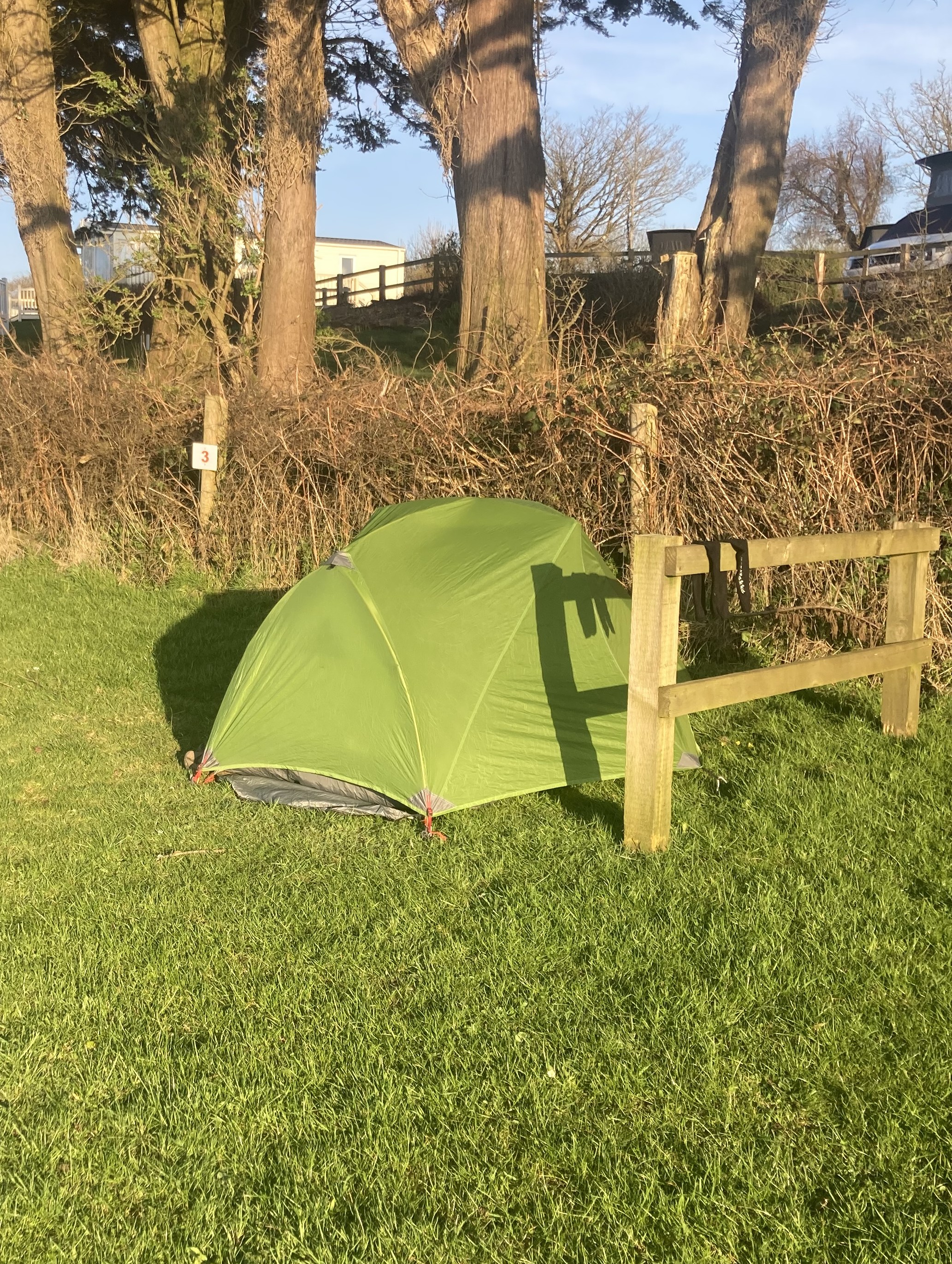
I was very weary by the time I left the trail to cross to my campground for the night. A 200m deep gorge was in the way, so that really capped off the day. Finally tottered in to a joyous welcome from the staff. There wasn’t much food to buy for dinner and breakfast, but they had a gas bottle that fitted my stove, so I can cook again at least. Baked beans and a fresh baguette for dinner, and breakfast. My sleeping bag zipper destroyed itself, so I just had a quilt for the night. A bit cool.
Tuesday April 3. 26km to Combe Martin, 770 m climbing.
The trail dropped steeply from Lynmouth to Lynbridge, then sidled the stream on the Lynwalk to the small town of Lynton. I never found out who Lyn was!
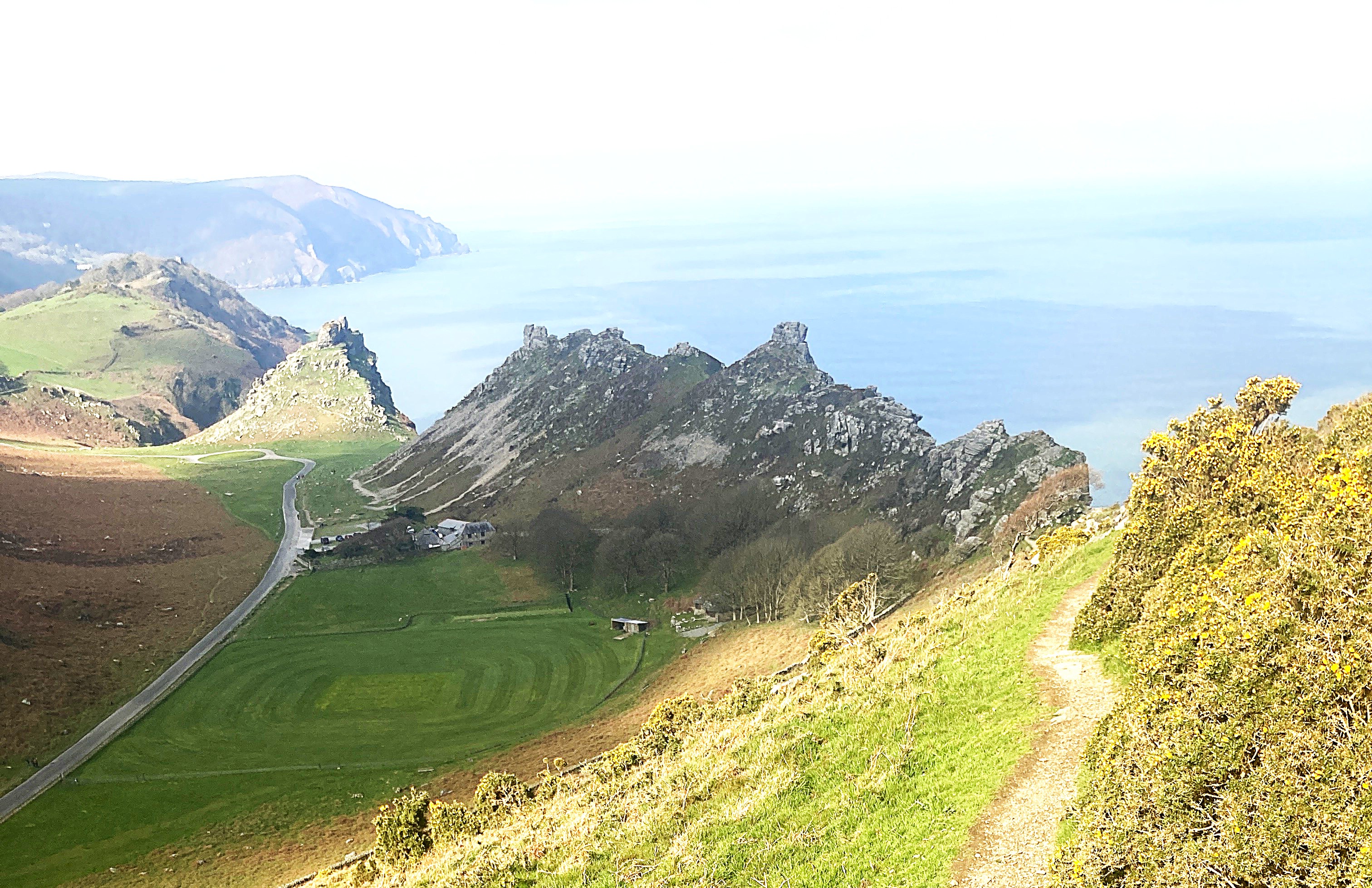
I bought some groceries for the next few days then found an open café for a second breakfast. Back on the South West trail by 10, climbing again to the Valley of Rocks. A class were using the topmost boulder for an abseiling and climbing lesson from a Christian outdoor centre a bit further on. I passed several houses on a ridgeline accessed by a toll road which also allowed access to beaches below. A very Samoan principle, where the beach may be public land but the access is not.
Several more descents and climbs of 150m and more followed quickly, leaving me exhausted before even reaching the main climb called the Great Hangman. With nowhere to camp I had to keep going up and over, then down a long ridge to Combe Martin and a campground by 6. Noodles for dinner. Repaired my sleeping bag with a row of safety pins, then dressed in long johns and puffer jacket with a beanie. Felt a little overdressed, but I slept right through. I shared the camp kitchen with another through hiker, Anna, but she was skipping through to the next town hoping her back would recover from a rest.
Wednesday April 5. 17km to North Morten, 300m climbing.
So much for the sunny days, with drizzle all day solidifying as the day went on to a light rain. I’m sure the English must have 153 words for moisture from the sky. Parka and overpants all day with mitts coming on and off as fingers chilled. Overheating from the exertion, so I kept the parka held in place by the waistband, but unzipped so I could open and close it as required.
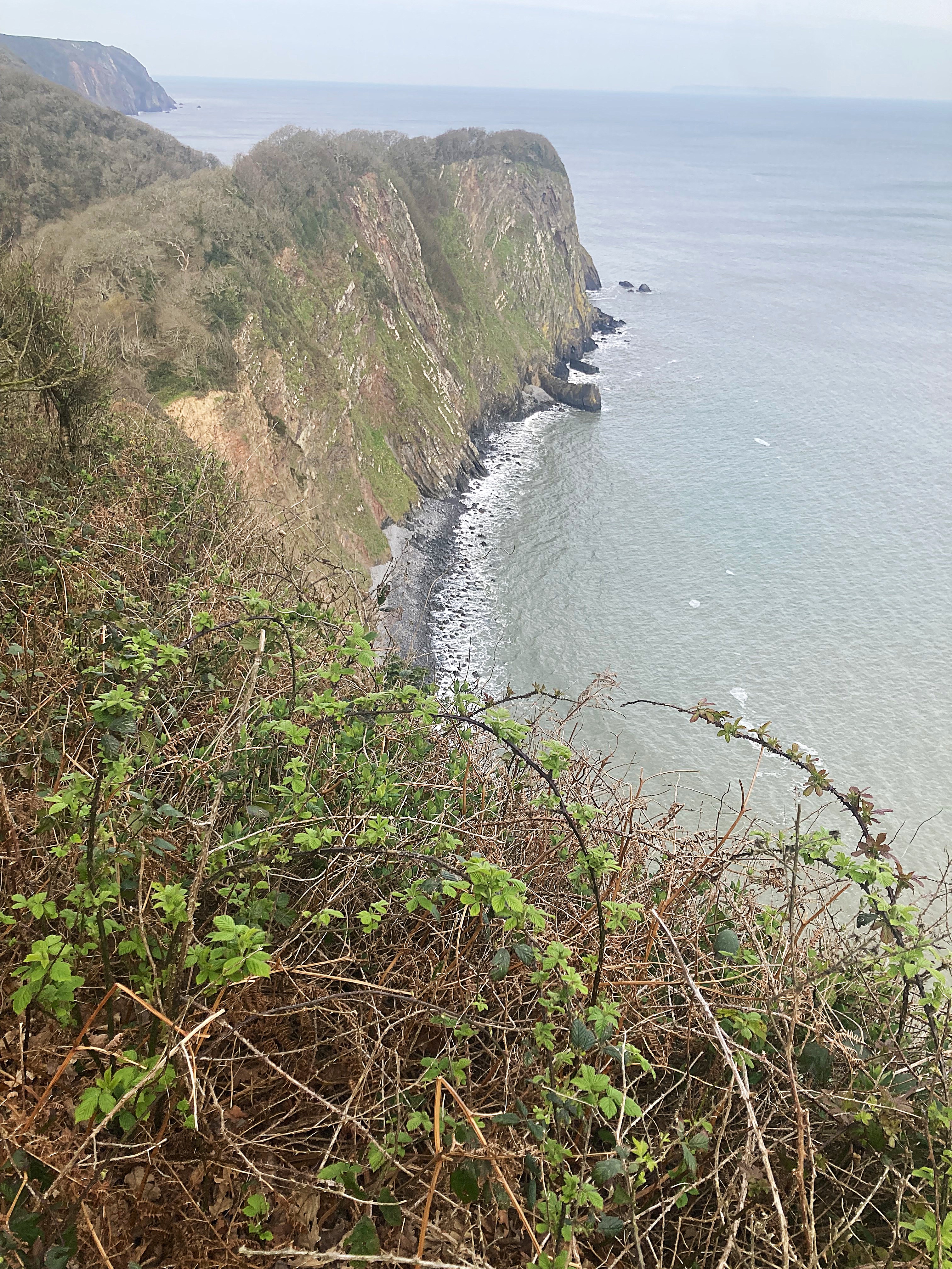
I’m starting to see spectacular rocky coastlines with many cliff edges and long drops. Smaller ups and downs as the trail crosses gullies, but my mapping app lost track of the total. I decided to stop at the first available campground, which was close to the trail but 100m above it, so I had a bit of a climb and had to wander around to find reception. This was a huge old farm given over to 200 dongas and a couple of 5 acre cleared paddocks for camper vans. I managed to find a flattish spot next to a hedge for some shelter from the weather, still blowing a half gale. Warm and snug for the night despite not using the inner tent, really only good for insects anyway. Breakfast was water and an apple before dropping down the 5 km to Woolacombe for a real cook up.
Thursday April 6. 25 km to wild camp near Broughton.
Woke to clear skies and a solid ground mist. Many walkers on the trail around Morte Point this morning. Then the beach to Woolacombe and the Captains Café. Many place names around here referring to the time of the Wreckers, when the law had it that shipwrecks could not be salvaged unless there were no survivors. The wreckers made sure there were no survivors. The one exception was a wreck that happened just after being taken by Spanish pirates. The presence of a dozen heavily armed men saved the crew and passengers. There was no record of the pirate’s fate.
More pleasant beach strolling along Woolacombe beach before climbing up over Boggy Point headland and down to the beach again at Croyde and another café for lunch. Croyde beach onto the next headland and a designer house made to look like a lighthouse, for sale at £10M, hmm. Down to Saunton from there and a beachfront hotel with rooms for £275 per night, pass! Busy and terrifying stone walled road walk for 500m or so with only the double yellow line on the edge to walk on. Once off the road the path entered a golf course with warning signs to watch for golfers as the path crossed several fairways. Finally into safer ground on a military exercise area being rehabilitated as a wetland. No camping, but I found a suitable thicket for a wild camp just on the edge. Dripping wet with condensation in the morning and a light frost all around me.
Friday April 7. 34 km to Bideford.
It was a pleasant walk along the top of a dyke into Braunton and a wharf side café for breakfast, but from there the rest of the day was horrible. An old rail trail meant that it was flattish, but sealed for cycles and straight lines of a kilometre or more made it very boring and hard on my feet..
Two major river systems formed one estuary that had to be crossed, but it was low tide with no ferries operating. I had to walk up one river valley to where a small bridge crossed over, back out to the point and upstream again to a crossing on stepping stones. A delicate operation as they were all covered in algae and very slippery. With all this in and out, the campground for tonight was about 5 km from last night’s spot but I had walked 34 km to get there.
The campground was very basic, but it was possible to charge up everything. Bideford is pronounced Biddyford!
Saturday April 8, 25 km to Upper Clovelly
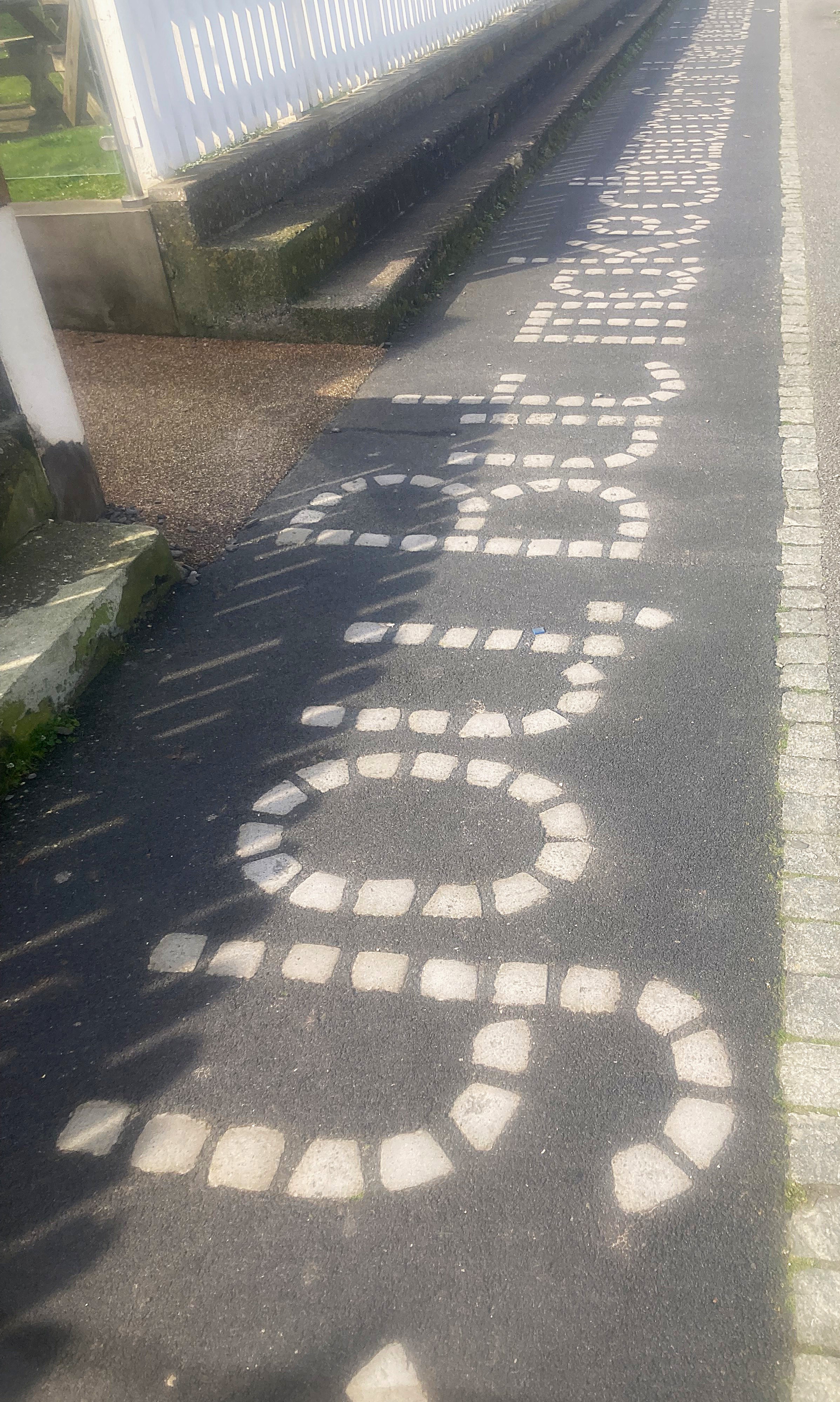
Easy walking at first around another swamp and golf course forming the “link” between the sea and the land then down to a café in Westward Ho! and the beach again. Yes, the town name had an apostrophe for reasons unknown. It also had the words to Rudyard Kipling’s ‘If’ embedded in the brick paving for about a kilometre of the seafront.
Off the beach and into another rollercoaster of a track with about 10 climbs of 100m or more, so I was pretty done in by the time I reached the campground. Another basic one on the highway with no shelter from the wind or the traffic noise, but a pizza van set up opposite, so I was well fed for a change. Another hiker, Viv, camped nearby, with a third hike tent as well but no occupant.
Sunday April 9, 18km to Hartland Quay.
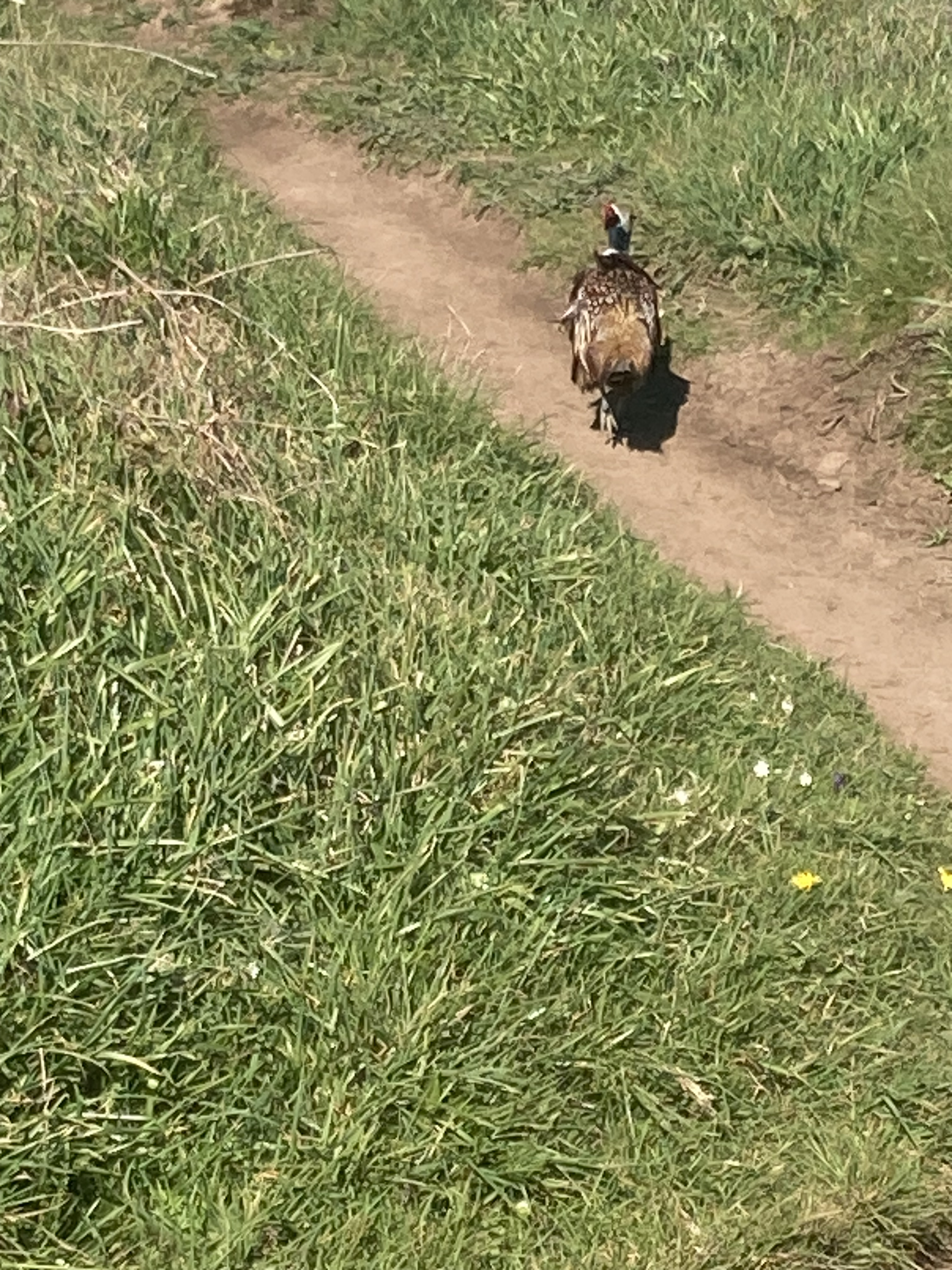
A spectacular day of walking clifftops, but the ups and down again were quite exhausting. Mostly walking along the edge of pasture with some cultivation going on, discing and harrowing. Upset several pheasant, who exploded out of the scrub yelling their heads off. Lower Clovelly is apparently a picturesque if tiny fishing port at the bottom of a very steep one-way road. A land rover takes passengers who are unable to walk down or back. I stayed on the clifftop and headed onwards, so no breakfast today.
Bad weather was forecast, so I booked to stay in the Hartland Quay hotel right on the waterfront. I even had a view of the sea from my room out one corner of the bow window.
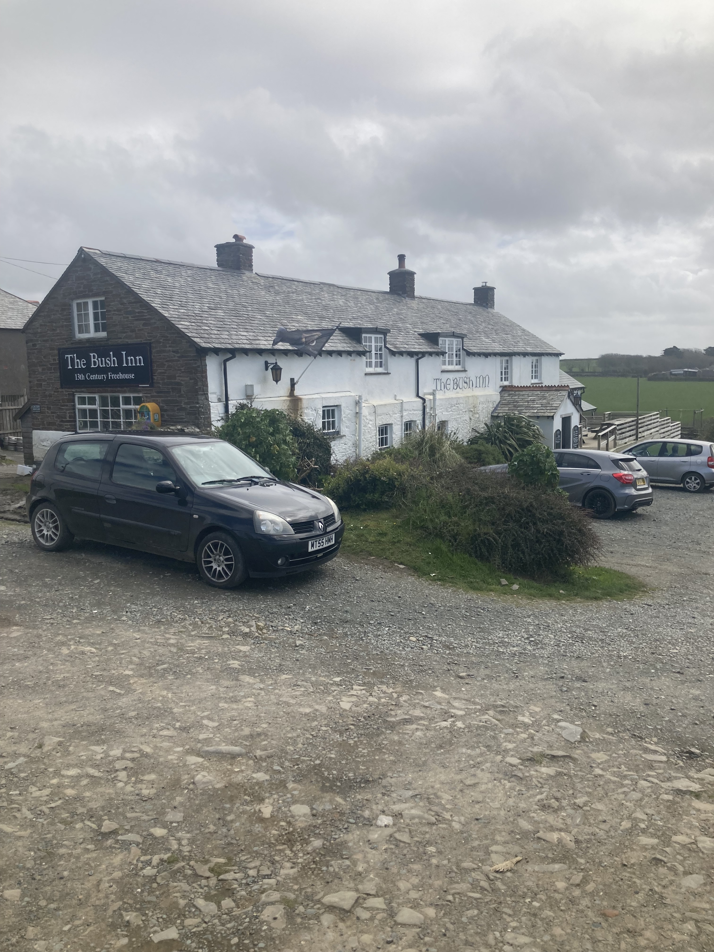
Monday April 10, 14 km to Morwenstow Bush Inn. 600m climbing.
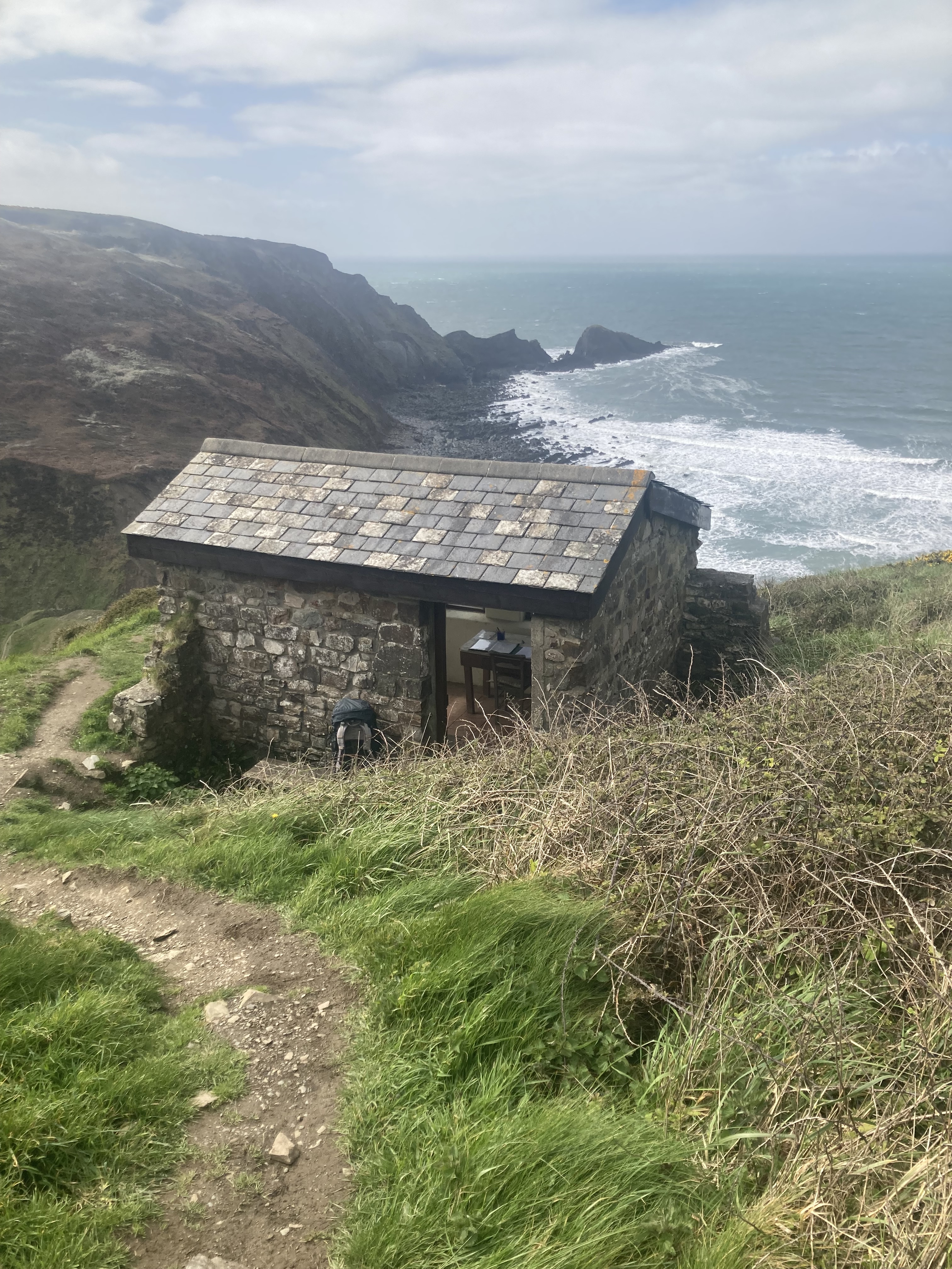
Today was meant to be all the way to Bude, 26 km, but the forecast 80 kph winds and rain made that unattractive to say the least. So oddly for me, planning ahead, I booked the Bush inn online for tonight and the Falcon Inn in Bude for tomorrow. ANZ let me down again, sending verification codes to my Aussie number. $10 a day for roaming privilege is just over the top. I was able to make the calls from the shelter of the Poets Hut on the clifftop.
I started the day with two long climbs with a really nasty cross wind, fortunately blowing onshore, so not trying to send me off the clifftops, except when there was a sudden lull, and I would lurch toward the cliff to regain balance. The trail followed the pasture edge, so only limited shelter from the gorse hedgerows. Easy walking then for a couple of hours, then 4 more climbs before my turnoff to Morwenstow and its 13th century pub and church surrounded by graves. The Bush Inn has been an accommodation house since 950AD! So the overhead beams were a problem, but only in the core area. I had a lovely room facing west with full sun coming in the window. I joined another hiker, Daphne from Holland, for dinner. A wonderful fish stew with warm bread and a chocolate fondant. No lunch today and didn’t even notice.
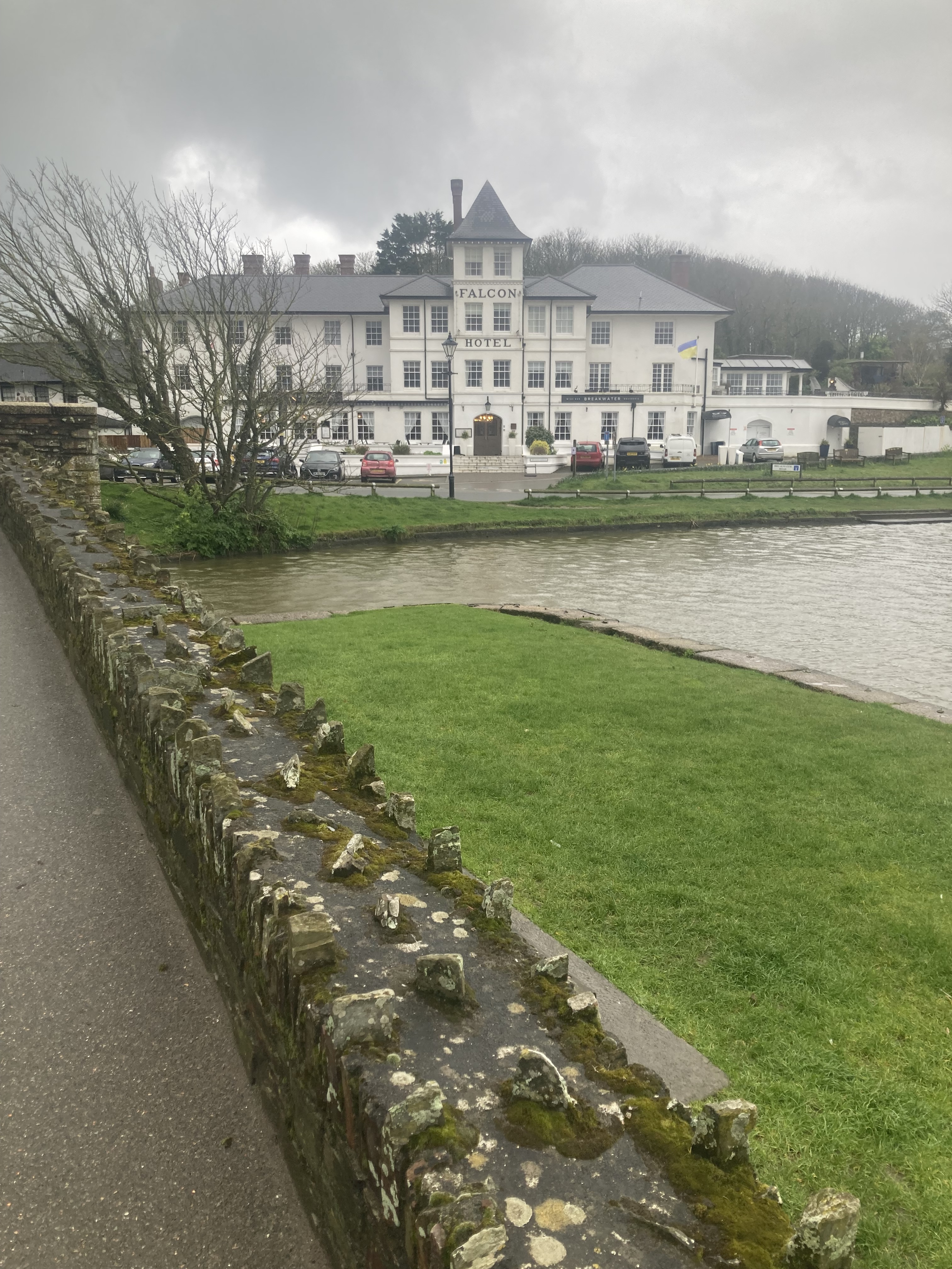
Tuesday April 11, 12 km to Bude.
Another good Cornish breakfast, (not English anymore), and off towards the trail by 9. Took the easy route from the pub to avoid a big drop and climb, but still had several more to get through the day. Easy walking through pasture with the strong cross wind again and rain that stung on contact. The chill was just starting to creep through as I arrived in Bude and the Falcon Hotel. I was too early for check-in so I settled into their posh restaurant for lunch of soup and stout, only to have their reception come through to let me know that my room was ready.
Wednesday April 12, zero day.
Foul weather so stayed put. Read a book, had lunch, slept.
Thursday April 13, 27 km to Boscastle, 1350m climbing.
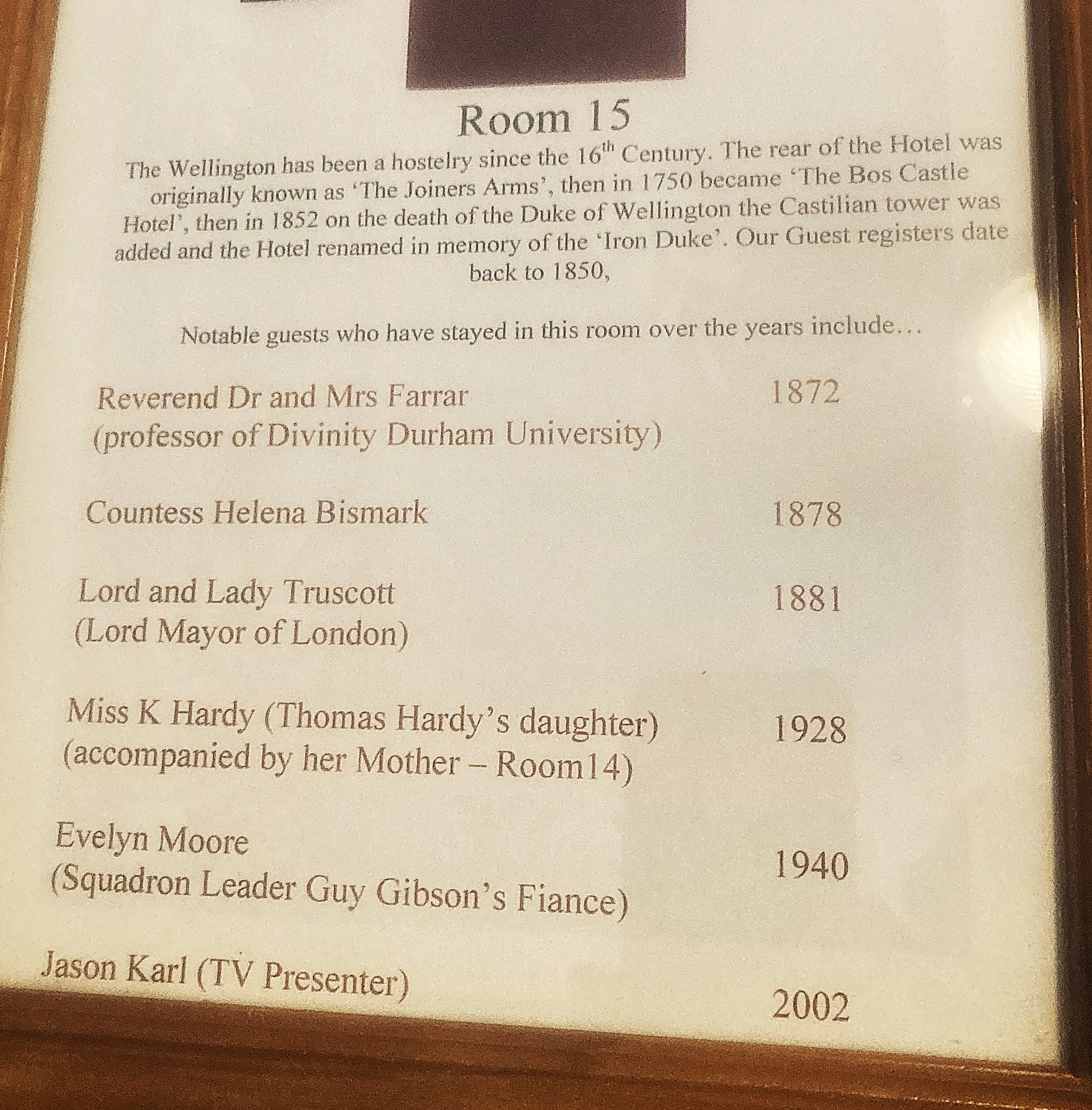
A hard day of steady walking with a half hour break for lunch at Crackington Haven, rolling into the Wellington hotel at 5:30. The coastal cliffs just continued to get more spectacular, but with all the ups and downs the last 10 km took 4 hours. The hotel was renamed to honour the Iron Duke after his death in the 1850’s. It had been a hotel for 200 years before that. My room had a list on the wall of the honoured guests who had stayed there, but the room looked like servant’s quarters; a small room up a narrow staircase, but with a modern bathroom.
I’ve booked a very expensive hotel in Port Isaac for tomorrow, then back camping I expect.
Friday April 14, 22km to the Old School house, Pt Isaac.1250m climbing
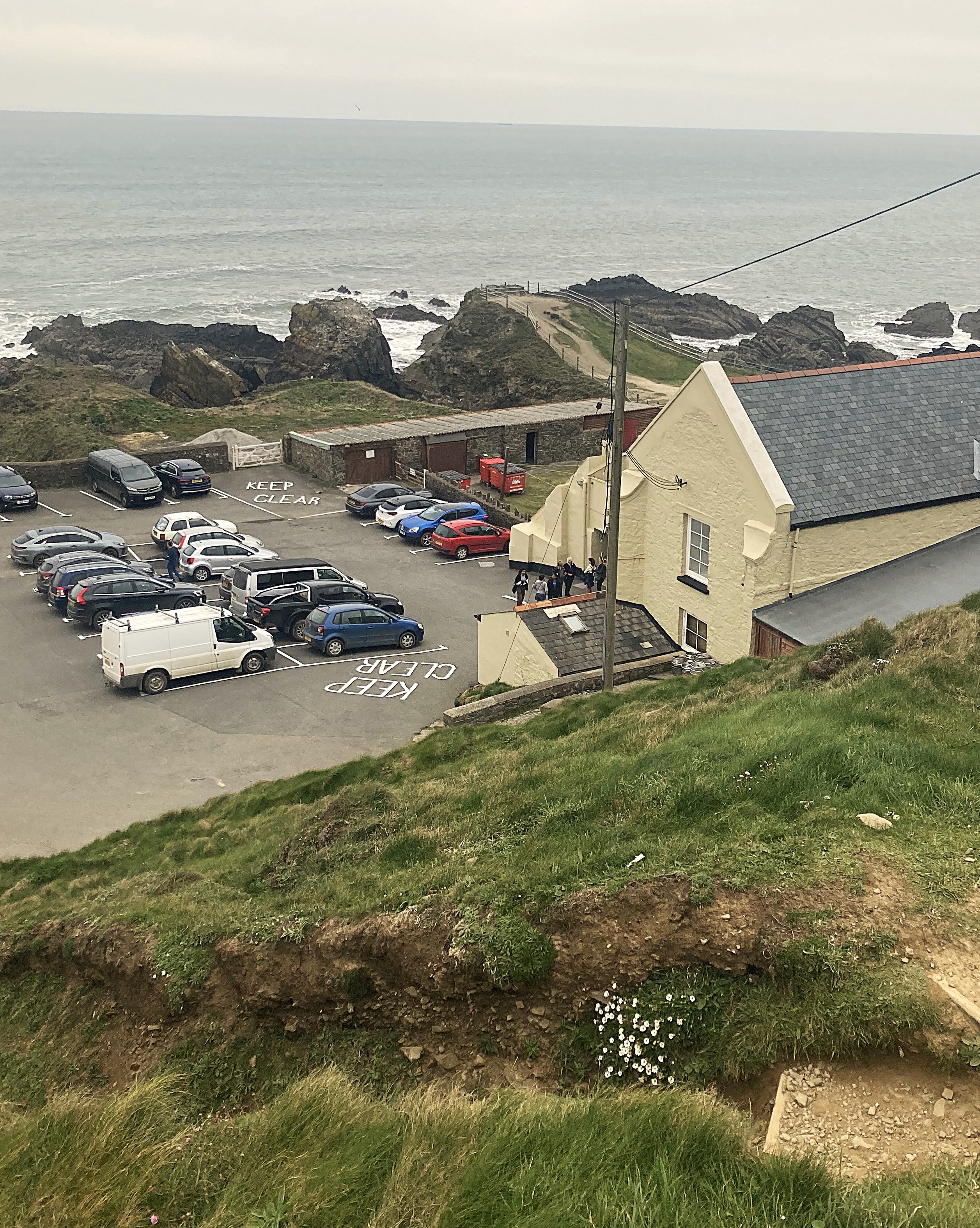
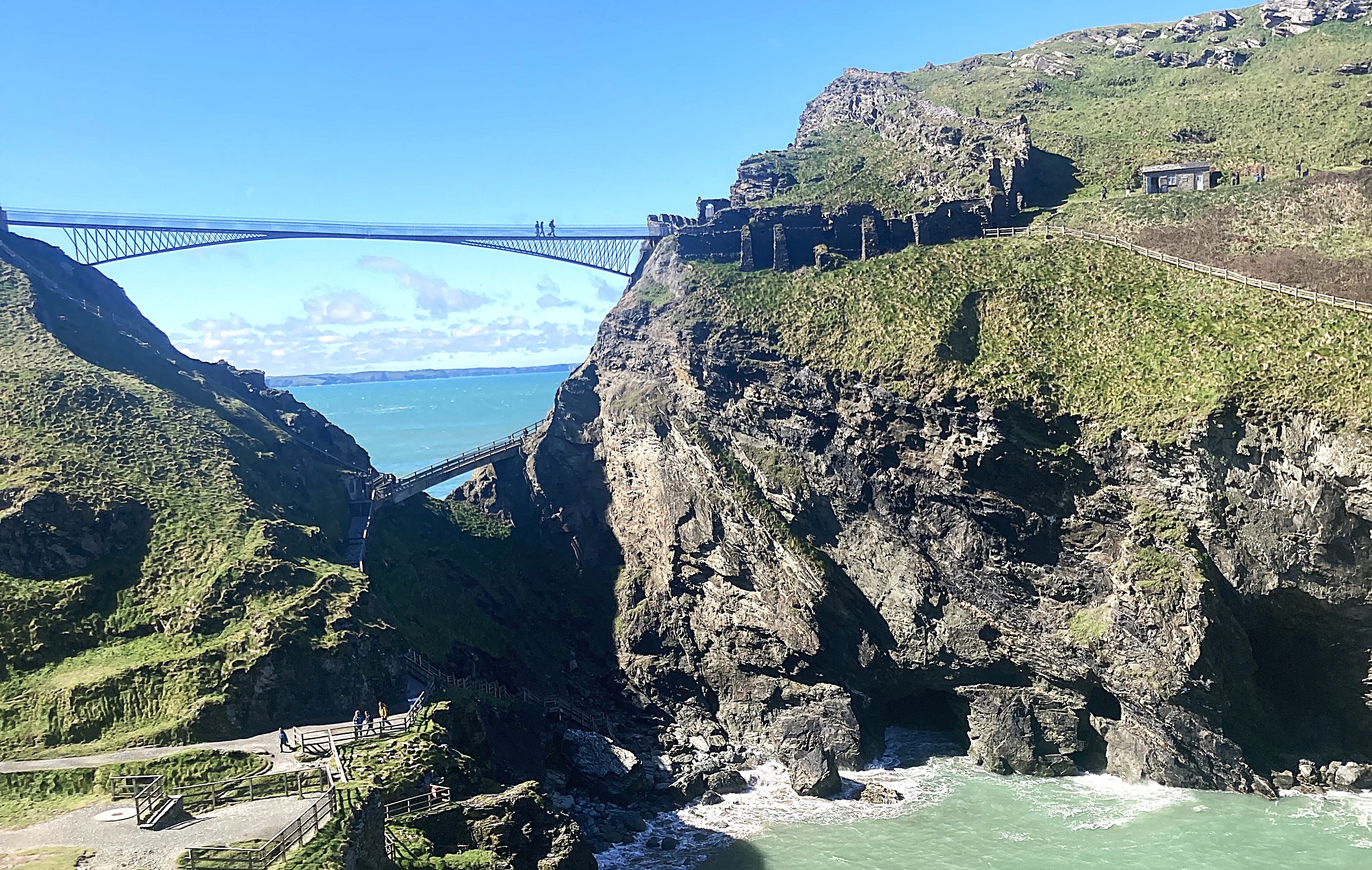
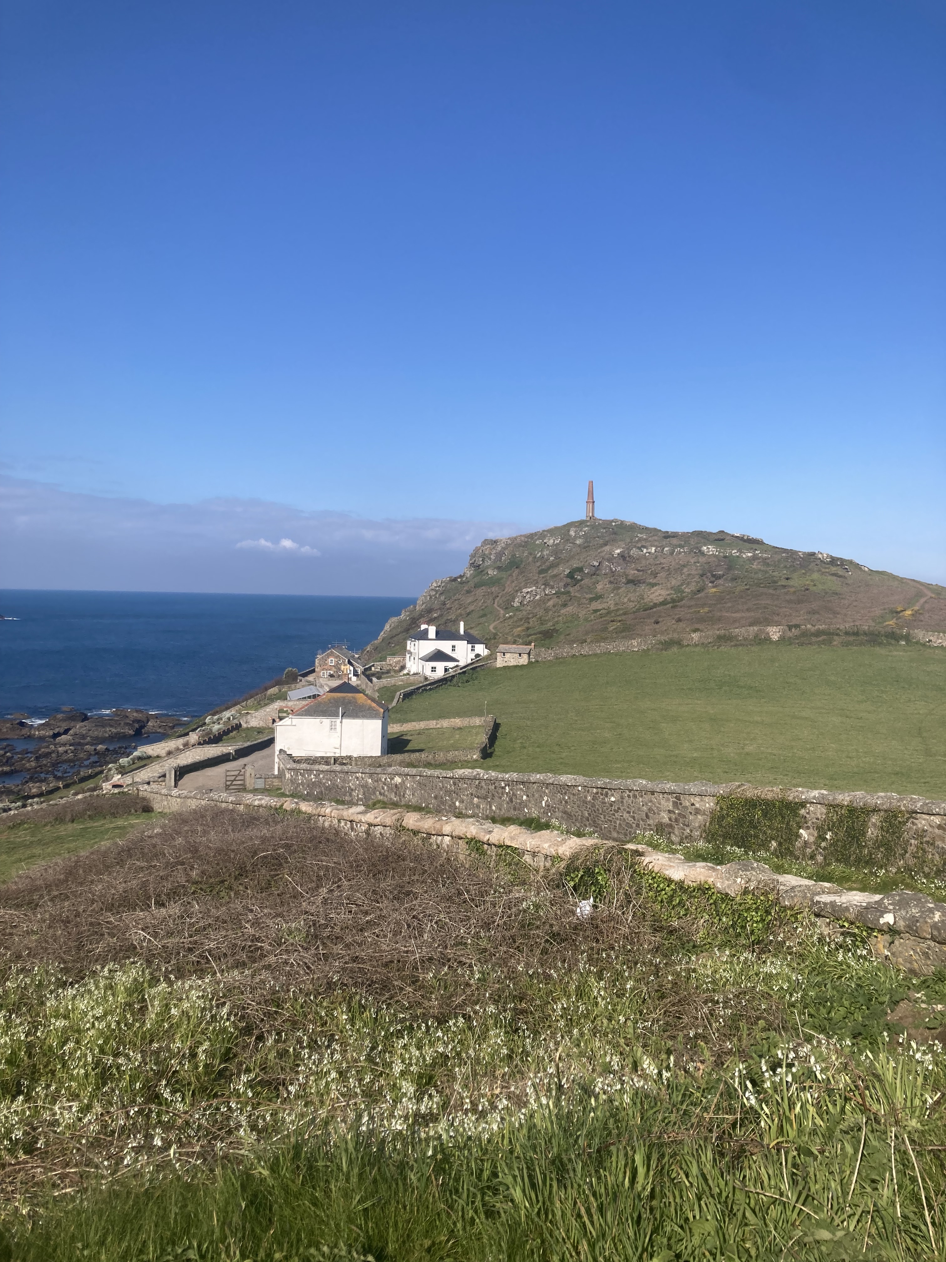
Comfortable walking to Tintagel, with a few long but steady climbs. It is easy to see how the entire island was fortified, with many ruined stone walls in strategic places. No places for horses on the island, which makes it a strange location for a stronghold. The new bridge across to it was the most spectacular part of the scene. There were hundreds of people thronging the village and queueing up to cross over at £18 per person. I kept going.
Harder walking through the afternoon, with 6 significant climbs, but they do seem to be getting easier. I was followed by another solo hiker moving at the same speed, but she disappeared as we approached civilisation at Port Gaverne.
The Old School house was the most expensive hotel for my trip at £141, while all the others have been in the £70-80 range. It was also the smallest room I have encountered this trip, with a bath/shower space I couldn’t stand up in. had a bath instead.
Port Isaac is the town used for the filming of Doc Martin, so memorabilia in that name was everywhere. I maybe recognised his house driveway, but who knows.
Saturday April 15. 19 km to Padstow, 920 m climbing.
A long climb to get out of Pt Isaac, then several steeper valleys and rocky headlands with the trail going in all directions. Easy walking then down into Polzeath with a very busy beach and hundreds of surfers. Shopped for some food for tonight and followed the easy path on beach and dunes to the tiny town of Rock and a £3 ferry across to Padstow. Lunch was a pastie on a bench among the hordes of people milling around the harbour and market stalls.
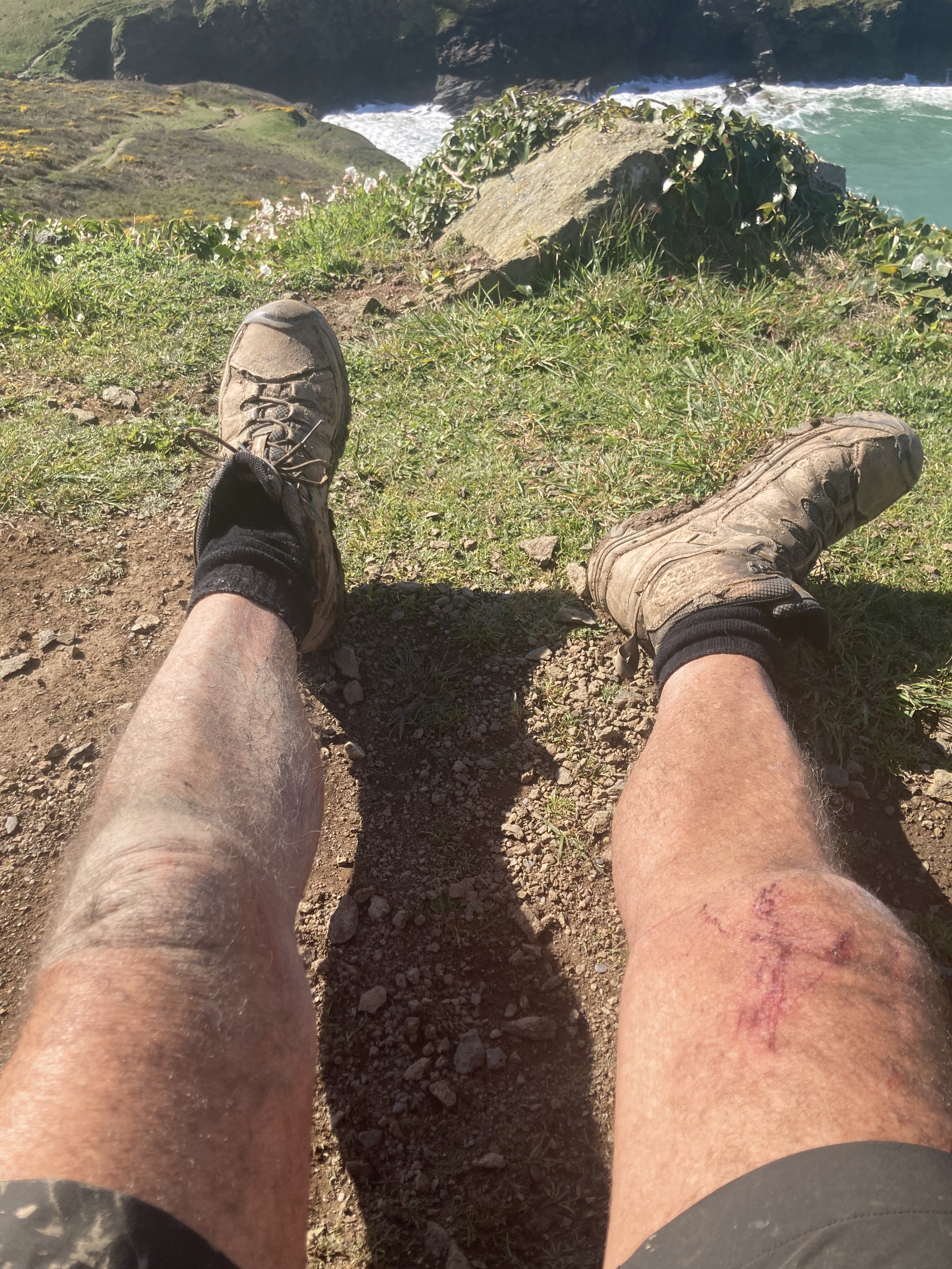
Today was my first day walking in shorts with no parka, so of course I tripped and nearly face planted into wet mud, saved by hands and knees going deep. Muddy and bloody for the rest of the day drew some concerned comments, but a hot shower at the campground had me set up again.
Sunday April 16. 28 km to Maugan Porth, 650m climbing.
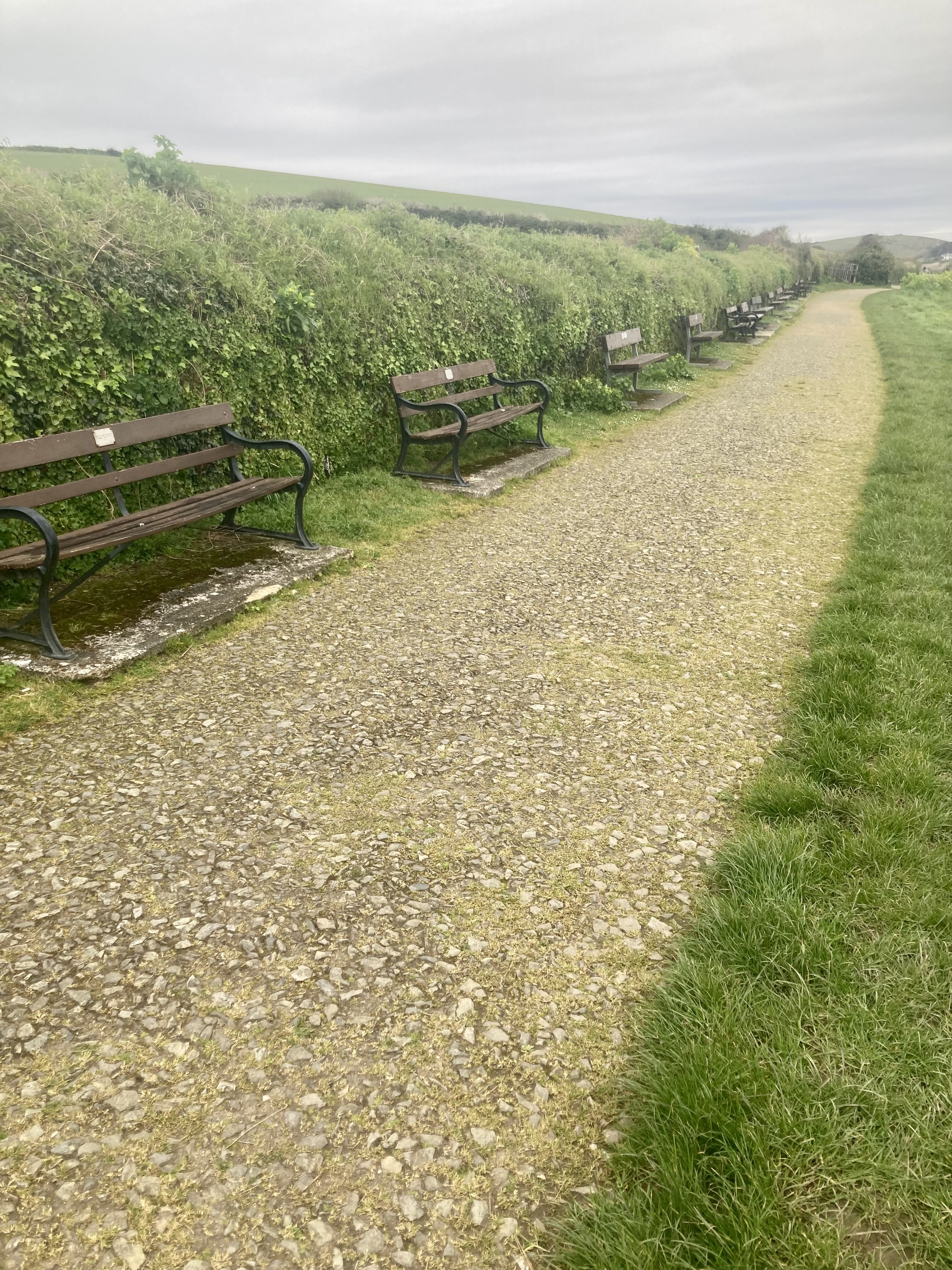
Walked out of Padstow on a sealed path lined with hundreds of benches, each with its memorial plaque, overlooking the Padstow Inlet and the Camel River. It was low tide, so the ferry route looked to be walkable.
A spectacular day’s walking with gentle climbs and a fjord like coast lined with cliffs and seabird apartment blocks. Went past several beaches, each with a bevy of surfers vying to catch a ride on a long rolling swell. Several cafes and campgrounds were closed, waiting for the main flush of people in July, but I found a bacon roll for breakfast in Trevonne and a coffee a few hours later at a trailer on Treyarnon Bay. I arrived at my planned campground at 1pm and decided to carry on to the next one as it was too early to stop and I felt good. The next campground was closed til July as well, so on to the next village. This was the best campground for my trip, with a sheltered and flat grassy site with water and the toilet block only 30m away. There are so few of these suitable for hikers that I’m starting to feel annoyed by them.
Monday April 17. 21 km to Dune Wild Camp, near Holywell.
Had a poor night sleep after a safety pin from my repair undid itself and punctured my sleeping mat. Found 3 holes so far.
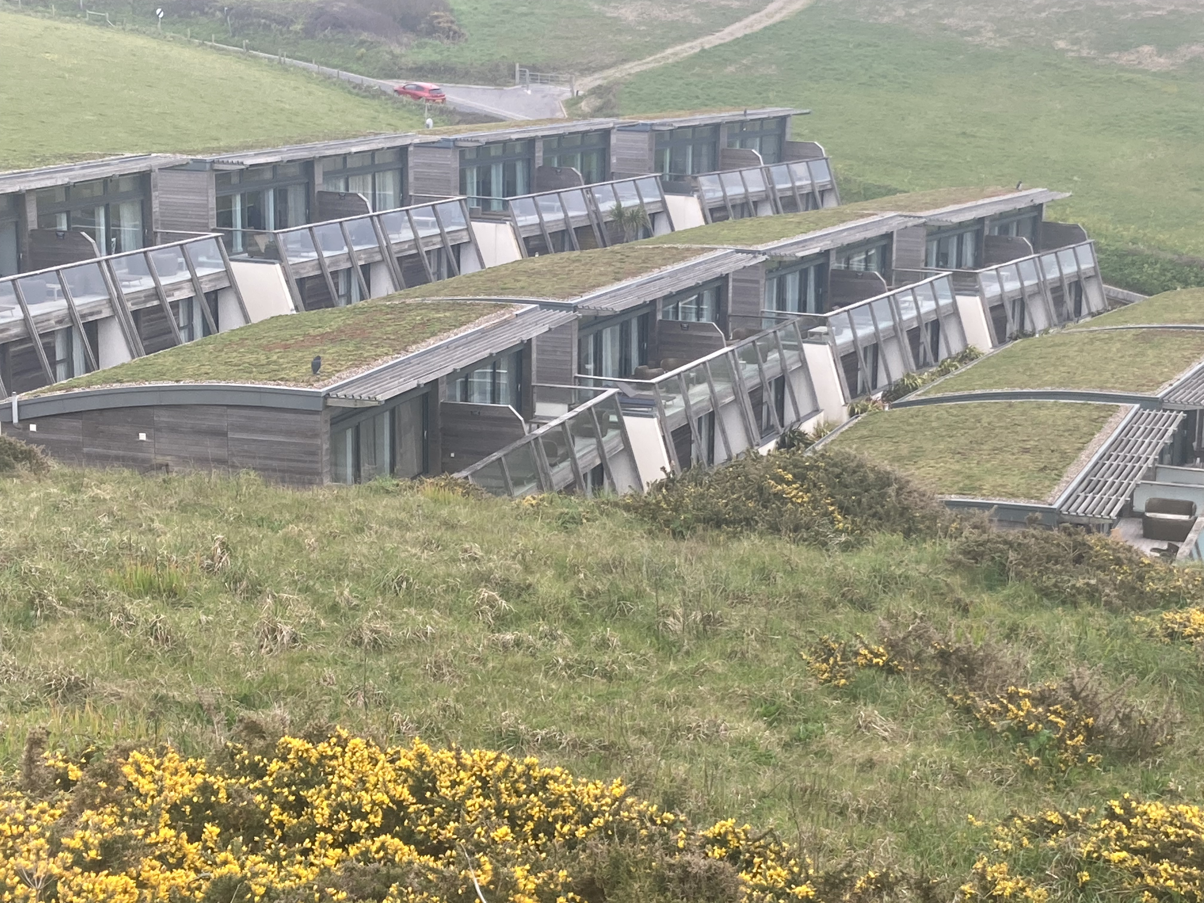
Very strange to walk into a large and busy town in such an old area. Such a mix of styles from ornate gothic to mock Eco housing to developer chic. Sometimes all at once in one building. Walked the main street of tiny shops and found dinner and chocolate bars in a convenience store. Three camping gear suppliers in town, none of whom had a suitable sleeping bag, but I did manage to find another gas bottle.
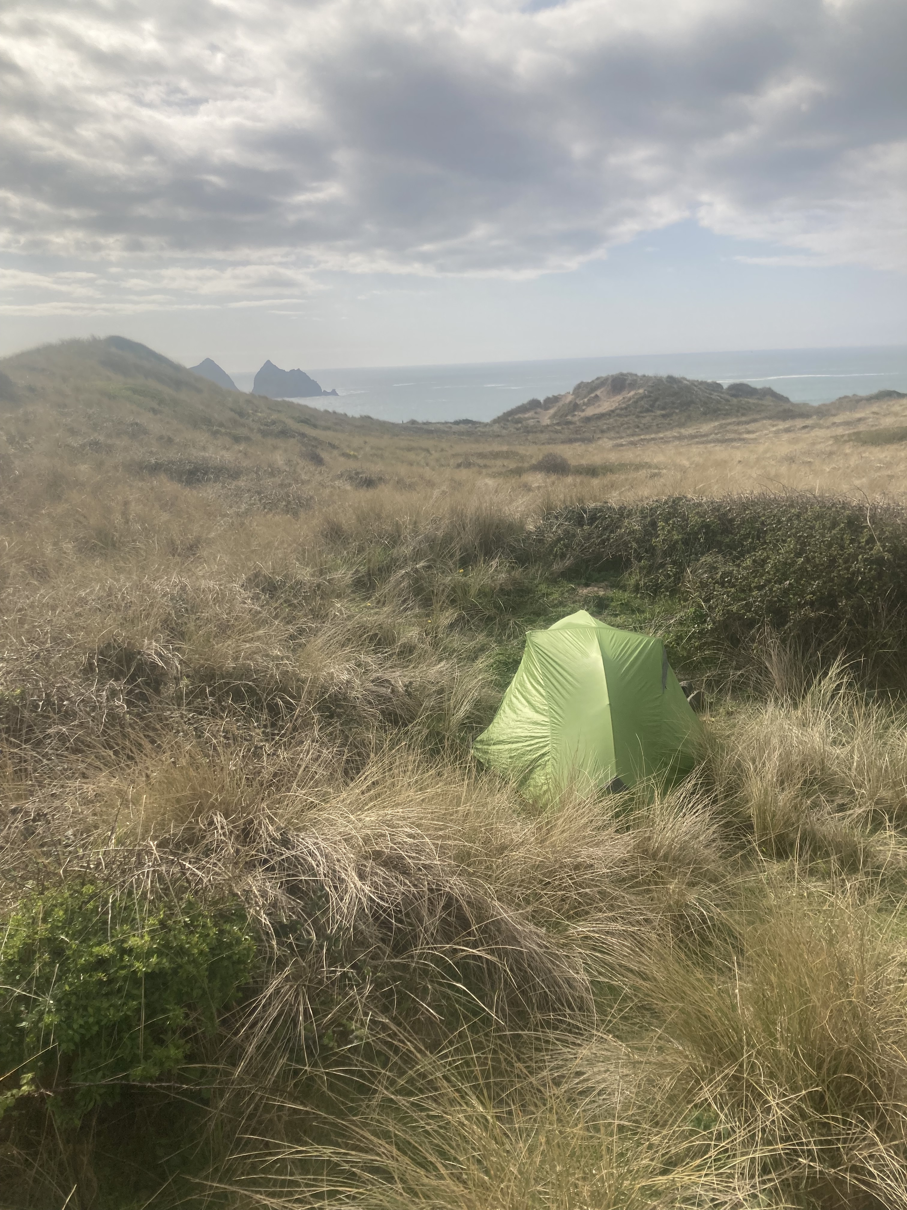
The season must be starting as I’m starting to see more hikers on the trail instead of dog walkers. One even stopped for a chat! I overtook another couple who were looking for a place to wild camp, but were too scared to be alone! I left them and strode off the main trail up into the dune system and found a low spot in a briar patch that almost hid me from view. Then several pairs of walkers came up my access track, ignoring me dutifully. My tent is such a garish green that it’d be impossible to miss. Pasta and coffee for dinner then kept hunting holes in my sleeping mat. It stayed up all night, so Success!
Tuesday April 18. 23 km to Campground above Porthtowan, 930m climbing.
Mostly easy strolling in clear weather with a chilly breeze. Thought about taking off my windbreaker a few times but never got quite hot enough.
Hundreds? of mineshafts, fenced or capped, with tailings dumps making the trail uneven and rocky, so slow going for the most part. Past a fenced off area of Defence land with a whole village of rusted out dongas, some with roofs fallen in.
Past all that wasteland and down down down to Perran Beach for 4 km of beach-walking to Perranporth and a café for breakfast.
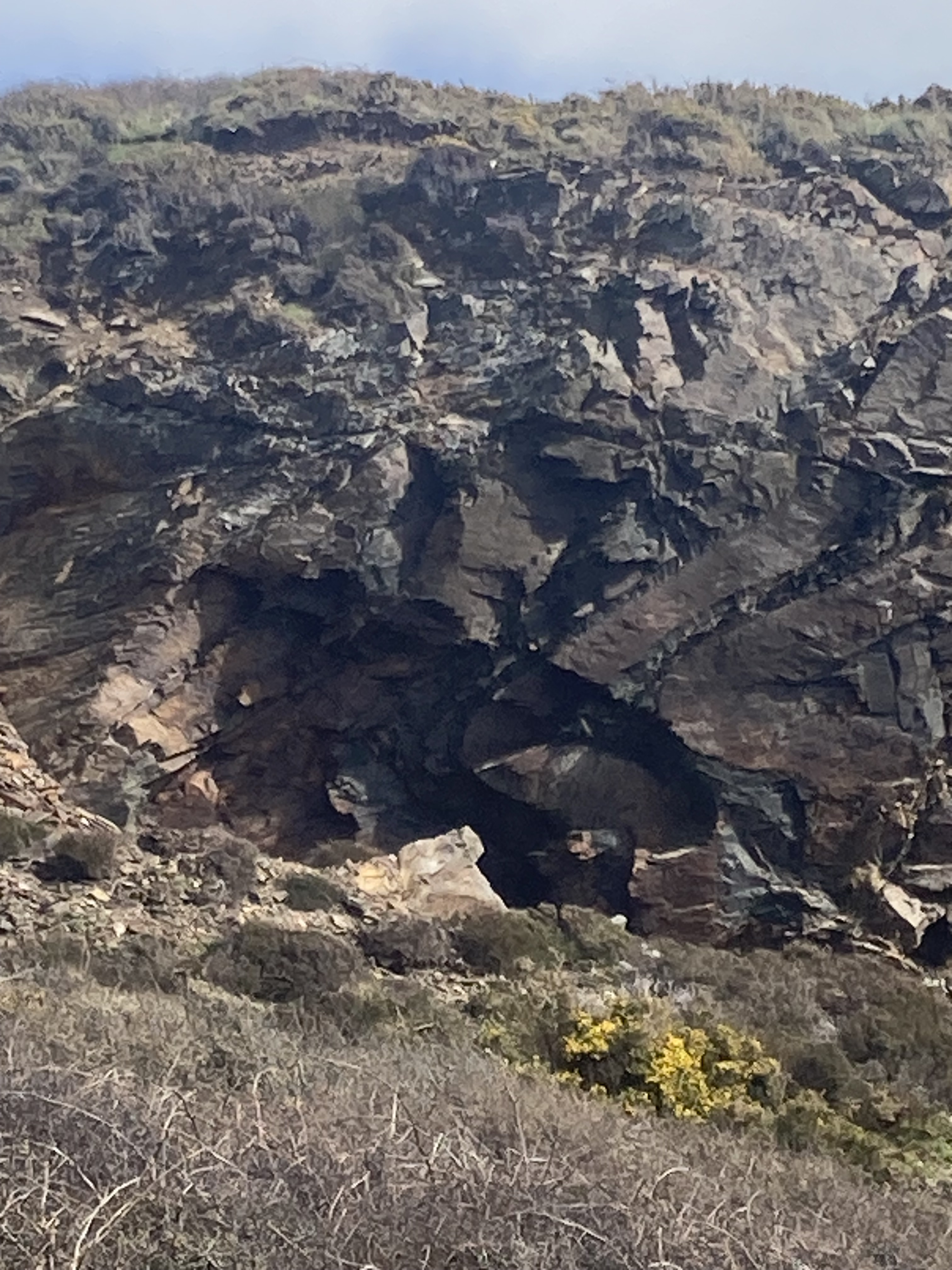
After Perranporth, mining residue was everywhere. Chimneys and foundations looking like castle ruins. Several attractive coves along the way, one even had a recently closed tourist mine. Several caves in the cliffs along the beaches looked to be manmade. A manned coast watch station on St Agnes head and down into Chapel Porth for lunch on a croque monsieur. Cheese toasty to you. More climbing to an exposed campground on a ridge crest. But it’s sunny, so I’m sitting outside to write this. I’m even wearing a sunhat.
Wednesday April 19. 30km to Lelant and the Badger Inn, 790 m climbing.
Had a good night in the campground despite the cold and heavy condensation inside the tent. Set off by 8 to head back to the trail avoiding the drop to town using back tracks. Negotiated several deep ravines but then had rolling clifftops across and down to Porthtowan and breakfast by the harbour. A strawberry milkshake tasted like no strawberries had been harmed.
More coastal cliffs with huge blocks dropped off the main land, lined with more mineshafts and chimneys. Easy walking to Godrevy lighthouse then dropped down to the beach to discover a proper river in my way. I walked upstream for a bit but eventually had to concede that I wasn’t going to get across and scrambled back up the cliff to follow the main trail upstream to a bridge. Back out to the main coast and several kms along a beach again to a big river and the port of Hayle. Rang ahead and booked the Badger Inn in Lelant for the night.
Thursday April 20. 20km to Pendean Watch camp.
As predicted by the guide book, this was the hardest day so far. It was easy enough into St Ives, with a few ups and downs but on a good path. Once out of the St Ives dog walker area, the track descended into a chaos of rock and bog, so very slow and careful going to get into the campground at Pendean Watch, although I did overtake three other groups of walkers. Very basic site with water and toilet but little shelter from the wind. A stone wall helped a bit. Another hiker here whose tent I saw with no occupant back on day 5.
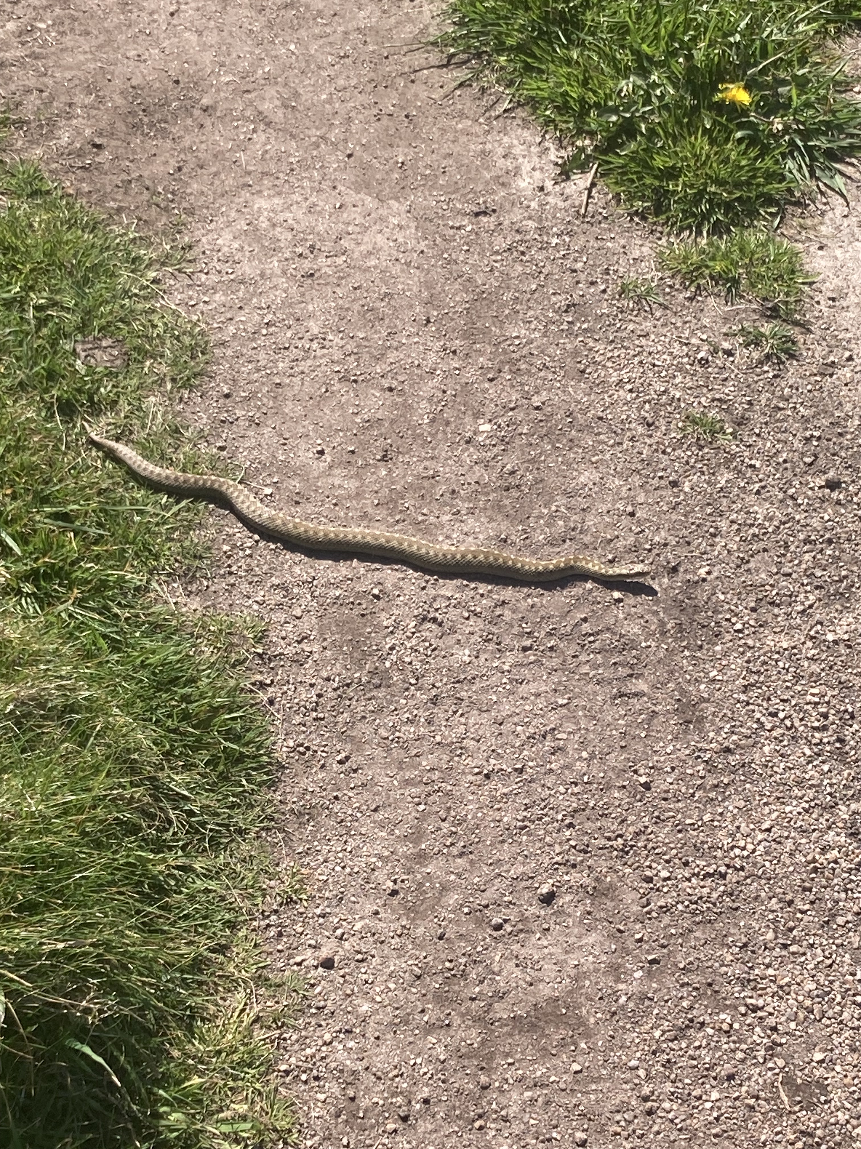
An exciting day for wildlife as well, with my first adder, a badger sett and a vole almost ran over my foot.
Friday April 21. 25km to Treen camp ground, with 900m climbing.
Really cold overnight and a freezing strong wind. I managed to cook dinner, but breakfast was impossible, so I set off for Cornwell Head where there was meant to be a café. Closed! Carried on another 5km to White sand Bay and a couple of kms on the beach to Sennen and a café by 12. Pizza, coffee and cake filled the empty spot and made the few kms to Lands End easy. Coffee and Ice cream at the First and Last House, before steeply dropping on steps to Porthcurno beach.
Heavy industry dominated most of this stretch of coast, with mine shafts going out under the sea for a mile from land. Hundreds of shafts, large and small, and clefts in the cliffs which were presumably seams of ore. Many were fenced off, barring access to gaping black holes. Others were left open.
The campground at Treen was high up above the beach. So, a final climb for the day with a barbed wire stile to negotiate carefully. They even had a shop with something for dinner. Tuna chunks in bolognaise sauce, but it wasn’t inviting enough to sit in the wind to heat it up, so I stayed in the sleeping bag snacking. Dinner eventuated as two bananas, pint of milk, 2 chocolate bars, 100gm peanuts and a can of elderflower soda.
Saturday April 22. 12 km to Mousehole Ships Inn, with 320m climbing.
Steady rain set in around 3 am and continued all day. I packed successfully inside the tent, taking down the fly only at the very last. Breakfasted in the camp kitchen on microwaved porridge and coffee.
Headed off by 8:30 into not quite drizzle, very slow going on rough and rocky paths, taking 31/2 hours for the 9 km to Lamorna and a café for soup, a huge meat pasty and a coffee. Feeling bloated for the next 3 km to Mousehole, pronounce Mouzel, and decided to stop in the hotel on the waterfront.
This small town is a classic fishing village, with narrow winding streets wrapped across a steep hillside. The harbour goes dry at low water with around 2m of water on the high tide. Many fishing dorys sitting in the mud amidst a complex array of ropes so they can be hauled in while still moored fore and aft. Not enough room for them to swing at anchor.
In 1998 I spent many days searching the mountains and rainforest around Cape Tribulation for a young man from this village, even taking his father and younger brother up and around Mt Sorrow. No trace of Daniel was ever found.
Sunday April 23. 22 km to campsite near Praa Sands, with 360m climbing.
Started the day off with a good breakfast from the pub after a poor sleep, probably due to the three pints of Guinness with dinner last night. Easy walking on hard paths to Marazion and views of Mont St Michael across the bay. Ferries were running continuously, but not exciting enough for me to leave the trail. Carried on, on good paths to Perranuthnoe and a café with a conservatory for lunch. So hot under the glass, I even checked that the heaters were turned off. The track continued past several beautiful stone houses and around several headlands to reach Praa sands and a long ridge walk up to the cold and windy campground. Found a flat spot near a hedge windbreak and set up by 3.

Monday April 24. 24 km to campsite near Mullion Cove, with 670m climbing.
Started the day with the 1 km return walk down the narrow road to the beach, waving at cars as they mostly slowed down for me. Beach walking was made difficult by having to deal with the soft sand on the top of the beach as the tide was at peak. Staying off the beach meant going up and down dunes also on soft sand, taking 2 hours to reach Porthlevon and one open café. The harbour was lined with large rock walls from which workers were removing scaffolding. Some sort of event had taken place over the past weekend.
More dune walking then a steep drop to cross Loe Bar, about 1 km of sand that had just emerged from the water as the tide dropped. Back up onto the clifftops before dropping again to a small cove with the very picturesque Gunwallow Church. Headed inland a km or so to reach a lovely National Trust campground; it even had trees and a shop with food. It was warm in the tent despite the wind, so I basically dozed in the tent from 3pm to 7 am.
Tuesday April 25. 16 km to Cadgewick cove, with 630m of climbing.
Off and walking by 8:30 after porridge and coffee. Wearing three layers on top against the freezing wind but with shorts underneath to stay cool. It was quite pleasant in a hollow or behind glass but horrible most of the time. I’m starting to be quite depressed, probably by poor diet as well as the loneliness.
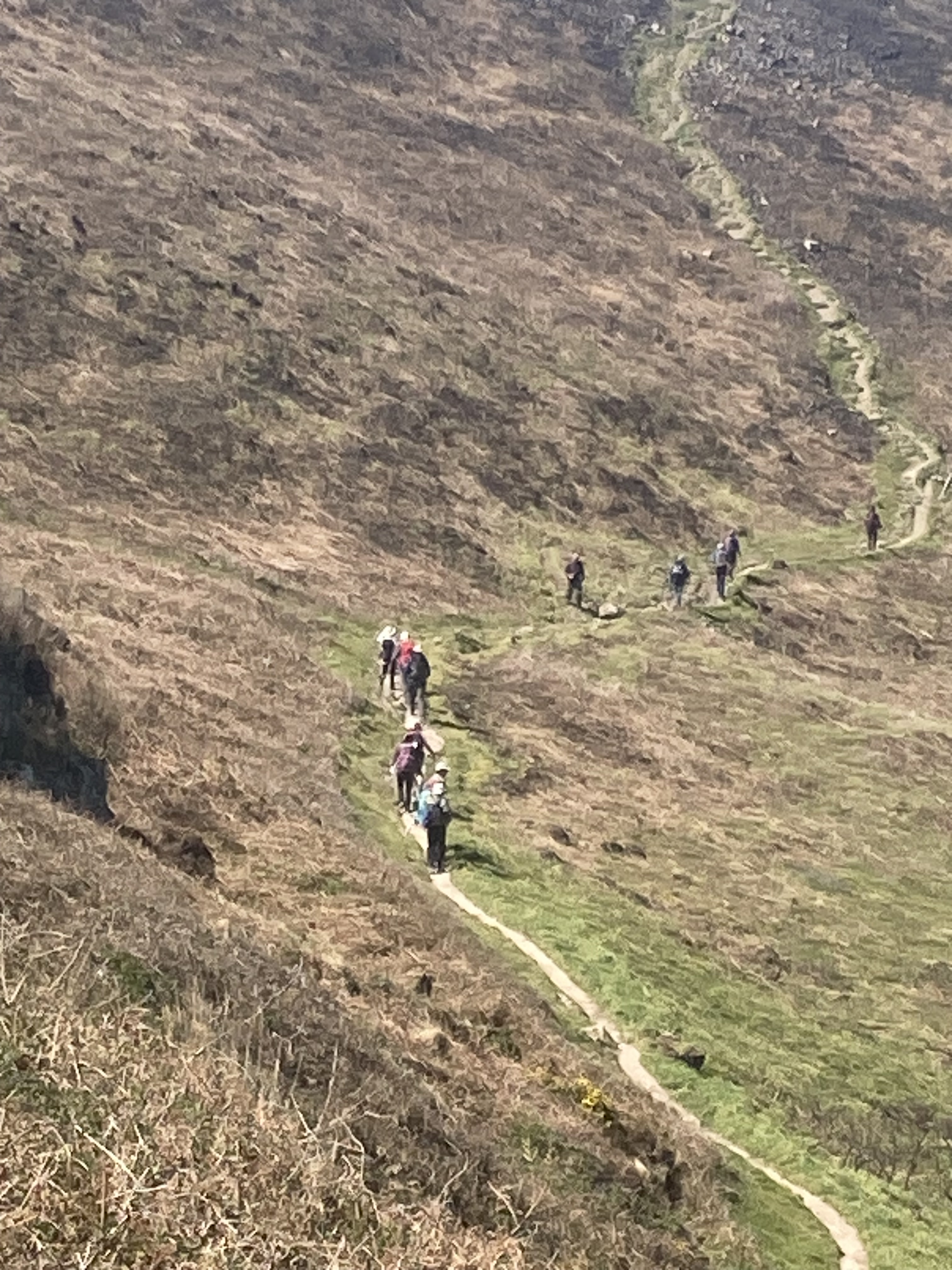
Made it to The Lizard, England’s southernmost point, and the last café for lunch. After lots of small ups and downs and managing to go off route and into some scrub bashing to get back on the path without climbing back up. It had looked like a good track from the top, but that was largely due to most people going down, then returning, so the track gets more worn.
I made it to Cadgwick Cove pub by 1pm and they had a room available, so I decided to stop early and look at options.
The trail has become much less interesting with housing development everywhere as well as simply following a fenced boundary on the waste ground between coast and farm. There is no wild forest or remote feel anymore. I’ve covered around 500 kms, and had a great taste of the Cornish coast, but that’s enough.
I decided to book to return home next week, allowing some time to check out the Lost Gardens of Haligan and the Eden project before taking the Eurostar over to Bussels and spending some time with Peter and Rose, then home.
The Lost Gardens were established prior to World War 1, then with the loss of staff, basically abandoned for 70 years or so. They have been rediscovered, and largely with volunteers, cleaned up and opened as an example of a self-sustaining regenerative property. It is spread over 200 acres, with 2 cafes, large shop and kitchen garden, grazing paddocks, market gardens, wild forest, formal flower gardens, guided tours, playgrounds, fern gardens, hothouses, even pineapples growing under a cool frame on manure heated compost. There are 20 gardeners employed now as well as other staff for the cafes and shop.
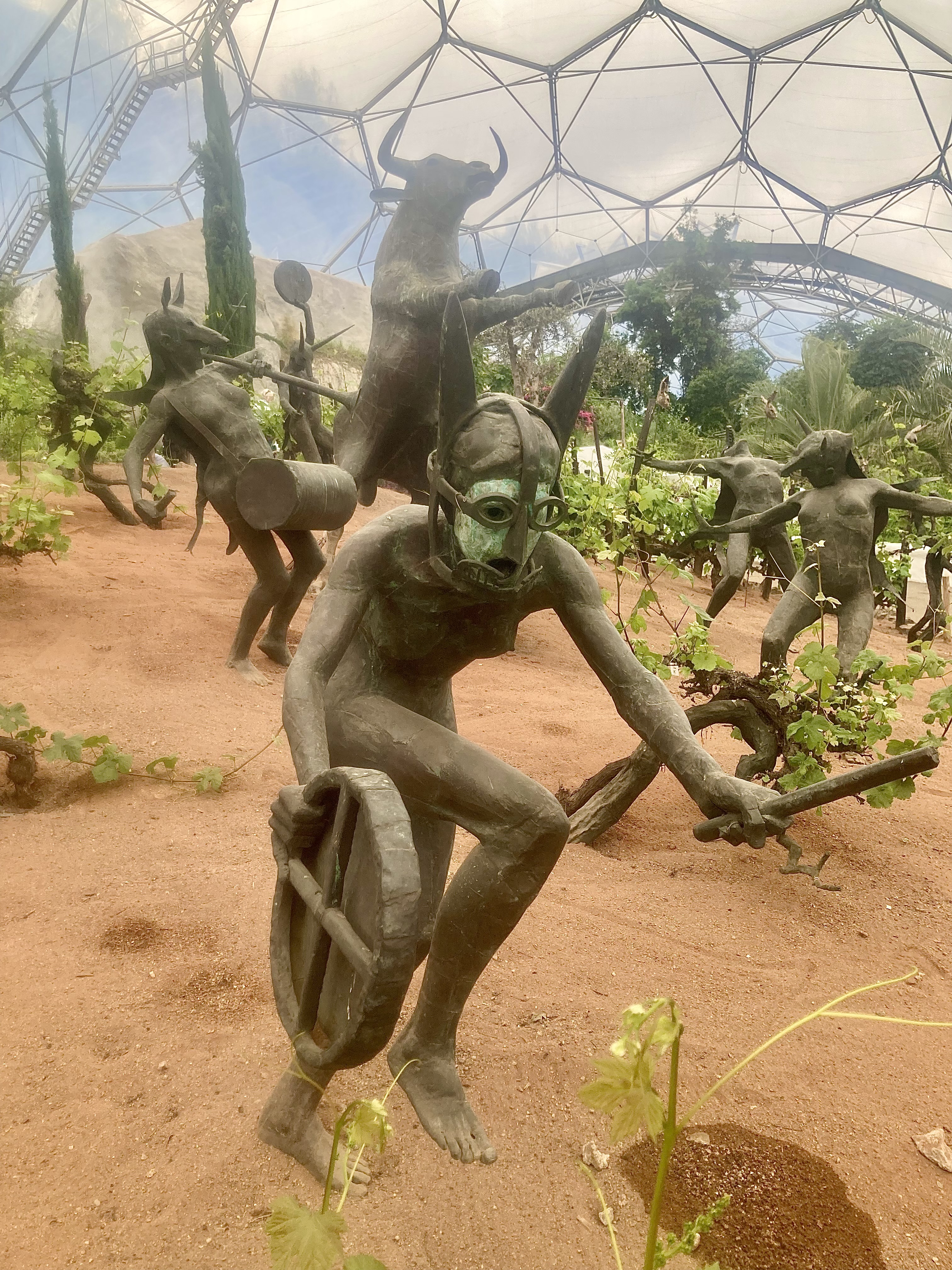
The Eden Project had been established in an abandoned quarry, to prove that it is possible to regenerate the wasteland and establish major vegetation types in large climate-controlled domes, called biomes. Thousands of people visit every day, so with a ticket for one year’s access costing £35 this is not a small operation.
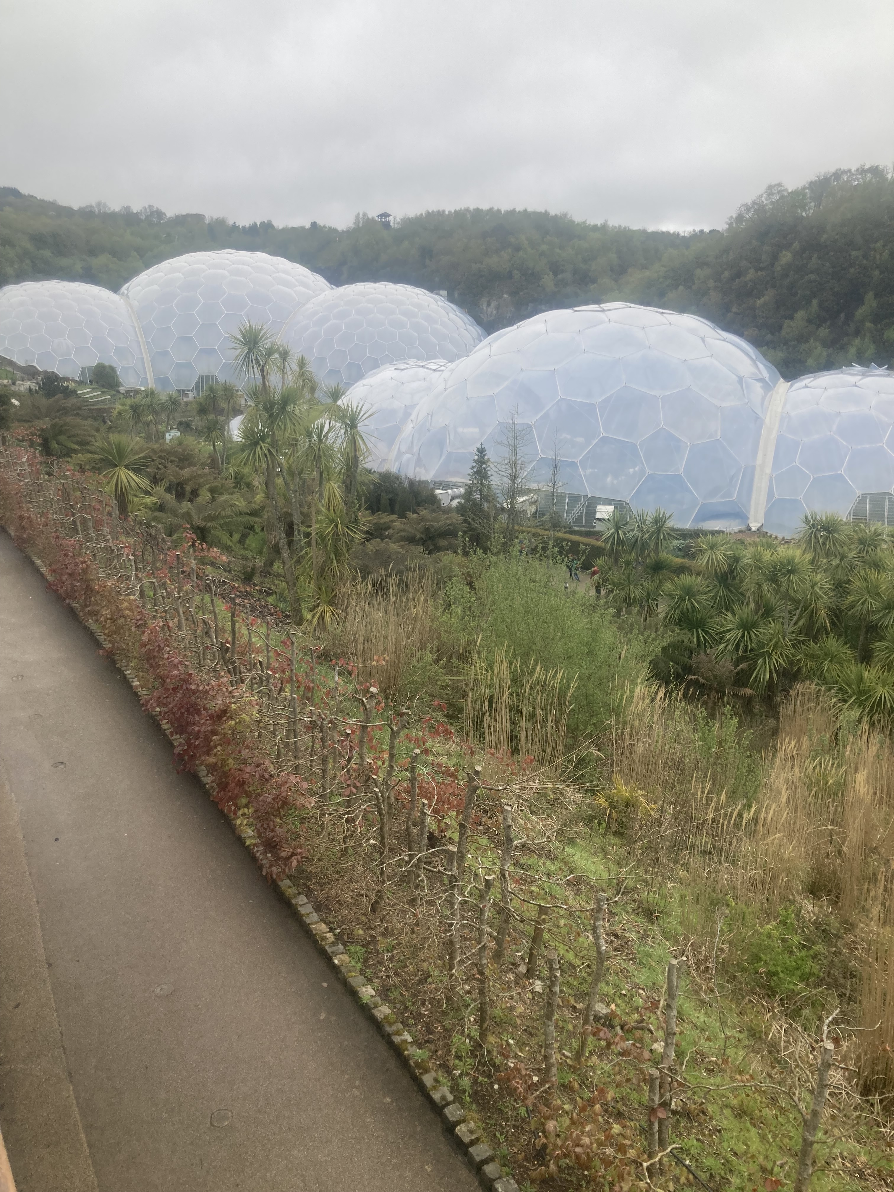
There are several areas of regeneration, each with a different theme as you walk down through to the biomes, the centre piece. There is a Korean DMZ, a Chinese water garden, a Pollination trail, a rock slide garden, vege garden, and others. The rainforest biome is controlled at 29C and 75% humidity, so quite pleasant for me though there were people obviously suffering and heading out. The Mediterranean biome operates at 20C. It’s hard to believe that it’s all been planted on waste ground, especially with 150-year-old olive trees. Huge dining rooms with 400 people inside and another 200 outside. A zipline stretched across the entire space, with people whizzing along for about 1 km.
Although there was lots of information about plant biodiversity and heritage values, I found nothing about where the soil came from or how the plants were fed. The project seems a massive education tool, largely used for entertainment.